1950s Maps of Pine Rock Township, Illinois
Explore 6 historic maps of Pine Rock Township from the 1950s. These maps offer a rare glimpse into what life looked like during the 1950s — showing old roads, neighborhoods, homes, and landmarks that have changed or disappeared over time.
Whether you're researching your family's past, planning a metal detecting trip, or studying how Pine Rock Township's landscape evolved across the 1950s, these high-resolution maps are a powerful tool for exploring the history of this region.
- Focus on a specific era: All maps on this page are from the 1950s, giving you a focused view of this time period.
- See what’s changed: Compare century-old streets, trails, and buildings to today's modern landscape using overlays and satellite layers.
- Research with precision: Use these maps for genealogy, historical research, land use analysis, or educational projects.
- View, download, or print: Maps are fully viewable online in high resolution, and can be downloaded or printed for your own records.
Start exploring Pine Rock Township's history through authentic maps from the 1950s. This is your window into the past.
Pine Rock Township, IL maps
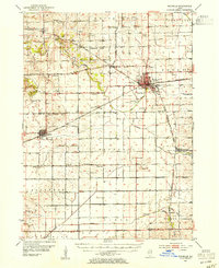
(6)- 1950 Map of Dixon, 1964 Print
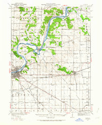 1950 Dixon1964 Print · USGSThe Rock River valley in the mid-twentieth century shows a landscape of busy river towns and dense rural school districts. Genealogists can locate family-named landmarks like Tealls Corners School, Emmert School, and the White Temple church.2 unique versions available
 - 1952 Map of Rochelle, 1954 Print
 1952 Rochelle1954 Print · USGSOgle and Lee Counties in the early fifties reveal a landscape of thriving rural schools and critical rail junctions centered on Rochelle. Genealogists can trace local roots through numerous landmarks including Reynolds Ch, Twin Grove Cem, and Willow Center Sch.3 unique versions available
 - 1954 Map of Rockford
 1954 Rockford1954 Print · USGSThe Rock River valley and the Illinois-Wisconsin borderlands are captured here in the mid-1950s during a period of robust industrial and agricultural activity. Genealogists and historians can trace rail-era corridors like the Illinois Central RR and locate landmarks from Big Foot Prairie to Lake Geneva.
 - 1955 Map of Rockford
 1955 Rockford1955 Print · USGSThe Rock River valley and southern Wisconsin dairy country are shown here in the mid-fifties as the region's manufacturing centers grew. Genealogists and historians can trace the paths of the Chicago and North Western RR and Illinois Central RR through hubs like Rockford and Beloit.
 - 1958 Map of Aurora, 1969 Print
 1958 Aurora1969 Print · USGSNorthern Illinois in the late fifties shows a landscape of powerful river industry and expanding transport corridors. Genealogists and historians can trace the development of Aurora and Joliet or locate sites like the Elwood Ordnance Plant and Starved Rock.3 unique versions available
 - 1958 Map of Rockford, 1974 Print
 1958 Rockford1974 Print · USGSNorthern Illinois and southern Wisconsin are shown here in the mid-twentieth century as rail-dependent industrial towns began to interface with growing lakefront communities. Genealogists can trace family roots through settlements like Saylesville and Tess Corners or locate historical landmarks like the Rockford Ordnance Depot.4 unique versions available
End of results
Showing maps 1-6 of 6
Top cities near Pine Rock Township
- Rockford historical maps
- Dixon historical maps
- Rochelle historical maps
- Oregon historical maps
- Byron historical maps
- Mount Morris historical maps
See more
Top neighborhoods of Pine Rock Township
Frequently asked questions
- What are the different types of historical maps available for Pine Rock Township?
- What is the oldest map of Pine Rock Township?
- Where can I purchase historical maps of Pine Rock Township for my home or office?
- Where can I download high-res historical maps of Pine Rock Township?
- Are there historical topographic maps available for Pine Rock Township?
- Is there historical aerial imagery available for Pine Rock Township?
- Where are historical maps of Pine Rock Township sourced from?