Old Maps of Du Quoin, Illinois
Explore 22 old maps of Du Quoin, spanning from 1910 to today. These high-resolution historic maps reveal how streets, neighborhoods, landmarks, and natural features evolved over time — perfect for genealogy, metal detecting, research, and local history exploration.
What you can do with these maps:
- See how Du Quoin changed over time: Compare historical maps to modern-day views to trace roads, homesites, rail lines & more.
- View detailed metadata: Each map includes creators, publishers, year, scale, and archive source.
- Overlay maps with satellite & LiDAR: Visualize the past alongside modern tools to explore terrain & human change.
- Trusted historical sources: Maps sourced from the USGS, Library of Congress, and other archives.
- Access maps your way: View online, download high-res files, or order prints for personal or research use.
Start exploring old maps of Du Quoin to uncover forgotten places, hidden landmarks, and the deep history beneath your feet.
Du Quoin, IL maps
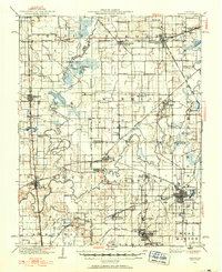
(22)- 1910 Map of Herrin
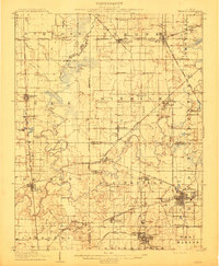 1910 Herrin1910 Print · USGSCovers Du Quoin, including Carbondale, Herrin, and other nearby areas2 unique versions available
 - 1910 Map of Murphysboro
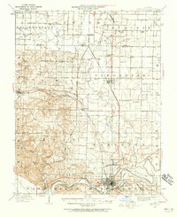
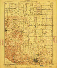 1910 Murphysboro1910 Print · USGSCovers Du Quoin, including Carbondale, Murphysboro, and other nearby areas2 unique versions available
 - 1924 Map of Pinckneyville, 1958 Print
 1924 Pinckneyville1958 Print · USGSCovers Du Quoin, including Pinckneyville, Pyatts, and other nearby areas2 unique versions available
 - 1926 Map of Pinckneyville
 1926 Pinckneyville1926 Print · USGSCovers Du Quoin, including Pinckneyville, Pyatts, and other nearby areas2 unique versions available
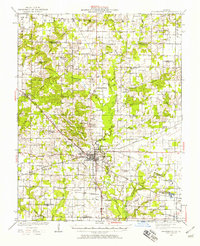
 - 1926 Map of Duquoin
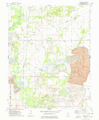
 1926 Duquoin1926 Print · USGSCovers Du Quoin, including Sesser, Tamaroa, and other nearby areas3 unique versions available
 - 1936 Map of Herrin
 1936 Herrin1936 Print · USGSCovers Du Quoin, including Carbondale, Herrin, and other nearby areas2 unique versions available
 - 1938 Map of Murphysboro, 1958 Print
 1938 Murphysboro1958 Print · USGSCovers Du Quoin, including Carbondale, Murphysboro, and other nearby areas
 - 1949 Map of Paducah
 1949 Paducah1949 Print · USGSCovers Du Quoin, including Cape Girardeau, Paducah, and other nearby areas2 unique versions available
 - 1950 Map of Paducah
 1950 Paducah1950 Print · USGSCovers Du Quoin, including Cape Girardeau, Paducah, and other nearby areas
 - 1954 Map of Paducah
 1954 Paducah1954 Print · USGSCovers Du Quoin, including Cape Girardeau, Paducah, and other nearby areas2 unique versions available
 - 1958 Map of Belleville, 1973 Print
 1958 Belleville1973 Print · USGSCovers Du Quoin, including Belleville, O'Fallon, and other nearby areas3 unique versions available
 - 1961 Map of Paducah
 1961 Paducah1961 Print · USGSCovers Du Quoin, including Cape Girardeau, Paducah, and other nearby areas2 unique versions available
 - 1962 Map of Belleville
 1962 Belleville1962 Print · USGSCovers Du Quoin, including Belleville, O'Fallon, and other nearby areas
 - 1964 Map of Paducah
 1964 Paducah1964 Print · USGSCovers Du Quoin, including Cape Girardeau, Paducah, and other nearby areas2 unique versions available
 - 1968 Map of Elkville, 1969 Print
 1968 Elkville1969 Print · USGSCovers Du Quoin, including Elkville, Dowell, and other nearby areas2 unique versions available
 - 1968 Map of Vergennes, 1970 Print
 1968 Vergennes1970 Print · USGSCovers Du Quoin, including Vergennes, Grubbs, and other nearby areas
 - 1974 Map of Pyatts, 1978 Print
 1974 Pyatts1978 Print · USGSCovers Du Quoin, including Pinckneyville, Pyatts, and other nearby areas2 unique versions available
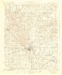
 - 1975 Map of Du Quoin, 1977 Print
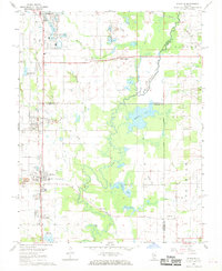
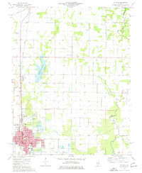 1975 Du Quoin1977 Print · USGSCovers Du Quoin, including Holden, Sunfield, and other nearby areas
 - 1984 Map of Carbondale, 1985 Print
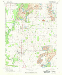
 1984 Carbondale1985 Print · USGSCovers Du Quoin, including Carbondale, Marion, and other nearby areas
 - 1985 Map of Pinckneyville
 1985 Pinckneyville1985 Print · USGSCovers Du Quoin, including Belleville, Centralia, and other nearby areas2 unique versions available
 - 1986 Map of Carbondale
 1986 Carbondale1986 Print · USGSCovers Du Quoin, including Carbondale, Marion, and other nearby areas
 - 1987 Map of Paducah, 1988 Print
 1987 Paducah1988 Print · USGSCovers Du Quoin, including Cape Girardeau, Paducah, and other nearby areas
End of results
Showing maps 1-22 of 22
Top cities near Du Quoin
- Herrin historical maps
- Murphysboro historical maps
- Pinckneyville historical maps
- Carterville historical maps
- Christopher historical maps
- Sesser historical maps
See more
Frequently asked questions
- What are the different types of historical maps available for Du Quoin?
- What is the oldest map of Du Quoin?
- Where can I purchase historical maps of Du Quoin for my home or office?
- Where can I download high-res historical maps of Du Quoin?
- Are there historical topographic maps available for Du Quoin?
- Is there historical aerial imagery available for Du Quoin?
- Where are historical maps of Du Quoin sourced from?