Old Maps of St. Johns, Illinois for Academic Research
Study the evolution of St. Johns with 10 high-resolution historic maps. Whether you're teaching, researching, or modeling changes in land use, these maps provide essential visual documentation of urban, environmental, and geographic change.
- Analyze long-term change: Track patterns in development, transportation, and natural features.
- Ideal for environmental or urban studies: Support academic projects with primary historical map data.
- Use in the classroom or lab: Educators and researchers rely on these maps to bring historical context to life.
These maps are a powerful tool for teaching, research, and visualizing how St. Johns has changed over the decades.
St. Johns, IL maps
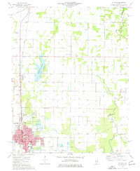
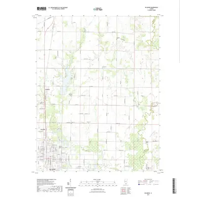
(10)- 1926 Map of Duquoin
 1926 Duquoin1926 Print · USGSSouthern Illinois coal country is at its industrial peak in the mid-twenties, with thriving rail towns and active collieries. You can trace early 20th-century family roots at Young's Chapel or locate old operations like the Big Ben Mine and Old Keller Mine.3 unique versions available
 - 1958 Map of Belleville, 1973 Print
 1958 Belleville1973 Print · USGSSouthern Illinois during the mid-twentieth century reveals a landscape of industrial growth and massive new reservoirs. Genealogists and historians can trace the paths of the Illinois Central RR through towns like Centralia or locate landmarks such as Emerald Mound and the Looking Glass Prairie.3 unique versions available
 - 1962 Map of Belleville
 1962 Belleville1962 Print · USGSSouthern Illinois in the late fifties reveals a landscape of industrial growth and ancient landmarks before the full expansion of the interstate system. Genealogists can trace family names and rural post offices near Centralia, Salem, and the historic Monks Mound.
 - 1975 Map of Du Quoin, 1977 Print
 1975 Du Quoin1977 Print · USGSMid-century Perry County is defined here by the intersection of industrial energy and small-town life. Researchers can trace the layout of Du Quoin during the 1970s, locating the Tamaroa South Oil Field, Browning Hospital, and several rural burial grounds.
 - 1985 Map of Pinckneyville
 1985 Pinckneyville1985 Print · USGSSouthern Illinois in the mid-eighties shows a landscape of prairie farms, coal extraction, and vital rail corridors. Researchers can trace the rail-side growth of Venedy Station and New Memphis Station or locate landmarks like St Libory Church and Memorial Gardens Cem.2 unique versions available
 - 2012 Map of Du Quoin, 2012 Print
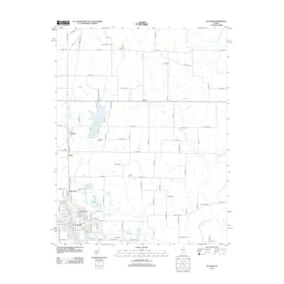 2012 Du Quoin2012 Print · USGSCovers St. Johns, including Du Quoin, Holden, and other nearby areas
 - 2015 Map of Du Quoin, 2015 Print
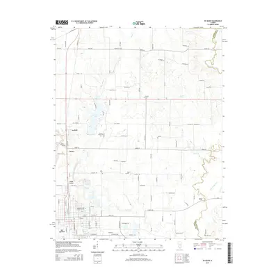 2015 Du Quoin2015 Print · USGSCovers St. Johns, including Du Quoin, Holden, and other nearby areas
 - 2018 Map of Du Quoin, 2018 Print
 2018 Du Quoin2018 Print · USGSCovers St. Johns, including Du Quoin, Holden, and other nearby areas
 - 2021 Map of Du Quoin, 2021 Print
 2021 Du Quoin2021 Print · USGSCovers St. Johns, including Du Quoin, Holden, and other nearby areas
 - 2024 Map of Du Quoin, 2024 Print
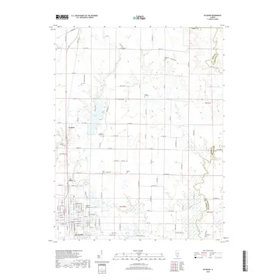
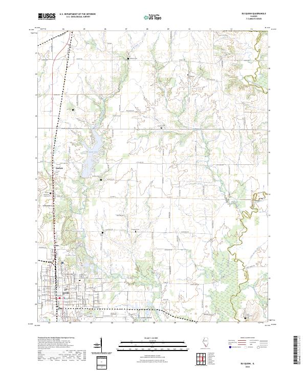 2024 Du Quoin2024 Print · USGSDu Quoin and the surrounding southern Illinois prairie are shown here in the 2020s, highlighting the intersection of municipal life and rural drainage. Researchers can trace local genealogy through numerous sites like Independent Order of Oddfellows Cem and Jones Cem near St. Johns.
End of results
Showing maps 1-10 of 10
Top cities near St. Johns
- Herrin historical maps
- Du Quoin historical maps
- Pinckneyville historical maps
- Christopher historical maps
- Sesser historical maps
- Zeigler historical maps
See more
Top neighborhoods of St. Johns
Frequently asked questions
- What are the different types of historical maps available for St. Johns?
- What is the oldest map of St. Johns?
- Where can I purchase historical maps of St. Johns for my home or office?
- Where can I download high-res historical maps of St. Johns?
- Are there historical topographic maps available for St. Johns?
- Is there historical aerial imagery available for St. Johns?
- Where are historical maps of St. Johns sourced from?