1970s Maps of Piatt County, Illinois
Explore 10 historic maps of Piatt County from the 1970s. These maps offer a rare glimpse into what life looked like during the 1970s — showing old roads, neighborhoods, homes, and landmarks that have changed or disappeared over time.
Whether you're researching your family's past, planning a metal detecting trip, or studying how Piatt County's landscape evolved across the 1970s, these high-resolution maps are a powerful tool for exploring the history of this region.
- Focus on a specific era: All maps on this page are from the 1970s, giving you a focused view of this time period.
- See what’s changed: Compare century-old streets, trails, and buildings to today's modern landscape using overlays and satellite layers.
- Research with precision: Use these maps for genealogy, historical research, land use analysis, or educational projects.
- View, download, or print: Maps are fully viewable online in high resolution, and can be downloaded or printed for your own records.
Start exploring Piatt County's history through authentic maps from the 1970s. This is your window into the past.
Piatt County, IL maps
(10)- 1970 Map of Seymour, 1971 Print
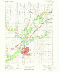
 1970 Seymour1971 Print · USGSEast of the Sangamon River in the early 1970s, this portion of Champaign County shows a landscape defined by the Central Illinois railway and rural townships. Trace family roots at Ingram Cem, St Boniface Ch, and the crossroads of Seymour.2 unique versions available
 - 1970 Map of Mahomet, 1971 Print
 1970 Mahomet1971 Print · USGSMahomet and the Sangamon River valley appear at a point of growth in the early seventies, with new highways and recreation areas taking shape. Trace local family history through Dunkard Cem and Argo Cem, or locate the Covered Bridge at Lake of the Woods.3 unique versions available
 - 1975 Map of Tuscola NW, 1977 Print
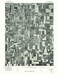
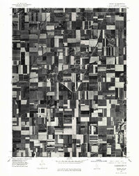 1975 Tuscola NW1977 Print · USGSMid-1970s agricultural patterns and rural settlements are revealed in this aerial survey of the Illinois prairie. Genealogists and land historians can trace property lines and farmstead locations surrounding Ivesdale and the banks of the Kaskaskia River.
 - 1975 Map of Tuscola SW, 1977 Print
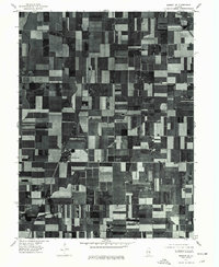
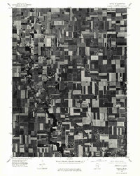 1975 Tuscola SW1977 Print · USGSMid-century Illinois farmland is captured in sharp detail during the autumn of 1975, showing the structured grid of the heartland. Genealogists and local historians can trace the exact footprints of homes and buildings in Atwood and Garrett or follow the banks of the Kaskaskia River.
 - 1975 Map of Bement NE, 1977 Print
 1975 Bement NE1977 Print · USGSPiatt County farmland and the village of Bement are captured in this mid-1970s aerial study. Researchers can examine the town's residential footprint at Bement and trace the original field patterns along the winding Lake Fork.
 - 1975 Map of Bement SE, 1977 Print
 1975 Bement SE1977 Print · USGSPiatt County farmland is captured in sharp aerial detail during the mid-seventies, showing the precise layout of the central Illinois agricultural grid. Researchers can trace the development of small rural centers like Hammond and Pierson among the fields near Lake and Fork.
 - 1979 Map of Monticello, 1980 Print
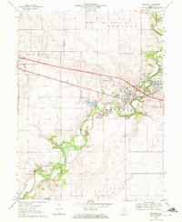
 1979 Monticello1980 Print · USGSMonticello and the Sangamon River valley are captured in the late seventies, showing a hub of rail activity and established rural settlements. Genealogists can trace family heritage through numerous burial sites like Marquiss Cem and Haneline Cem or explore the Illinois Railway Museum.
 - 1979 Map of Farmer City South, 1980 Print
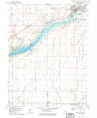 1979 Farmer City South1980 Print · USGSThe rural landscapes of De Witt and Piatt counties are captured here in the late seventies as the new reservoir at Lake Clinton takes shape. Researchers can trace ancestral sites at Fullerton Church, St. Joseph Cemetery, and McCord Cemetery.
 - 1979 Map of Mansfield, 1980 Print
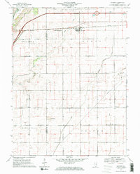
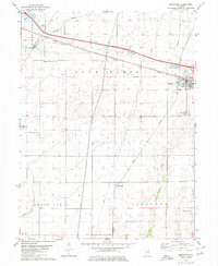 1979 Mansfield1980 Print · USGSMansfield and the surrounding Illinois prairie are shown during the late 1970s as a junction for the CONRAIL and NORFOLK AND WESTERN railroads. Researchers can locate family landmarks like Mackey Cem, Bethel Ch, and numerous private runways including the Weidner Landing Field.
 - 1979 Map of Weldon East, 1980 Print
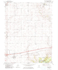 1979 Weldon East1980 Print · USGSPiatt County farmland in the late seventies is marked by the busy Illinois Central Gulf rail line and quiet rural townships. Genealogists can locate family sites near Weldon, DeLand, or the wooded grounds of Robert Allerton Park.
End of results
Showing maps 1-10 of 10
Top cities of Piatt County
- Monticello historical maps
- Bement historical maps
- Cerro Gordo historical maps
- Mansfield historical maps
- Hammond historical maps
- De Land historical maps
See more
Frequently asked questions
- What are the different types of historical maps available for Piatt County?
- What is the oldest map of Piatt County?
- Where can I purchase historical maps of Piatt County for my home or office?
- Where can I download high-res historical maps of Piatt County?
- Are there historical topographic maps available for Piatt County?
- Is there historical aerial imagery available for Piatt County?
- Where are historical maps of Piatt County sourced from?