Old Maps of Port Barrington, Illinois
Explore 27 old maps of Port Barrington, spanning from 1920 to today. These high-resolution historic maps reveal how streets, neighborhoods, landmarks, and natural features evolved over time — perfect for genealogy, metal detecting, research, and local history exploration.
What you can do with these maps:
- See how Port Barrington changed over time: Compare historical maps to modern-day views to trace roads, homesites, rail lines & more.
- View detailed metadata: Each map includes creators, publishers, year, scale, and archive source.
- Overlay maps with satellite & LiDAR: Visualize the past alongside modern tools to explore terrain & human change.
- Trusted historical sources: Maps sourced from the USGS, Library of Congress, and other archives.
- Access maps your way: View online, download high-res files, or order prints for personal or research use.
Start exploring old maps of Port Barrington to uncover forgotten places, hidden landmarks, and the deep history beneath your feet.
Port Barrington, IL maps
(27)- 1920 Map of Grays Lake
 1920 Grays Lake1920 Print · USGSLake County and the Illinois-Wisconsin borderlands are shown here in the early twenties, when the region was a bustling network of lakeside retreats and rural school districts. Genealogists and historians can trace dozens of family-named landmarks and institutions, including the English Prairie School, St Marys Chapel, and Union Cemetery.3 unique versions available
 - 1923 Map of Grays Lake
 1923 Grays Lake1923 Print · USGSThe glacial lake country of northern Illinois is captured here in the early twenties, just as the resort and rail economy flourished. Genealogists can trace family roots at St Marys Chapel, English Prairie School, and numerous villages like Wauconda and Spring Grove.4 unique versions available
 - 1923 Map of Barrington
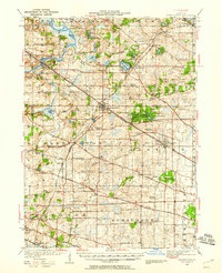
 1923 Barrington1923 Print · USGSNorthwest of Chicago in the early twenties, these townships were a network of farm-to-market roads and lakefront resorts. Trace the early boundaries of the Cook County Forest Preserve and find long-gone rural landmarks like Speeck Resort or Quentins Corners.4 unique versions available
 - 1935 Map of Barrington, 1958 Print
 1935 Barrington1958 Print · USGSNortheastern Illinois appears here in the decades following the first World War as rural townships began to shift toward a suburban future. Genealogists can trace family roots through numerous district schools and local landmarks like St Johns Church, Lake Zurich, and Fox River Grove.
 - 1954 Map of Rockford
 1954 Rockford1954 Print · USGSThe Rock River valley and the Illinois-Wisconsin borderlands are captured here in the mid-1950s during a period of robust industrial and agricultural activity. Genealogists and historians can trace rail-era corridors like the Illinois Central RR and locate landmarks from Big Foot Prairie to Lake Geneva.
 - 1955 Map of Rockford
 1955 Rockford1955 Print · USGSThe Rock River valley and southern Wisconsin dairy country are shown here in the mid-fifties as the region's manufacturing centers grew. Genealogists and historians can trace the paths of the Chicago and North Western RR and Illinois Central RR through hubs like Rockford and Beloit.
 - 1958 Map of Rockford, 1974 Print
 1958 Rockford1974 Print · USGSNorthern Illinois and southern Wisconsin are shown here in the mid-twentieth century as rail-dependent industrial towns began to interface with growing lakefront communities. Genealogists can trace family roots through settlements like Saylesville and Tess Corners or locate historical landmarks like the Rockford Ordnance Depot.4 unique versions available
 - 1960 Map of Barrington, 1962 Print
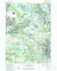
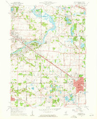 1960 Barrington1962 Print · USGSThe Fox River valley and the emerging suburban corridors of Cook and Lake Counties are captured here at the dawn of the 1960s. Researchers can locate family landmarks such as Evergreen Cem, St Ann Sch, and the rail lines of the Chicago and North Western.4 unique versions available
 - 1960 Map of Wauconda, 1962 Print
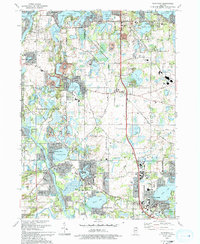
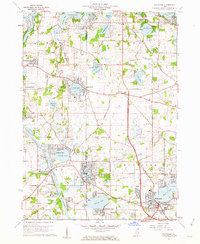 1960 Wauconda1962 Print · USGSThe Fox River and its surrounding glacial lakes are shown during a period of mid-century residential growth. Researchers can trace the development of Island Lake and Wauconda, or locate local landmarks like the Drive-in Theater and St Marys Chapel.5 unique versions available
 - 1960 Map of Grayslake, 1965 Print
 1960 Grayslake1965 Print · USGSLake County's glacial landscape is captured here in the early sixties, showing the rise of commuter suburbs among the region's famous waterways. Researchers can locate dozens of country landmarks like Wray-Imeson Cem, Allendale Farm Sch, and Antioch Airport.
 - 1961 Map of Barrington, 1965 Print
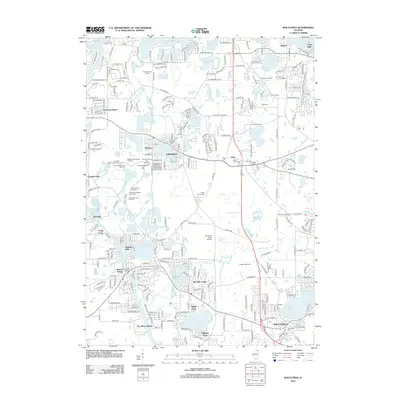
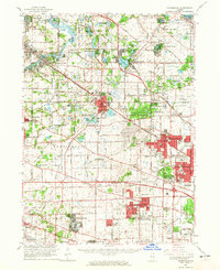 1961 Barrington1965 Print · USGSThe northwest Chicago suburbs were in the midst of a massive post-war building boom in the early sixties. Genealogists and local historians can trace the early footprints of Hoffman Estates and Inverness, or locate landmarks like Arlington Park Racetrack and St Michael Cemetery.
 - 1963 Map of Rockford
 1963 Rockford1963 Print · USGSThe mid-century industrial corridor along the Rock River is shown here during a period of rapid post-war growth. Researchers can trace the extensive rail lines of the Chicago and North Western or locate local landmarks like the Rockford Ordnance Depot and Holy Hill.
 - 1981 Map of Elgin
 1981 Elgin1981 Print · USGSNorthern Illinois and southern Wisconsin are shown in the early eighties as suburban growth meets glacial terrain. Trace the paths of the Milwaukee Road through Harvard or explore the wetlands of Volo Bog State Natural Area.
 - 1993 Map of Wauconda
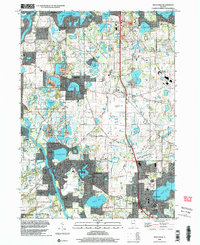
 1993 Wauconda1993 Print · USGSThe Fox River and its glacial lakes defined the Lake County borderlands in the early nineties as residential growth expanded around traditional preserves. Genealogists can trace family names at Fisher Family Cem or locate the old Crown Sch and St Marys Chapel.
 - 1993 Map of Barrington
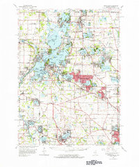
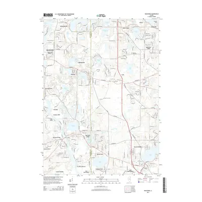
 1993 Barrington1993 Print · USGSNorthern Illinois riverside towns and residential enclaves are shown in the early nineties as they expanded around the Fox River. Researchers can trace the rail corridor and locate White Cem, St Ann Sch, and Lake Barrington.
 - 1998 Map of Wauconda, 2003 Print
 1998 Wauconda2003 Print · USGSLake County and McHenry County communities are shown here at a peak of suburban growth in the late nineties. Genealogists and local historians can locate legacy sites like Fisher Family Cem, St Marys Chapel, and the Oak Knoll Landing Strip.
 - 2012 Map of Barrington, 2012 Print
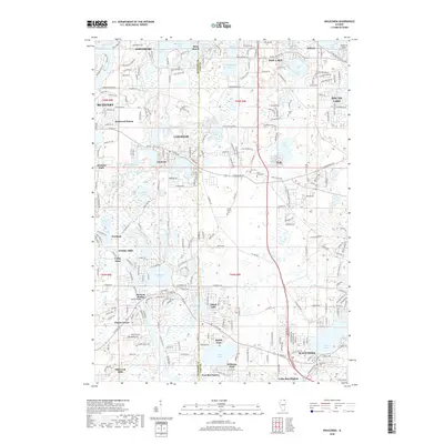
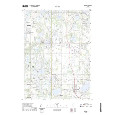
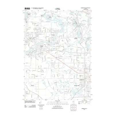 2012 Barrington2012 Print · USGSCovers Port Barrington, including Carpentersville, Cary, and other nearby areas
 - 2012 Map of Wauconda, 2012 Print
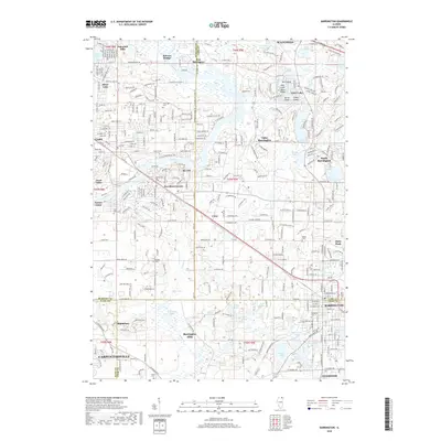
 2012 Wauconda2012 Print · USGSCovers Port Barrington, including McHenry, Round Lake, and other nearby areas
 - 2015 Map of Wauconda, 2015 Print
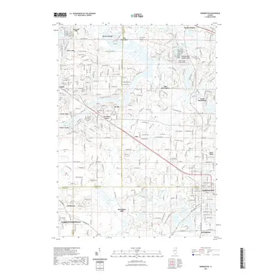
 2015 Wauconda2015 Print · USGSCovers Port Barrington, including McHenry, Round Lake, and other nearby areas
 - 2015 Map of Barrington, 2015 Print
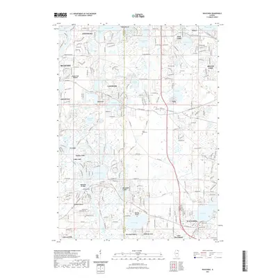
 2015 Barrington2015 Print · USGSCovers Port Barrington, including Carpentersville, Cary, and other nearby areas
 - 2018 Map of Wauconda, 2018 Print
 2018 Wauconda2018 Print · USGSCovers Port Barrington, including McHenry, Round Lake, and other nearby areas
 - 2018 Map of Barrington, 2018 Print
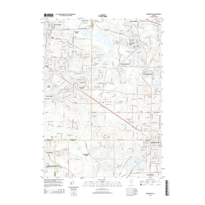
 2018 Barrington2018 Print · USGSCovers Port Barrington, including Carpentersville, Cary, and other nearby areas
 - 2021 Map of Wauconda, 2021 Print
 2021 Wauconda2021 Print · USGSCovers Port Barrington, including McHenry, Round Lake, and other nearby areas
 - 2021 Map of Barrington, 2021 Print
 2021 Barrington2021 Print · USGSCovers Port Barrington, including Carpentersville, Cary, and other nearby areas
 - 2023 Map of Wauconda, 2023 Print
 2023 Wauconda2023 Print · USGSCovers Port Barrington, including McHenry, Round Lake, and other nearby areas
Showing maps 1-25 of 27
Top cities near Port Barrington
- Elgin historical maps
- Schaumburg historical maps
- Arlington Heights historical maps
- Palatine historical maps
- Mount Prospect historical maps
- Hoffman Estates historical maps
See more
Frequently asked questions
- What are the different types of historical maps available for Port Barrington?
- What is the oldest map of Port Barrington?
- Where can I purchase historical maps of Port Barrington for my home or office?
- Where can I download high-res historical maps of Port Barrington?
- Are there historical topographic maps available for Port Barrington?
- Is there historical aerial imagery available for Port Barrington?
- Where are historical maps of Port Barrington sourced from?