1970s Maps of Randolph County, Illinois
Explore 13 historic maps of Randolph County from the 1970s. These maps offer a rare glimpse into what life looked like during the 1970s — showing old roads, neighborhoods, homes, and landmarks that have changed or disappeared over time.
Whether you're researching your family's past, planning a metal detecting trip, or studying how Randolph County's landscape evolved across the 1970s, these high-resolution maps are a powerful tool for exploring the history of this region.
- Focus on a specific era: All maps on this page are from the 1970s, giving you a focused view of this time period.
- See what’s changed: Compare century-old streets, trails, and buildings to today's modern landscape using overlays and satellite layers.
- Research with precision: Use these maps for genealogy, historical research, land use analysis, or educational projects.
- View, download, or print: Maps are fully viewable online in high resolution, and can be downloaded or printed for your own records.
Start exploring Randolph County's history through authentic maps from the 1970s. This is your window into the past.
Randolph County, IL maps
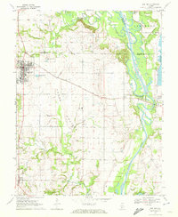
(13)- 1970 Map of Baldwin, 1972 Print
 1970 Baldwin1972 Print · USGSThe border of Randolph and St. Clair counties at the start of the 1970s shows a region balanced between coal mining and small-town life. Researchers can trace rural lineages through numerous sites like St Johns Cem, Lessley Cem, and the St Johns Sch.2 unique versions available
 - 1970 Map of Bloomsdale, 1972 Print
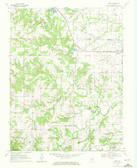
 1970 Bloomsdale1972 Print · USGSThe Mississippi River borderlands between Missouri and Illinois are captured here in the early seventies. Genealogists can trace the rural communities of Bloomsdale and Needmore, while historians can locate Fort Chartres State Park and the lines of the St Louis San Francisco railroad.3 unique versions available
 - 1970 Map of Ames, 1972 Print
 1970 Ames1972 Print · USGSMonroe and Randolph Counties are captured here in the early 1970s, showing a landscape of traditional farmsteads and rural parish life. Researchers can trace family history through sites like St Patrick Sch Cem, Nelson Cem, and the rail corridor of the Gulf Mobile and Ohio.
 - 1970 Map of Prairie Du Rocher, 1972 Print
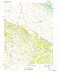
 1970 Prairie Du Rocher1972 Print · USGSThe Mississippi River floodplain and limestone bluffs define the Randolph County borderlands around the 1970s. Genealogists and historians can trace rail-side settlements like Prairie du Rocher, the Modoc Rock Shelter National Historic Site, and riverfront sites at Mudds Landing.3 unique versions available
 - 1970 Map of Chester, 1972 Print
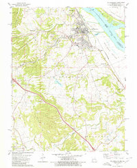
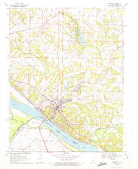 1970 Chester1972 Print · USGSChester and the Mississippi River bluffs are captured here in the early 1970s, showcasing a landscape defined by industry and state institutions. Genealogists and researchers can trace family plots at Evergreen Cem or locate the State Penitentiary and nearby Mine Tunnels.2 unique versions available
 - 1970 Map of Walsh, 1972 Print
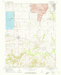
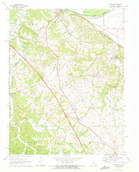
 1970 Walsh1972 Print · USGSRandolph County at the dawn of the seventies shows a landscape where traditional settlements like Walsh meet intensive industrial Strip Mine operations. Researchers can trace family sites at St Pius Cem or locate the Central Community Sch and Missouri Illinois rail line.3 unique versions available
 - 1970 Map of Lithium, 1972 Print
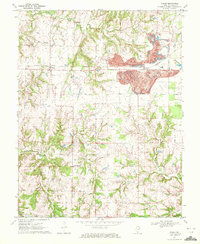
 1970 Lithium1972 Print · USGSPerry County in the early seventies shows a landscape in transition as new highway construction began to redefine the area. Local researchers can locate Lithium, Brewer, and unique landmarks like the Ball Mill Resurgence or the Drive-in Theater.2 unique versions available
 - 1970 Map of Kaskaskia, 1972 Print
 1970 Kaskaskia1972 Print · USGSKaskaskia Island and its riverfront settlements are documented in the early seventies, showcasing a unique Illinois territory west of the Mississippi. Trace the locations of Old Kaskaskia, Kaskaskia Cem, and the historic FORT KASKASKIA STATE PARK bluffs.2 unique versions available
 - 1970 Map of Red Bud, 1972 Print
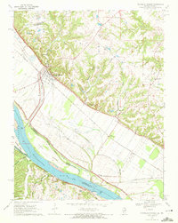
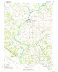
 1970 Red Bud1972 Print · USGSRed Bud and the surrounding Horse Prairie are captured here at the start of the 1970s during a period of significant river engineering. Researchers can trace family sites like Brickley Cemetery or follow the Gulf Mobile and Ohio rail line past Trinity School.3 unique versions available
 - 1970 Map of Belgique, 1972 Print
 1970 Belgique1972 Print · USGSThe Mississippi River bottomlands of Perry County come into sharp focus in the early seventies, showing a landscape shaped by both the river and the rail. Researchers can locate vanished landmarks and family sites like Nativity Cem, School No 73, and the rural community of Belgique.
 - 1970 Map of Evansville, 1972 Print
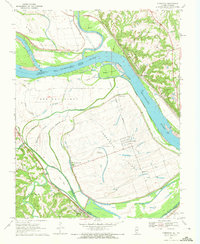
 1970 Evansville1972 Print · USGSRandolph County's river valley comes alive in the early seventies as the Kaskaskia River winds past rural settlements and active rail lines. Researchers can trace family history through sites like St Johns Ch, Ellis Grove, and McCormick Cem.2 unique versions available
 - 1971 Map of Rolla
 1971 Rolla1971 Print · USGSThe Missouri Ozarks are captured here during the early seventies, showing a landscape of deep river valleys and industrial mining towns. Researchers can trace historic lead mining operations at St Joseph Mines and locate rural landmarks like Viburnum and the Galveston Trail.
 - 1979 Map of Ste. Genevieve, 1980 Print
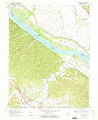
 1979 Ste. Genevieve1980 Print · USGSSte. Genevieve's riverfront and industrial interior are captured in the late seventies as the region balanced its historical roots with active mining and rail operations. Genealogists and local historians can trace family sites near Holy Cross Cem or locate former industrial hubs like Quarry Town and the Mississippi Mine.
End of results
Showing maps 1-13 of 13
Top cities of Randolph County
- Chester historical maps
- Sparta historical maps
- Red Bud historical maps
- Steeleville historical maps
- Coulterville historical maps
- Percy historical maps
See more
Frequently asked questions
- What are the different types of historical maps available for Randolph County?
- What is the oldest map of Randolph County?
- Where can I purchase historical maps of Randolph County for my home or office?
- Where can I download high-res historical maps of Randolph County?
- Are there historical topographic maps available for Randolph County?
- Is there historical aerial imagery available for Randolph County?
- Where are historical maps of Randolph County sourced from?