Old Maps of Randolph County, Illinois for Academic Research
Study the evolution of Randolph County with 158 high-resolution historic maps. Whether you're teaching, researching, or modeling changes in land use, these maps provide essential visual documentation of urban, environmental, and geographic change.
- Analyze long-term change: Track patterns in development, transportation, and natural features.
- Ideal for environmental or urban studies: Support academic projects with primary historical map data.
- Use in the classroom or lab: Educators and researchers rely on these maps to bring historical context to life.
These maps are a powerful tool for teaching, research, and visualizing how Randolph County has changed over the decades.
Randolph County, IL maps
(158)- 1907 Map of Weingarten, 1961 Print
 1907 Weingarten1961 Print · USGSSte. Genevieve County at the start of the twentieth century shows a landscape of riverfront commerce and interior mining. Trace family roots at New Offenburg or locate the old Copper Mine and rural landmarks like the Burns School.2 unique versions available
 - 1909 Map of Weingarten
 1909 Weingarten1909 Print · USGSSoutheast Missouri at the dawn of the twentieth century shows a network of river towns and rail-connected hamlets. Genealogists can trace family land near Ste Genevieve and locate vanished landmarks like the Copper Mine or the Pine Valley School.3 unique versions available
 - 1912 Map of Baldwin, 1967 Print
 1912 Baldwin1967 Print · USGSRandolph and St. Clair counties come alive in this early twentieth-century survey of the Kaskaskia River valley. Genealogists can trace family footprints across dozens of local school sites, including Charter Oak School, Stringtown School, and the rural community of Schuline.
 - 1914 Map of Baldwin
 1914 Baldwin1914 Print · USGSSouthern Illinois farm country and the meandering Kaskaskia River define this 1910s landscape. Genealogists can locate nearly thirty named schoolhouses, including Hiawassie School and Risdon School, alongside the early routes of the Illinois Southern railroad.2 unique versions available
 - 1914 Map of Coulterville, 1965 Print
 1914 Coulterville1965 Print · USGSSouthern Illinois during the height of the steam era reveals a landscape of thriving rail hubs and rural school districts. Genealogists and local historians can trace the foundations of Sparta, Coulterville, and Steeleville alongside dozens of named country schools like Brick School and Temple School.
 - 1915 Map of Renault
 1915 Renault1915 Print · USGSThe Illinois river bluffs and the American Bottom appear here in the early twentieth century as a landscape of thriving rail-side villages and rural schools. You can trace early family sites like Stuptown Church, the historic Ruma Convent, and landings at Prairie du Rocher.4 unique versions available
 - 1915 Map of Chester
 1915 Chester1915 Print · USGSThe Mississippi River bottoms and the bluffs of Illinois meet here just before the Great War. Genealogists can trace family footprints across dozens of local schoolhouses like Walnut Ridge School and vanished river landings such as Okaw Ldg.5 unique versions available
 - 1916 Map of Campbell Hill, 1953 Print
 1916 Campbell Hill1953 Print · USGSThe Mississippi River borderlands in the early twentieth century are captured here during a peak era of rail-and-river commerce. Genealogists can trace family names through dozens of rural schools like Oak School and settlements like Shiloh Hill or Wine Hill.3 unique versions available
 - 1917 Map of Coulterville
 1917 Coulterville1917 Print · USGSSouthern Illinois during the early twentieth century was defined by its coal-belt junctions and a dense grid of rural schoolhouses. Genealogists and historians can trace family locations near landmarks like Lost Prairie School, the Illinois Central rail lines, and the growing town of Sparta.3 unique versions available
 - 1918 Map of Campbell Hill
 1918 Campbell Hill1918 Print · USGSThe Illinois-Missouri borderlands near Campbell Hill are shown here during the late First World War era, where rail lines and river landings drove the local economy. Genealogists can trace family footprints across numerous rural school districts like Ebenezer School, Tangen School, and settlements such as Shiloh Hill.3 unique versions available
 - 1940 Map of Renault, 1955 Print
 1940 Renault1955 Print · USGSThe Illinois-Missouri borderlands come to life in the 1940s, highlighting the river-driven economy and rural community structure of the Mississippi valley. Genealogists can trace family footprints through dozens of local landmarks, from the Ruma Convent to historic schoolhouses like Yankeetown School and Foster School.2 unique versions available
 - 1942 Map of Baldwin, 1960 Print
 1942 Baldwin1960 Print · USGSMid-century southwestern Illinois reveals a landscape of river-bend settlements and extensive rail networks. Genealogists can locate many local landmarks like Jordan Grove School, the Mobile and Ohio rail line, and the village of Evansville along the Kaskaskia River.
 - 1947 Map of Chester
 1947 Chester1947 Print · USGSThe Illinois-Missouri borderlands are captured here in the mid-forties, showing the shifted course of the river and the isolated Kaskaskia Island. Researchers can trace old river landings and rural schoolhouses like Okaw Ldg, Cain Hill School, and the site of Old Kaskaskia.3 unique versions available
 - 1949 Map of Saint Louis
 1949 Saint Louis1949 Print · USGSGreater St. Louis and its surrounding river valleys are captured here just after the war, showing the metropolitan core and the rural Ozark fringe. Researchers can trace the sprawling rail network of the Wabash RR or locate landmarks like Meramec Caverns Airport and Scott Air Force Base.2 unique versions available
 - 1949 Map of Paducah
 1949 Paducah1949 Print · USGSThe confluence of the Ohio, Mississippi, Tennessee, and Cumberland rivers at the close of the 1940s reveals a region bound by water and rail. Researchers can trace historic river landings, timberlands in the Shawnee National Forest, and the coal-mining infrastructure around West Frankfort and Herrin.2 unique versions available
 - 1949 Map of Rolla, 1950 Print
 1949 Rolla1950 Print · USGSThe Missouri Ozarks are captured here just after the war, showing a landscape of deep river valleys and emerging reservoir projects. Genealogists and historians can trace the mining towns of Bonne Terre and Potosi or follow the early route of U.S. Highway 66.
 - 1950 Map of Paducah
 1950 Paducah1950 Print · USGSThe confluence of the great midwestern rivers defines this mid-century landscape at the intersection of Illinois, Kentucky, and Missouri. Genealogists and historians can trace the rail-and-river economy through the hubs of Paducah, Cairo, and Metropolis or locate family roots near the Wildcat Hills.
 - 1953 Map of Rolla
 1953 Rolla1953 Print · USGSSoutheast Missouri’s mining towns and timberlands are seen here at the start of the 1950s. Genealogists and historians can trace the rail-and-river economy through local hubs like Fredericktown and the lead-mining heritage of Potosi and Desloge.
 - 1954 Map of Paducah
 1954 Paducah1954 Print · USGSSouthern Illinois and Western Kentucky intersect at the great river confluences during this mid-century era of rail and river industry. Genealogists and historians can trace family roots and commerce through river towns like Cairo, Metropolis, and Golconda, or along the tracks of the Illinois Central Railroad.2 unique versions available
 - 1954 Map of Rolla, 1970 Print
 1954 Rolla1970 Print · USGSThe Missouri Ozarks and the historic Lead Belt are captured in the late sixties, showing a landscape of deep river hollows and industrial mines. Researchers can trace the routes of the Missouri Pacific RR to extraction sites like the Iron Mountain Mine or Pea Ridge Mine.2 unique versions available
 - 1958 Map of Rolla
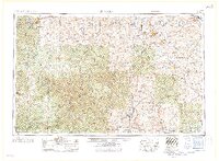 1958 Rolla1958 Print · USGSThe Missouri Ozarks and the lead-rich hills of the southeast are captured here in the late fifties as timber and mining shaped the local economy. Researchers can locate family landmarks like the Rolla Cemetery or trace old rail lines including the Missouri-Illinois RR and St Louis-San Francisco RR.
 - 1958 Map of Belleville, 1973 Print
 1958 Belleville1973 Print · USGSSouthern Illinois during the mid-twentieth century reveals a landscape of industrial growth and massive new reservoirs. Genealogists and historians can trace the paths of the Illinois Central RR through towns like Centralia or locate landmarks such as Emerald Mound and the Looking Glass Prairie.3 unique versions available
 - 1959 Map of Rolla
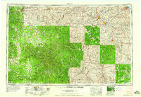 1959 Rolla1959 Print · USGSMid-century Missouri is defined here by the deep forests of the Ozarks and the industrial peaks of the St Francois Mountains. Genealogists and historians can trace the development of towns like Potosi and Fredericktown or locate rural landmarks like Dry Fork Church and the Phelps County Courthouse.
 - 1960 Map of Rolla
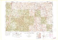 1960 Rolla1960 Print · USGSThe Ozark Highlands in the mid-twentieth century reveal a landscape of deep timber and heavy industry. Researchers can trace the rail-and-mine economy through the St Louis-San Francisco RR and the Iron Mountain Mine, alongside the growth of Fort Leonard Wood.
 - 1961 Map of Paducah
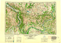 1961 Paducah1961 Print · USGSThe Lower Ohio Valley at mid-century is a landscape defined by its great rivers and newly formed reservoirs. Researchers can trace the riverfronts of Paducah and Metropolis, or locate smaller settlements like Old Shawneetown and Cave in Rock along the banks.2 unique versions available
Showing maps 1-25 of 158
Top cities of Randolph County
- Chester historical maps
- Sparta historical maps
- Red Bud historical maps
- Steeleville historical maps
- Coulterville historical maps
- Percy historical maps
See more
Frequently asked questions
- What are the different types of historical maps available for Randolph County?
- What is the oldest map of Randolph County?
- Where can I purchase historical maps of Randolph County for my home or office?
- Where can I download high-res historical maps of Randolph County?
- Are there historical topographic maps available for Randolph County?
- Is there historical aerial imagery available for Randolph County?
- Where are historical maps of Randolph County sourced from?