Old Maps of Shiloh Station, Illinois for Genealogy
Trace your family roots with 12 historic maps of Shiloh Station. These high-res maps reveal old neighborhoods, homesites, landmarks, and streets — helping you uncover where your ancestors lived and how the area evolved over time.
- Explore historic neighborhoods: Identify where your relatives may have lived in the 1800s or 1900s.
- Compare maps over time: Trace the changes in streets, buildings, and landmarks for multi-generational research.
- Perfect for genealogy & ancestry research: Used by family historians and researchers to map out lineage and migration.
These maps are an incredible resource for exploring your personal connection to Shiloh Station's past.
Shiloh Station, IL maps
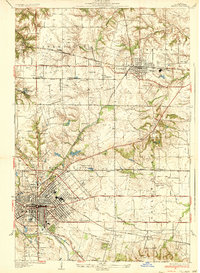
(12)- 1907 Map of Belleville
 1907 Belleville1907 Print · USGSSouthwestern Illinois is seen at a height of rail-driven expansion in the early twentieth century. Trace genealogy and land history in Belleville, O'Fallon, and Summerfield along the Vandalia System and other regional lines.3 unique versions available
 - 1937 Map of O'Fallon
 1937 O'Fallon1937 Print · USGSSt. Clair County's coal and rail landscape is on full display during the late 1930s. Genealogists and historians can trace rail depots like Shiloh Sta, local mines including St Ellen Mine, and numerous country schools such as Whiteside Sch.2 unique versions available
 - 1954 Map of O'Fallon, 1959 Print
 1954 O'Fallon1959 Print · USGSMid-century St. Clair County thrives as an industrial and rail hub connecting Belleville and O'Fallon. Researchers can trace the legacy of the St Louis and O'Fallon Mine or locate family sites at Oak Hill Cem and Milburn Sch.4 unique versions available
 - 1958 Map of Belleville, 1973 Print
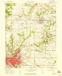
 1958 Belleville1973 Print · USGSSouthern Illinois during the mid-twentieth century reveals a landscape of industrial growth and massive new reservoirs. Genealogists and historians can trace the paths of the Illinois Central RR through towns like Centralia or locate landmarks such as Emerald Mound and the Looking Glass Prairie.3 unique versions available
 - 1962 Map of Belleville
 1962 Belleville1962 Print · USGSSouthern Illinois in the late fifties reveals a landscape of industrial growth and ancient landmarks before the full expansion of the interstate system. Genealogists can trace family names and rural post offices near Centralia, Salem, and the historic Monks Mound.
 - 1985 Map of Carlyle Lake
 1985 Carlyle Lake1985 Print · USGSSouthwestern Illinois in the mid-eighties shows a landscape of growing commuter suburbs and massive water management projects. Genealogists and historians can locate family plots at Lakeview Memorial Gardens Cem or trace the early footprint of Southern Illinois Univ (Edwardsville).2 unique versions available
 - 1991 Map of O'Fallon
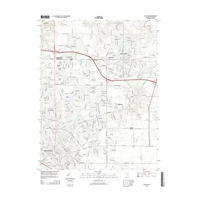
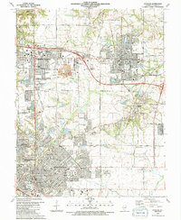 1991 O'Fallon1991 Print · USGSSt. Clair County experiences significant suburban growth in the early nineties as residential developments expand around traditional industry. Trace family roots and local history through Messenger Cem, the tracks of the Southern Railway, and Shiloh Station.2 unique versions available
 - 2012 Map of O'Fallon, 2012 Print
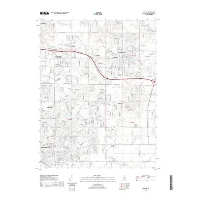
 2012 O'Fallon2012 Print · USGSCovers Shiloh Station, including Belleville, O'Fallon, and other nearby areas
 - 2015 Map of O'Fallon, 2015 Print
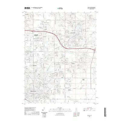
 2015 O'Fallon2015 Print · USGSCovers Shiloh Station, including Belleville, O'Fallon, and other nearby areas
 - 2018 Map of O'Fallon, 2018 Print
 2018 O'Fallon2018 Print · USGSCovers Shiloh Station, including Belleville, O'Fallon, and other nearby areas
 - 2021 Map of O'Fallon, 2021 Print
 2021 O'Fallon2021 Print · USGSCovers Shiloh Station, including Belleville, O'Fallon, and other nearby areas
 - 2024 Map of O'Fallon, 2024 Print
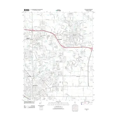
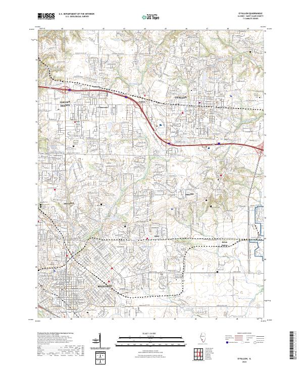 2024 O'Fallon2024 Print · USGSSt. Clair County is shown here as a major regional hub during its contemporary growth, defined by military and educational centers. Trace local roots at Old Saint Clair County Cem or follow the METRO line near BELLEVILLE and SCOTT AFB.
End of results
Showing maps 1-12 of 12
Top cities near Shiloh Station
- Belleville historical maps
- O'Fallon historical maps
- Granite City historical maps
- Collinsville historical maps
- East St. Louis historical maps
- Fairview Heights historical maps
See more
Frequently asked questions
- What are the different types of historical maps available for Shiloh Station?
- What is the oldest map of Shiloh Station?
- Where can I purchase historical maps of Shiloh Station for my home or office?
- Where can I download high-res historical maps of Shiloh Station?
- Are there historical topographic maps available for Shiloh Station?
- Is there historical aerial imagery available for Shiloh Station?
- Where are historical maps of Shiloh Station sourced from?