1990s Maps of Carrier Mills, Illinois
Explore 2 historic maps of Carrier Mills from the 1990s. These maps offer a rare glimpse into what life looked like during the 1990s — showing old roads, neighborhoods, homes, and landmarks that have changed or disappeared over time.
Whether you're researching your family's past, planning a metal detecting trip, or studying how Carrier Mills's landscape evolved across the 1990s, these high-resolution maps are a powerful tool for exploring the history of this region.
- Focus on a specific era: All maps on this page are from the 1990s, giving you a focused view of this time period.
- See what’s changed: Compare century-old streets, trails, and buildings to today's modern landscape using overlays and satellite layers.
- Research with precision: Use these maps for genealogy, historical research, land use analysis, or educational projects.
- View, download, or print: Maps are fully viewable online in high resolution, and can be downloaded or printed for your own records.
Start exploring Carrier Mills's history through authentic maps from the 1990s. This is your window into the past.
Carrier Mills, IL maps
(2)- 1996 Map of Harrisburg
 1996 Harrisburg1996 Print · USGSSaline County's industrial and agricultural heartland is captured here in the mid-nineties, showing the evolving landscape of HARRISBURG and its neighbors. Researchers can locate family roots at Walnut Grove Ch or trace the reach of the Reclaimed Strip Mine near Ledford.
 - 1996 Map of Carrier Mills, 1998 Print
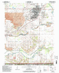
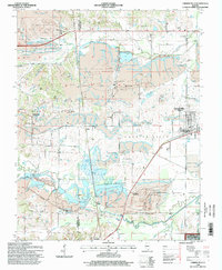 1996 Carrier Mills1998 Print · USGSThe coalfields of southern Illinois are captured here in the late twentieth century as industrial extraction met large-scale reclamation. Genealogists and historians can trace family landmarks like Jenny Ridge Cem, South America Ch, and the Dykersburg Sch amidst the area's massive Strip Mines.2 unique versions available
End of results
Showing maps 1-2 of 2
Top cities near Carrier Mills
- Marion historical maps
- Harrisburg historical maps
- Eldorado historical maps
- Galatia historical maps
- Creal Springs historical maps
- Thompsonville historical maps
See more
Frequently asked questions
- What are the different types of historical maps available for Carrier Mills?
- What is the oldest map of Carrier Mills?
- Where can I purchase historical maps of Carrier Mills for my home or office?
- Where can I download high-res historical maps of Carrier Mills?
- Are there historical topographic maps available for Carrier Mills?
- Is there historical aerial imagery available for Carrier Mills?
- Where are historical maps of Carrier Mills sourced from?