Old Maps of Doddsville, Illinois for Academic Research
Study the evolution of Doddsville with 14 high-resolution historic maps. Whether you're teaching, researching, or modeling changes in land use, these maps provide essential visual documentation of urban, environmental, and geographic change.
- Analyze long-term change: Track patterns in development, transportation, and natural features.
- Ideal for environmental or urban studies: Support academic projects with primary historical map data.
- Use in the classroom or lab: Educators and researchers rely on these maps to bring historical context to life.
These maps are a powerful tool for teaching, research, and visualizing how Doddsville has changed over the decades.
Doddsville, IL maps
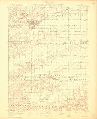
(14)- 1912 Map of Macomb, 1966 Print
 1912 Macomb1966 Print · USGSMcDonough County during the early twentieth century shows a landscape of scattered farmsteads and one-room schoolhouses. Genealogists can trace family landmarks like Runkle School and Pennington Point or follow the path of the Waubonsie Trail.
 - 1914 Map of Macomb
 1914 Macomb1914 Print · USGSWestern Illinois before the Great War is captured here through its dense network of rural school districts and burgeoning rail lines. Genealogists can locate specific family landmarks such as Pennington Point, the Town Hall, and the path of the historic Waubonsie Trail.4 unique versions available
 - 1958 Map of Burlington, 1968 Print
 1958 Burlington1968 Print · USGSThe tri-state river country of Iowa, Illinois, and Missouri is captured here in the mid-fifties, dominated by the Mississippi River and major rail lines. Genealogists and historians can trace the development of river towns like Keokuk or locate the sprawling Iowa Army Ammunition Plant.4 unique versions available
 - 1961 Map of Burlington
 1961 Burlington1961 Print · USGSThe tri-state borderlands along the Mississippi River are captured here during the late fifties and early sixties, showing the vital river-and-rail economy of Iowa, Illinois, and Missouri. Genealogists and historians can trace the development of major hubs like Galesburg and Macomb alongside landmark sites such as the Iowa Ordnance Plant and the historic river town of Nauvoo.
 - 1963 Map of Burlington
 1963 Burlington1963 Print · USGSThe tri-state river country of the Mississippi and Illinois valleys comes alive in this mid-century survey. Genealogists and historians can trace the industrial and academic growth of the region, from the Iowa Ordnance Plant to campuses like Knox College and Western Illinois University.
 - 1974 Map of Doddsville, 1977 Print
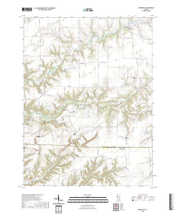
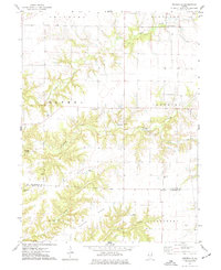 1974 Doddsville1977 Print · USGSThe McDonough and Schuyler County line in the mid-1970s is a landscape of winding creek valleys and high ridges. Researchers can trace local history through numerous burial sites like Stoneking Cem and Pennington Cem or locate the Strip Mine near Grindstone Creek.
 - 1985 Map of Macomb
 1985 Macomb1985 Print · USGSWest Central Illinois in the mid-eighties shows a robust network of river towns and rail corridors spanning from the Illinois River to the Lamoine. Genealogists and historians can trace the foundations of Macomb, find rural landmarks like Pennington Point, or locate early conservation sites like Argyle Lake State Park.
 - 1989 Map of Macomb
 1989 Macomb1989 Print · USGSWest Central Illinois in the late eighties shows a landscape of river-bottom conservation and rail-town commerce. Researchers can trace the extensive wetlands of the Illinois River or locate historic transport hubs in Macomb, Colchester, and Beardstown.
 - 1990 Map of Burlington
 1990 Burlington1990 Print · USGSThe tri-state confluence of Iowa, Illinois, and Missouri is mapped here at the end of the twentieth century. Genealogists and historians can trace the riverfront heritage of Burlington, Keokuk, and Fort Madison, or locate sites like the Battle of Athens State Historic Site.2 unique versions available
 - 2012 Map of Doddsville, 2012 Print
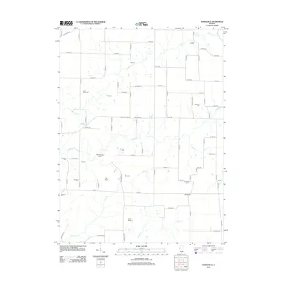 2012 Doddsville2012 Print · USGSCovers Doddsville, including McDonough County, Schuyler County, and other nearby areas
 - 2015 Map of Doddsville, 2015 Print
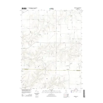 2015 Doddsville2015 Print · USGSCovers Doddsville, including McDonough County, Schuyler County, and other nearby areas
 - 2018 Map of Doddsville, 2018 Print
 2018 Doddsville2018 Print · USGSCovers Doddsville, including McDonough County, Schuyler County, and other nearby areas
 - 2021 Map of Doddsville, 2021 Print
 2021 Doddsville2021 Print · USGSCovers Doddsville, including McDonough County, Schuyler County, and other nearby areas
 - 2024 Map of Doddsville, 2024 Print
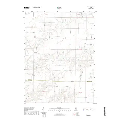
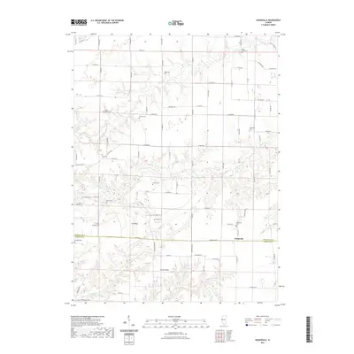
 2024 Doddsville2024 Print · USGSDoddsville and the surrounding Illinois prairie are mapped here at the county line, revealing a landscape of family farms and creek valleys. Genealogists can trace family names at Doddsville Cem and Rigg Cem, or explore the terrain near Gin Ridge.
End of results
Showing maps 1-14 of 14
Top cities near Doddsville
- Macomb historical maps
- Rushville historical maps
- Colchester historical maps
- Vermont historical maps
- Industry historical maps
- Table Grove historical maps
See more
Frequently asked questions
- What are the different types of historical maps available for Doddsville?
- What is the oldest map of Doddsville?
- Where can I purchase historical maps of Doddsville for my home or office?
- Where can I download high-res historical maps of Doddsville?
- Are there historical topographic maps available for Doddsville?
- Is there historical aerial imagery available for Doddsville?
- Where are historical maps of Doddsville sourced from?