1970s Maps of Nashville, Illinois
Explore 4 historic maps of Nashville from the 1970s. These maps offer a rare glimpse into what life looked like during the 1970s — showing old roads, neighborhoods, homes, and landmarks that have changed or disappeared over time.
Whether you're researching your family's past, planning a metal detecting trip, or studying how Nashville's landscape evolved across the 1970s, these high-resolution maps are a powerful tool for exploring the history of this region.
- Focus on a specific era: All maps on this page are from the 1970s, giving you a focused view of this time period.
- See what’s changed: Compare century-old streets, trails, and buildings to today's modern landscape using overlays and satellite layers.
- Research with precision: Use these maps for genealogy, historical research, land use analysis, or educational projects.
- View, download, or print: Maps are fully viewable online in high resolution, and can be downloaded or printed for your own records.
Start exploring Nashville's history through authentic maps from the 1970s. This is your window into the past.
Nashville, IL maps
(4)- 1974 Map of Beaucoup
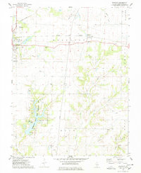 1974 Beaucoup1974 Print · USGSWashington County, Illinois, is captured here in the mid-seventies during a peak period of local oil extraction and conservation development. Researchers can trace family history through numerous burial sites like Old County Cem or locate the Beaucoup Oil Field and the Becks Farm Landing Strip.
 - 1974 Map of Hoyleton, 1978 Print
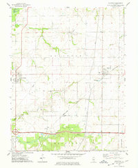 1974 Hoyleton1978 Print · USGSWashington County during the mid-1970s reveals a landscape of established prairie farms and small railroad towns. Genealogists and historians can locate specific landmarks like St Johns Cems, North Prairie Cem, and the rail-oriented layout of Hoyleton.
 - 1974 Map of Nashville, 1978 Print
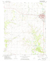 1974 Nashville1978 Print · USGSNashville and the surrounding Illinois prairie are shown in the 1970s as a landscape of agricultural tradition meeting modern oil extraction. Genealogists can locate family landmarks like St Peters Cem, Trinity Sch, and the Cordes Oil Field.2 unique versions available
 - 1974 Map of Addieville, 1978 Print
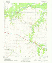 1974 Addieville1978 Print · USGSAddieville and Washington County in the mid-seventies show a landscape defined by prairie agriculture and the winding Kaskaskia River. Genealogists can trace family footprints at Zion Cem and Lively Cem or locate the rural siding at Frogtown.
End of results
Showing maps 1-4 of 4
Top cities near Nashville
- Centralia historical maps
- Okawville historical maps
- Coulterville historical maps
- Germantown historical maps
- Tamaroa historical maps
- Irvington historical maps
See more
Frequently asked questions
- What are the different types of historical maps available for Nashville?
- What is the oldest map of Nashville?
- Where can I purchase historical maps of Nashville for my home or office?
- Where can I download high-res historical maps of Nashville?
- Are there historical topographic maps available for Nashville?
- Is there historical aerial imagery available for Nashville?
- Where are historical maps of Nashville sourced from?