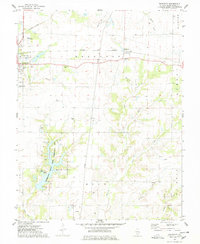
1974 Map of Beaucoup
USGS Topo · Published 1974About this map
Washington County Lake and the surrounding Washington County State Conservation Area dominate the southwestern quadrant of this mid-1970s landscape. This region of Illinois is characterized by a mix of agricultural utility and energy extraction, with the Beaucoup Oil Field and Du Bois Oil Field marked by numerous wells and a network of pipelines. The local infrastructure is anchored by the Nashville city limits and the smaller settlement of Beaucoup, connected by the Louisville and Nashville transit corridor. Genealogists will find a high density of small burial grounds, including Old County Cem, Kennedy Cem, and St Annes Cem. In addition to traditional farming and industry, unique local landmarks like the Becks Farm Landing Strip and a Quarry indicate the varied uses of the Washington County terrain during this era.
Find a feature on this map
41 named features on this map. Tap any name to fly to it.
Don’t see what you’re looking for? This feature index may not catch every label — zoom into the map to look around manually.
Map Details
Editions of this 1974 Beaucoup Map
This is the sole edition of this map. No revisions or reprints were ever made.
Other maps of this area

1924 · Pinckneyville
USGS Topo · 1:62,500

1926 · Pinckneyville
USGS Topo · 1:62,500

1926 · Duquoin
USGS Topo · 1:62,500

1931 · Hoyleton
USGS Topo · 1:48,000

1932 · Nashville
USGS Topo · 1:62,500

1936 · Nashville
USGS Topo · 1:62,500

1943 · Ashley
USGS Topo · 1:62,500

1946 · Ashley
USGS Topo · 1:62,500

1958 · Belleville
USGS Topo · 1:250,000

1962 · Belleville
USGS Topo · 1:250,000