Old Maps of Plum Hill, Illinois for Metal Detecting
Plan your next treasure hunt with 11 historic maps of Plum Hill. Find old homesites, ghost towns, trails, and gathering spots that may be lost to time — perfect for identifying promising metal detecting locations.
- Locate forgotten sites: Uncover places like long-lost settlements, abandoned rail lines, or gathering spots.
- Plan better hunts: Use map overlays combined with LiDAR or satellite views to narrow in on historically rich areas.
- Made for detectorists: Thousands of hobbyists use these maps to discover relics, coins, and hidden history.
Use these historic maps to boost your research and find new opportunities beneath the surface of Plum Hill.
Plum Hill, IL maps
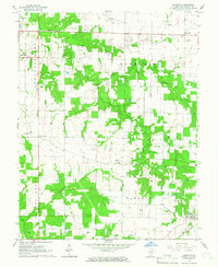
(11)- 1910 Map of Okawville
 1910 Okawville1910 Print · USGSEastern St. Clair and Washington counties appear here in the early 1900s, where the winding river bottomlands met the expanding railroad. Local historians can trace the development of Okawville along the Louisville & Nashville RR or find rural landmarks like Stone Church and Woodland School.2 unique versions available
 - 1940 Map of Okawville, 1958 Print
 1940 Okawville1958 Print · USGSSouthwestern Illinois at the start of the 1940s remains a landscape of tight-knit farming hamlets and river-bottom wetlands. Researchers can trace the heritage of German settlements and rail stops from St Libory and Darmstadt to the mineral springs area of Okawville.
 - 1958 Map of Belleville, 1973 Print
 1958 Belleville1973 Print · USGSSouthern Illinois during the mid-twentieth century reveals a landscape of industrial growth and massive new reservoirs. Genealogists and historians can trace the paths of the Illinois Central RR through towns like Centralia or locate landmarks such as Emerald Mound and the Looking Glass Prairie.3 unique versions available
 - 1962 Map of Belleville
 1962 Belleville1962 Print · USGSSouthern Illinois in the late fifties reveals a landscape of industrial growth and ancient landmarks before the full expansion of the interstate system. Genealogists can trace family names and rural post offices near Centralia, Salem, and the historic Monks Mound.
 - 1964 Map of Oakdale, 1966 Print
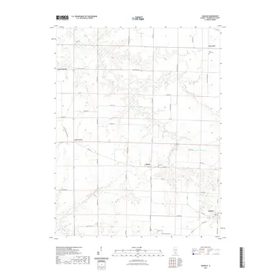
 1964 Oakdale1966 Print · USGSWashington County farming communities and crossroad settlements are captured here in the mid-sixties. You can trace family roots at St Johns Cem, locate the old Lookout Tower, and follow the Missouri Illinois rail line through Oakdale.
 - 1985 Map of Pinckneyville
 1985 Pinckneyville1985 Print · USGSSouthern Illinois in the mid-eighties shows a landscape of prairie farms, coal extraction, and vital rail corridors. Researchers can trace the rail-side growth of Venedy Station and New Memphis Station or locate landmarks like St Libory Church and Memorial Gardens Cem.2 unique versions available
 - 2012 Map of Oakdale, 2012 Print
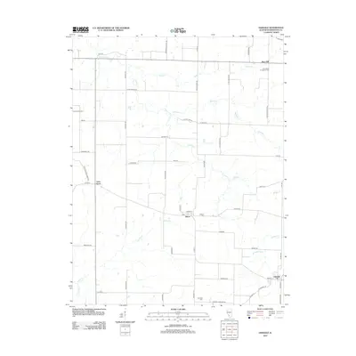 2012 Oakdale2012 Print · USGSCovers Plum Hill, including Lively Grove, Oakdale, and other nearby areas
 - 2015 Map of Oakdale, 2015 Print
 2015 Oakdale2015 Print · USGSCovers Plum Hill, including Lively Grove, Oakdale, and other nearby areas
 - 2018 Map of Oakdale, 2018 Print
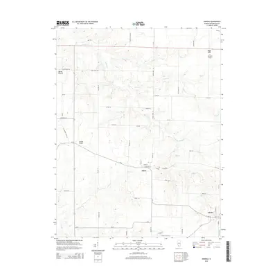
 2018 Oakdale2018 Print · USGSCovers Plum Hill, including Lively Grove, Oakdale, and other nearby areas
 - 2021 Map of Oakdale, 2021 Print
 2021 Oakdale2021 Print · USGSCovers Plum Hill, including Lively Grove, Oakdale, and other nearby areas
 - 2024 Map of Oakdale, 2024 Print
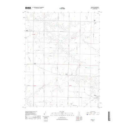
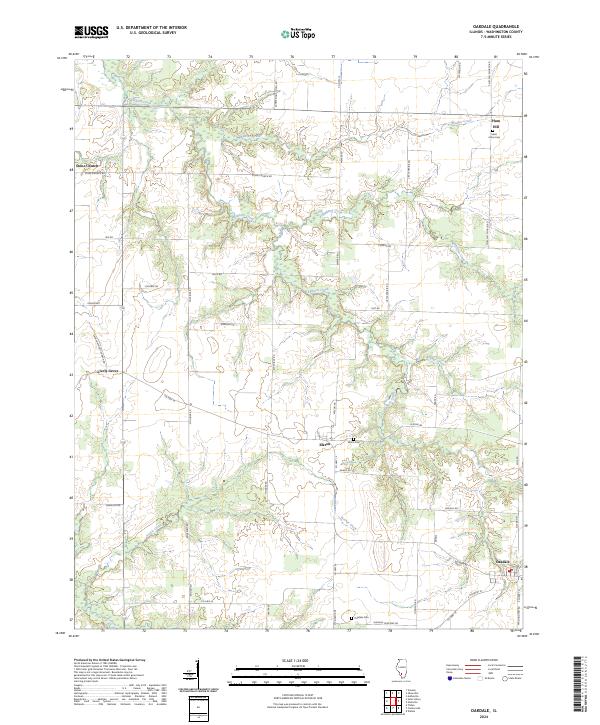 2024 Oakdale2024 Print · USGSWashington County at the start of the 2020s remains a landscape of quiet crossroads and historic farmsteads. Researchers can trace ancestral locations near Saint Johns Cem or follow the historic routes of Stone Church Rd and Jimtown Rd.
End of results
Showing maps 1-11 of 11
Top cities near Plum Hill
- Sparta historical maps
- New Baden historical maps
- Nashville historical maps
- Okawville historical maps
- Coulterville historical maps
- Germantown historical maps
See more
Frequently asked questions
- What are the different types of historical maps available for Plum Hill?
- What is the oldest map of Plum Hill?
- Where can I purchase historical maps of Plum Hill for my home or office?
- Where can I download high-res historical maps of Plum Hill?
- Are there historical topographic maps available for Plum Hill?
- Is there historical aerial imagery available for Plum Hill?
- Where are historical maps of Plum Hill sourced from?