Old Maps of Plainfield Township, Illinois for Metal Detecting
Plan your next treasure hunt with 40 historic maps of Plainfield Township. Find old homesites, ghost towns, trails, and gathering spots that may be lost to time — perfect for identifying promising metal detecting locations.
- Locate forgotten sites: Uncover places like long-lost settlements, abandoned rail lines, or gathering spots.
- Plan better hunts: Use map overlays combined with LiDAR or satellite views to narrow in on historically rich areas.
- Made for detectorists: Thousands of hobbyists use these maps to discover relics, coins, and hidden history.
Use these historic maps to boost your research and find new opportunities beneath the surface of Plainfield Township.
Plainfield Township, IL maps
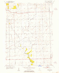
(40)- 1892 Map of Joliet
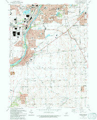
 1892 Joliet1892 Print · USGSWill County at the end of the nineteenth century was a bustling intersection of canal trade and heavy rail. Genealogists can trace the early streets of Joliet and Lockport or locate long-standing rural landmarks like Caton Farm and Grinton.6 unique versions available
 - 1923 Map of Joliet
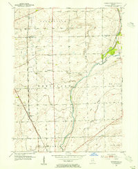
 1923 Joliet1923 Print · USGSJoliet and the Des Plaines River valley are shown here in the 1920s, a hub of heavy industry and vital shipping canals. Genealogists and local historians can trace family roots through numerous country schools like Spaulding School, the Du Page Church, and the expansive State Penitentiary Farm.5 unique versions available
 - 1925 Map of Yorkville
 1925 Yorkville1925 Print · USGSKendall County in the mid-twenties shows a landscape of river-valley commerce and a dense network of interurban electric rail lines. Genealogists can locate family-named schoolhouses like Tamarack School and rural hubs such as Platteville and Helmar.2 unique versions available
 - 1953 Map of Yorkville SE, 1955 Print
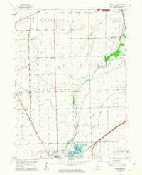
 1953 Yorkville SE1955 Print · USGSIn the early 1950s, the rural border between Kendall and Will counties remained a landscape of family farms and local school districts. Genealogists can locate community landmarks such as Naausay Cem, Marysville Sch, and the village of Plattville.3 unique versions available
 - 1953 Map of Normantown, 1955 Print
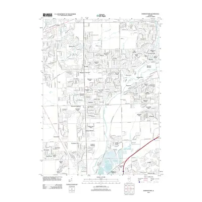
 1953 Normantown1955 Print · USGSThe rural prairies of Du Page and Will counties are shown in the early fifties as the region transitioned toward modernization. Genealogists can trace early family sites like Vermont Cem, Wheatland Sch, and the rail stop at Normantown.
 - 1954 Map of Aurora South, 1955 Print
 1954 Aurora South1955 Print · USGSThe Fox River valley and the southern reaches of Aurora are captured in the mid-fifties, showing a landscape of growing suburbs and rural prairie. Genealogists can trace family names at Mt Olivet Cem or locate the rural Oswego Prairie Ch and Scotch Sch.4 unique versions available
 - 1954 Map of Plainfield, 1955 Print
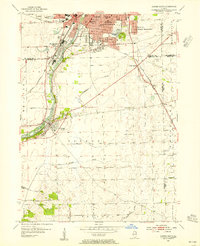
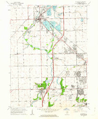
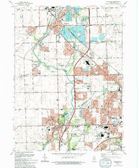
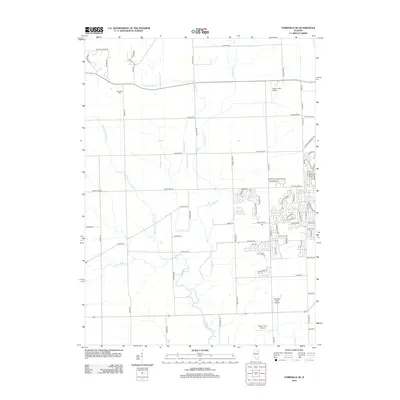
 1954 Plainfield1955 Print · USGSWill County during the mid-fifties reveals a landscape defined by the Du Page River and the bustling industrial corridors of the Elgin Joliet and Eastern Railroad. Researchers can locate family landmarks like Caton Farm, trace historic burials at St Marys Cem, or find early rural schools such as Van Horn Sch.
 - 1954 Map of Yorkville, 1959 Print
 1954 Yorkville1959 Print · USGSKendall County in the mid-1950s shows a balance between growing riverside towns and an expansive agricultural interior. Genealogists can trace family roots through rural landmarks like Naausay Ch, Jericho Cem, and the long-standing diagonal of the Old Indian Boundary.2 unique versions available
 - 1954 Map of Joliet, 1960 Print
 1954 Joliet1960 Print · USGSMid-century Joliet and Plainfield are captured here during a period of heavy industrial and transit growth. Researchers can trace the alignment of the Lincoln Highway and find localized details like the State Prison Farm and Caton Farm.
 - 1958 Map of Aurora, 1969 Print
 1958 Aurora1969 Print · USGSNorthern Illinois in the late fifties shows a landscape of powerful river industry and expanding transport corridors. Genealogists and historians can trace the development of Aurora and Joliet or locate sites like the Elwood Ordnance Plant and Starved Rock.3 unique versions available
 - 1961 Map of Aurora
 1961 Aurora1961 Print · USGSNorthern Illinois at the height of the post-war era reveals a landscape of massive industrial works and thriving river towns. Genealogists and historians can trace the paths of the Lincoln Highway or locate long-standing landmarks like the Green River Ordnance Plant and Starved Rock State Park.
 - 1962 Map of Plainfield, 1963 Print
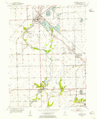
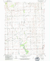
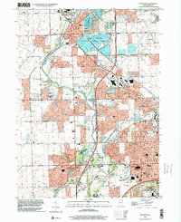
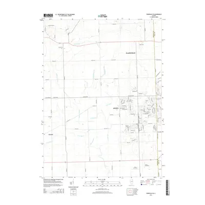
 1962 Plainfield1963 Print · USGSWill County during the early sixties shows the rapid transition from agrarian roots to suburban industrial hub. Genealogists and researchers can trace family sites at Caton Farm, multiple schools like Troy Sch, and several burial grounds including St Marys Cem.3 unique versions available
 - 1962 Map of Normantown, 1963 Print
 1962 Normantown1963 Print · USGSThe Illinois prairie near the Du Page and Will County line is shown here in the early sixties as it transitions from agriculture to industry. You can trace early settlement roots at Vermont Cem or locate former aviation sites like Matter Airport and Aero Airport.3 unique versions available
 - 1985 Map of Aurora, 1989 Print
 1985 Aurora1989 Print · USGSNortheastern Illinois is captured in the mid-1980s as suburban growth began to bridge the gap between the Fox River cities and the outer prairies. Researchers can trace the development of Naperville and Aurora or locate rural landmarks like Fairview Cem and the Illinois and Michigan Canal.
 - 1993 Map of Aurora South, 1994 Print
 1993 Aurora South1994 Print · USGSThe Fox River corridor shows significant suburban growth in the early nineties as residential developments expand around Oswego. Genealogists and local historians can trace family sites at Oswego Prairie Cemetery and the small settlement of Wolfs.
 - 1993 Map of Yorkville SE, 1994 Print
 1993 Yorkville SE1994 Print · USGSKendall and Will counties maintain their rural character in the early nineties, defined by the winding branches of the Aux Sable. Trace local genealogy at the Naausay Cem or follow the historic Indian Reservation Boundary through Seward and Naausay.
 - 1993 Map of Plainfield, 1994 Print
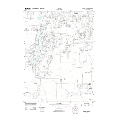
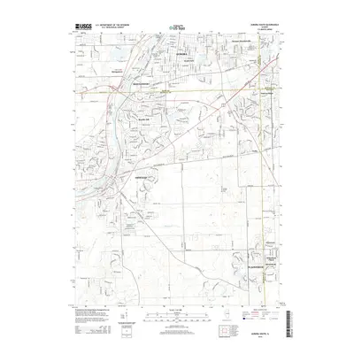
 1993 Plainfield1994 Print · USGSWill County in the early nineties shows a landscape of suburban growth and preserved river corridors north of Joliet. Researchers can locate family sites at Plainfield Cemetery, trace the Du Page River, or find the Servant of Mary Convent.
 - 1993 Map of Normantown, 1994 Print
 1993 Normantown1994 Print · USGSWill County’s transition from prairie farmland to bustling suburban corridor is captured here in the early nineties. Genealogists and local researchers can trace family landmarks like Vermont Cem, the Wheatland-Salem Ch, and the rail lines of the Elgin Joliet and Eastern RR.
 - 1998 Map of Plainfield, 2002 Print
 1998 Plainfield2002 Print · USGSThe Plainfield and Joliet area is shown here in the late 1990s as suburban growth began to surround the Du Page River. Genealogists and local historians can trace the County Farm Cem, the EJ & E RR, and the Servant of Mary Convent.
 - 2012 Map of Aurora South, 2012 Print
 2012 Aurora South2012 Print · USGSCovers Plainfield Township, including Aurora, Plainfield, and other nearby areas
 - 2012 Map of Plainfield, 2012 Print
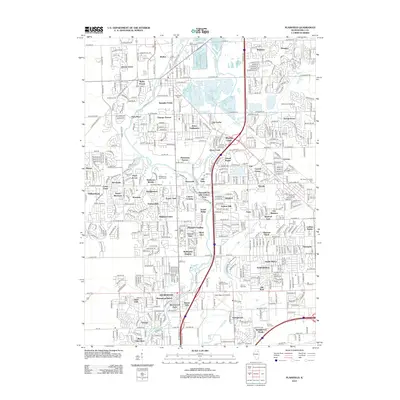 2012 Plainfield2012 Print · USGSCovers Plainfield Township, including Joliet, Plainfield, and other nearby areas
 - 2012 Map of Yorkville SE, 2012 Print
 2012 Yorkville SE2012 Print · USGSCovers Plainfield Township, including Joliet, Plainfield, and other nearby areas
 - 2012 Map of Normantown, 2012 Print
 2012 Normantown2012 Print · USGSCovers Plainfield Township, including Aurora, Naperville, and other nearby areas
 - 2015 Map of Aurora South, 2015 Print
 2015 Aurora South2015 Print · USGSCovers Plainfield Township, including Aurora, Plainfield, and other nearby areas
 - 2015 Map of Yorkville SE, 2015 Print
 2015 Yorkville SE2015 Print · USGSCovers Plainfield Township, including Joliet, Plainfield, and other nearby areas
Showing maps 1-25 of 40
Top cities near Plainfield Township
- Aurora historical maps
- Joliet historical maps
- Naperville historical maps
- Bolingbrook historical maps
- Wheaton historical maps
- Downers Grove historical maps
See more
Top neighborhoods of Plainfield Township
- Lily Cache historical maps
- Coynes historical maps
- Walker historical maps
- Crystal Lawns historical maps
- Caton Farm historical maps
- Aspen Falls historical maps
See more
Frequently asked questions
- What are the different types of historical maps available for Plainfield Township?
- What is the oldest map of Plainfield Township?
- Where can I purchase historical maps of Plainfield Township for my home or office?
- Where can I download high-res historical maps of Plainfield Township?
- Are there historical topographic maps available for Plainfield Township?
- Is there historical aerial imagery available for Plainfield Township?
- Where are historical maps of Plainfield Township sourced from?