Old Maps of Rockdale, Illinois for Hiking & Exploration
Hike through history with 45 historic maps of Rockdale. Explore old trails, ghost towns, and forgotten backroads — perfect for outdoor adventurers and local explorers.
- Rediscover forgotten places: Map out old mining camps, roads, and footpaths that no longer exist on modern maps.
- Layer with modern tools: Combine with LiDAR or satellite views to plan hikes through historical terrain.
- Made for exploration: Popular among hikers, overlanders, and local history lovers.
Use these maps to find adventure and explore the hidden past of Rockdale.
Rockdale, IL maps
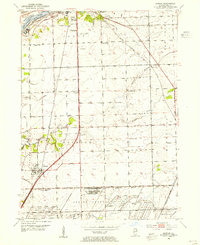
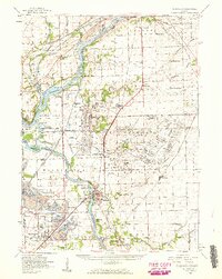
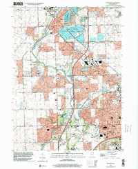
(45)- 1892 Map of Joliet
 1892 Joliet1892 Print · USGSWill County at the end of the nineteenth century was a bustling intersection of canal trade and heavy rail. Genealogists can trace the early streets of Joliet and Lockport or locate long-standing rural landmarks like Caton Farm and Grinton.6 unique versions available
 - 1892 Map of Wilmington
 1892 Wilmington1892 Print · USGSWill County at the end of the nineteenth century is defined by its strategic river confluences and a rapidly expanding rail network. Genealogists and local historians can trace the early footprints of Wilmington and Braidwood, or find vanished rail stops like Blodget and Drummond.3 unique versions available
 - 1918 Map of Wilmington
 1918 Wilmington1918 Print · USGSWill County in the late teens is a landscape shaped by the convergence of major rivers and several historic rail lines. Genealogists and historians can trace numerous rural schoolhouses like Red Brick School and Schweizer School alongside river towns such as Wilmington and Channahon.5 unique versions available
 - 1923 Map of Joliet
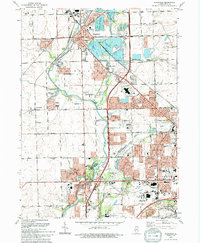
 1923 Joliet1923 Print · USGSJoliet and the Des Plaines River valley are shown here in the 1920s, a hub of heavy industry and vital shipping canals. Genealogists and local historians can trace family roots through numerous country schools like Spaulding School, the Du Page Church, and the expansive State Penitentiary Farm.5 unique versions available
 - 1953 Map of Elwood, 1955 Print
 1953 Elwood1955 Print · USGSNear the village of Elwood in the early fifties, the landscape was defined by the massive expansion of the Joliet Arsenal and a heavy rail network. Local historians can trace old schoolhouse sites like Rose Hill Sch and Brown Sch alongside the Old Indian Bdy.3 unique versions available
 - 1954 Map of Joliet, 1955 Print
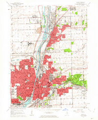
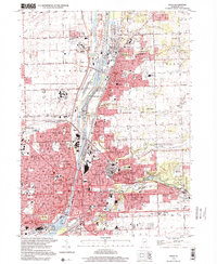
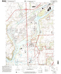
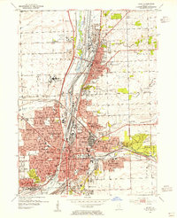 1954 Joliet1955 Print · USGSThe industrial heart of the Des Plaines River corridor comes alive in the mid-1950s. Trace the complex rail and canal networks through Lockport and Joliet, finding historic landmarks like Stateville State Prison and Lewis College.
 - 1954 Map of Plainfield, 1955 Print
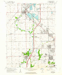
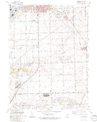
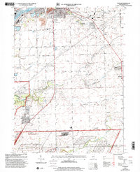
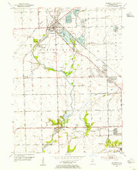 1954 Plainfield1955 Print · USGSWill County during the mid-fifties reveals a landscape defined by the Du Page River and the bustling industrial corridors of the Elgin Joliet and Eastern Railroad. Researchers can locate family landmarks like Caton Farm, trace historic burials at St Marys Cem, or find early rural schools such as Van Horn Sch.
 - 1954 Map of Channahon, 1955 Print
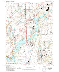
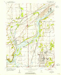 1954 Channahon1955 Print · USGSWill County at mid-century reveals a landscape shaped by major river junctions and the legacy of the canal era. Researchers can trace historical property lines and infrastructure through Channahon, finding detail on landmarks like Willard Grove Cem, Smith Bridge, and the Schweizer Sch.4 unique versions available
 - 1954 Map of Wilmington, 1960 Print
 1954 Wilmington1960 Print · USGSWill and Grundy counties in the mid-fifties show a landscape of industrial convergence where major railroads meet the state's storied canal systems. Researchers can trace the Old Indian Boundary or locate family sites like the Soldiers Widows Home and Willard Grove Cem.3 unique versions available
 - 1954 Map of Joliet, 1960 Print
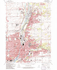
 1954 Joliet1960 Print · USGSMid-century Joliet and Plainfield are captured here during a period of heavy industrial and transit growth. Researchers can trace the alignment of the Lincoln Highway and find localized details like the State Prison Farm and Caton Farm.
 - 1958 Map of Aurora, 1969 Print
 1958 Aurora1969 Print · USGSNorthern Illinois in the late fifties shows a landscape of powerful river industry and expanding transport corridors. Genealogists and historians can trace the development of Aurora and Joliet or locate sites like the Elwood Ordnance Plant and Starved Rock.3 unique versions available
 - 1961 Map of Aurora
 1961 Aurora1961 Print · USGSNorthern Illinois at the height of the post-war era reveals a landscape of massive industrial works and thriving river towns. Genealogists and historians can trace the paths of the Lincoln Highway or locate long-standing landmarks like the Green River Ordnance Plant and Starved Rock State Park.
 - 1962 Map of Joliet, 1963 Print
 1962 Joliet1963 Print · USGSGreater Joliet and Lockport are captured here in the early sixties, centered on the vital industrial corridor of the Des Plaines River. Researchers can trace the layouts of Stateville State Prison, the historic Illinois and Michigan Canal, and local neighborhoods like Lidice.3 unique versions available
 - 1962 Map of Plainfield, 1963 Print
 1962 Plainfield1963 Print · USGSWill County during the early sixties shows the rapid transition from agrarian roots to suburban industrial hub. Genealogists and researchers can trace family sites at Caton Farm, multiple schools like Troy Sch, and several burial grounds including St Marys Cem.3 unique versions available
 - 1985 Map of Ottawa
 1985 Ottawa1985 Print · USGSThe Illinois River valley in the mid-1980s shows a landscape balancing river commerce with sprawling energy and mining operations. Researchers can trace the layout of mining towns like Coal City or find family landmarks such as Oakwood Memorial Cem and Smiths Mound.
 - 1985 Map of Aurora, 1989 Print
 1985 Aurora1989 Print · USGSNortheastern Illinois is captured in the mid-1980s as suburban growth began to bridge the gap between the Fox River cities and the outer prairies. Researchers can trace the development of Naperville and Aurora or locate rural landmarks like Fairview Cem and the Illinois and Michigan Canal.
 - 1991 Map of Ottawa
 1991 Ottawa1991 Print · USGSNorth-central Illinois in the early nineties remains a vital corridor of river commerce and heavy rail. Genealogists and historians can trace the legacy of industrial mining near Morris or explore the river-bluff geography of Starved Rock State Park and Buffalo Rock.
 - 1993 Map of Joliet, 1994 Print
 1993 Joliet1994 Print · USGSJoliet and Lockport are shown at a peak of industrial and institutional development in the early 1990s. Researchers can trace historic cemeteries like Mt Olivet Cemetery or the footprints of the Stateville Correctional Center and the Lockport Locks.
 - 1993 Map of Plainfield, 1994 Print
 1993 Plainfield1994 Print · USGSWill County in the early nineties shows a landscape of suburban growth and preserved river corridors north of Joliet. Researchers can locate family sites at Plainfield Cemetery, trace the Du Page River, or find the Servant of Mary Convent.
 - 1993 Map of Channahon, 1994 Print
 1993 Channahon1994 Print · USGSThe industrial and natural landscapes of Channahon and Minooka meet in the 1990s at the river forks. Genealogists and historians can trace family-named sites like Troutman Grove Cem alongside the sprawling Joliet Ammunitions Plant.
 - 1993 Map of Elwood, 1994 Print
 1993 Elwood1994 Print · USGSSouth of Joliet in the early nineties, this area showcases the heavy industrial and military infrastructure surrounding the village of Elwood. Genealogists and historians can locate Brown Cem, Oak Villa Sch, and the sprawling Joliet Ammunitions Plant.
 - 1998 Map of Joliet, 2001 Print
 1998 Joliet2001 Print · USGSJoliet and Lockport are shown at a peak of industrial and suburban development in the late nineties. Trace the canal-side heritage of the Joliet Steel Works and landmarks like Stateville Correctional Center or Brandon Locks.
 - 1998 Map of Plainfield, 2002 Print
 1998 Plainfield2002 Print · USGSThe Plainfield and Joliet area is shown here in the late 1990s as suburban growth began to surround the Du Page River. Genealogists and local historians can trace the County Farm Cem, the EJ & E RR, and the Servant of Mary Convent.
 - 1999 Map of Channahon, 2002 Print
 1999 Channahon2002 Print · USGSChannahon and Minooka sit at a major river confluence at the close of the twentieth century. Trace the industrial and military landscape from the Joliet Training Area to the Abraham Lincoln National Cemetery.
 - 1999 Map of Elwood, 2002 Print
 1999 Elwood2002 Print · USGSPrairie restoration and military history define this area of Will County at the close of the century. Genealogists and historians can locate Brown Cem, the Abraham Lincoln National Cemetery, and the Elgin Joliet and Eastern RR.
Showing maps 1-25 of 45
Top cities near Rockdale
- Chicago historical maps
- Aurora historical maps
- Joliet historical maps
- Naperville historical maps
- Bolingbrook historical maps
- Orland Park historical maps
See more
Frequently asked questions
- What are the different types of historical maps available for Rockdale?
- What is the oldest map of Rockdale?
- Where can I purchase historical maps of Rockdale for my home or office?
- Where can I download high-res historical maps of Rockdale?
- Are there historical topographic maps available for Rockdale?
- Is there historical aerial imagery available for Rockdale?
- Where are historical maps of Rockdale sourced from?