1910s Maps of Rockford, Rockford Township
Explore 5 historic maps of Rockford from the 1910s. These maps offer a rare glimpse into what life looked like during the 1910s — showing old roads, neighborhoods, homes, and landmarks that have changed or disappeared over time.
Whether you're researching your family's past, planning a metal detecting trip, or studying how Rockford's landscape evolved across the 1910s, these high-resolution maps are a powerful tool for exploring the history of this region.
- Focus on a specific era: All maps on this page are from the 1910s, giving you a focused view of this time period.
- See what’s changed: Compare century-old streets, trails, and buildings to today's modern landscape using overlays and satellite layers.
- Research with precision: Use these maps for genealogy, historical research, land use analysis, or educational projects.
- View, download, or print: Maps are fully viewable online in high resolution, and can be downloaded or printed for your own records.
Start exploring Rockford's history through authentic maps from the 1910s. This is your window into the past.
Rockford, Rockford Township maps
(5)- 1917 Map of Kings, 1969 Print
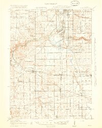
 1917 Kings1969 Print · USGSNorthern Illinois agriculture and rail lines meet south of Rockford during the early twentieth century. Genealogists can trace rural family roots through dozens of district schools like Black Walnut School and the rail junctions of Davis Junction and Holcomb.
 - 1918 Map of Rockford
 1918 Rockford1918 Print · USGSWinnebago County at the end of the Great War reveals a landscape where the river-and-rail economy was in full swing. Genealogists and historians can trace family-named schools like Dickenson School and Eddy School, or locate the Winnebago County Boys Reform School.3 unique versions available
 - 1918 Map of Belvidere
 1918 Belvidere1918 Print · USGSBoone County and the Kishwaukee River valley are captured here in the final year of the Great War. Researchers can trace dozens of rural school sites like Quailtrap School or locate family roots near Argyle and the Scotch Cemetery.
 - 1918 Map of Kings
 1918 Kings1918 Print · USGSThe Rock River valley served as a massive military and rail hub during the First World War. Local historians can trace the early layout of Camp Grant and dozens of country schools like Killbuck School and Maple Corners School.3 unique versions available
 - 1918 Map of Kirkland
 1918 Kirkland1918 Print · USGSNorthern Illinois prairie lands are shown here during the height of the steam rail era. You can trace early family roots through dozens of rural landmarks like Bloods Point School, Gunn School, and the junction at Kirkland.4 unique versions available
End of results
Showing maps 1-5 of 5
Top cities near Rockford
- Belvidere historical maps
- Loves Park historical maps
- Machesney Park historical maps
- Roscoe historical maps
- South Beloit historical maps
- Rockton historical maps
See more
Top neighborhoods of Rockford
- Winnebago Court historical maps
- Morris Kennedy Subdivision historical maps
- Normandy Heights historical maps
- Ravinia Park historical maps
- Silver Hills historical maps
- Kishwaukee Subdivision historical maps
See more
Frequently asked questions
- What are the different types of historical maps available for Rockford?
- What is the oldest map of Rockford?
- Where can I purchase historical maps of Rockford for my home or office?
- Where can I download high-res historical maps of Rockford?
- Are there historical topographic maps available for Rockford?
- Is there historical aerial imagery available for Rockford?
- Where are historical maps of Rockford sourced from?