Old Maps of Hessen Cassel, Indiana for Genealogy
Trace your family roots with 10 historic maps of Hessen Cassel. These high-res maps reveal old neighborhoods, homesites, landmarks, and streets — helping you uncover where your ancestors lived and how the area evolved over time.
- Explore historic neighborhoods: Identify where your relatives may have lived in the 1800s or 1900s.
- Compare maps over time: Trace the changes in streets, buildings, and landmarks for multi-generational research.
- Perfect for genealogy & ancestry research: Used by family historians and researchers to map out lineage and migration.
These maps are an incredible resource for exploring your personal connection to Hessen Cassel's past.
Hessen Cassel, IN maps
(10)- 1953 Map of Muncie, 1966 Print
 1953 Muncie1966 Print · USGSIndiana and Ohio borderlands thrive in the early fifties, showing a landscape defined by manufacturing cities and an intensive railroad network. Genealogists can trace family roots across the Indiana-Ohio line through Muncie, Celina, and Portland via the Pennsylvania railroad.5 unique versions available
 - 1956 Map of Muncie
 1956 Muncie1956 Print · USGSEastern Indiana and western Ohio are shown at a peak of rail-driven industry in the mid-fifties. Genealogists and rail historians can trace the paths of the Pennsylvania RR through Muncie or locate landmarks like Lake Saint Marys (Grand Lake Reservoir) and Frances Slocum State Forest.
 - 1962 Map of Poe
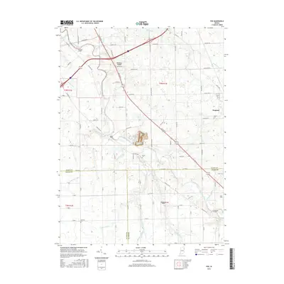
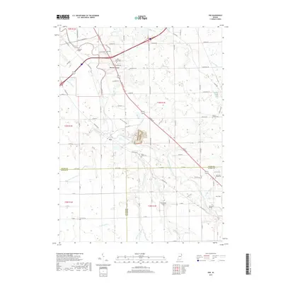
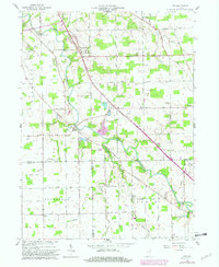 1962 Poe1962 Print · USGSSouthern Allen County was a landscape of fertile drainage and river crossings in the early sixties. Researchers can trace family roots at Hessen Cassel, locate burial sites like Bethel Cem, and see the St Marys River before modern expansion.4 unique versions available
 - 1986 Map of Wabash
 1986 Wabash1986 Print · USGSThe Wabash Valley and surrounding Indiana farm country are captured here in the mid-eighties, showing a landscape reshaped by major reservoirs. Genealogists and local historians can trace the paths of the Old Indian Trail and the industrial reach of the Conrail line through towns like Lagro and Warren.2 unique versions available
 - 1994 Map of Poe, 1995 Print
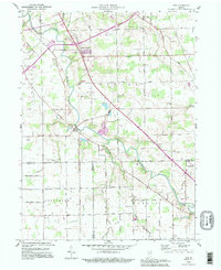 1994 Poe1995 Print · USGSNortheastern Indiana farmland at the close of the twentieth century is captured here as the St Marys River meanders through Allen County. Genealogists can locate family landmarks like Bethel Cem, Scheiman Bridge, and the community of Hoagland in its mid-nineties state.
 - 2010 Map of Poe, 2010 Print
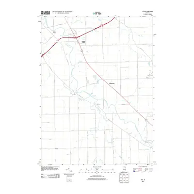 2010 Poe2010 Print · USGSCovers Hessen Cassel, including Middletown, Poe, and other nearby areas
 - 2013 Map of Poe, 2013 Print
 2013 Poe2013 Print · USGSCovers Hessen Cassel, including Middletown, Poe, and other nearby areas
 - 2016 Map of Poe, 2016 Print
 2016 Poe2016 Print · USGSCovers Hessen Cassel, including Middletown, Poe, and other nearby areas
 - 2019 Map of Poe, 2019 Print
 2019 Poe2019 Print · USGSCovers Hessen Cassel, including Middletown, Poe, and other nearby areas
 - 2022 Map of Poe, 2022 Print
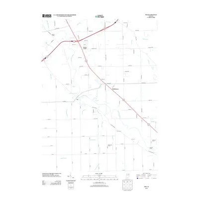
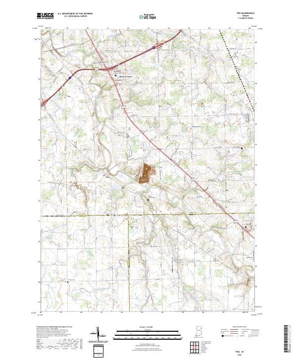 2022 Poe2022 Print · USGSSoutheastern Allen County is revealed here during the early 2020s, showing a landscape defined by the Saint Marys River and long-standing rural communities. Genealogists can locate family landmarks at Bethel Baptist Cem or trace the early settlement at Poe.
End of results
Showing maps 1-10 of 10
Top cities near Hessen Cassel
- Fort Wayne historical maps
- New Haven historical maps
- Bluffton historical maps
- Decatur historical maps
- Ossian historical maps
- Leo-Cedarville historical maps
See more
Frequently asked questions
- What are the different types of historical maps available for Hessen Cassel?
- What is the oldest map of Hessen Cassel?
- Where can I purchase historical maps of Hessen Cassel for my home or office?
- Where can I download high-res historical maps of Hessen Cassel?
- Are there historical topographic maps available for Hessen Cassel?
- Is there historical aerial imagery available for Hessen Cassel?
- Where are historical maps of Hessen Cassel sourced from?