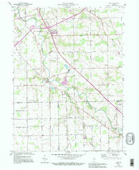
1994 Map of Poe
USGS Topo · Published 1995About this map
The St Marys River winds through this rural landscape south of Fort Wayne, defining the layout of historical settlements like Poe and Hessen Cassel. This 1994 revision reflects the persistence of agrarian roots across Marion, Jefferson, and Pleasant townships, where a dense network of drainage ditches—including Houk Ditch and Snyder Ditch—manages the low-lying terrain. The map is a vital resource for family historians, documenting several rural burying grounds such as Bethel Cem, Archbold Cem, and Honan Cem. Education and faith are anchored by local institutions like Emmanuel Sch and Zion Sch, while the presence of the Radio Facility and the modern road network, including the diagonal Wayne Trace, illustrates the intersection of traditional Indiana farmland with late-twentieth-century infrastructure.
Find a feature on this map
48 named features on this map. Tap any name to fly to it.
Don’t see what you’re looking for? This feature index may not catch every label — zoom into the map to look around manually.
Map Details
Editions of this 1994 Poe Map
This is the sole edition of this map. No revisions or reprints were ever made.
Other maps of this area

1953 · Fort Wayne
USGS Topo · 1:250,000

1953 · Muncie
USGS Topo · 1:250,000

1956 · Muncie
USGS Topo · 1:250,000

1956 · Fort Wayne
USGS Topo · 1:250,000

1956 · Fort Wayne West
USGS Topo · 1:24,000

1956 · Fort Wayne East
USGS Topo · 1:24,000

1957 · Maples
USGS Topo · 1:24,000

1961 · Hoagland
USGS Topo · 1:24,000

1962 · Poe
USGS Topo · 1:24,000

1962 · Uniondale
USGS Topo · 1:24,000