1900s (20th Century) Maps of Leo-Cedarville, Indiana
Explore 9 historic maps of Leo-Cedarville from the 1900s (20th Century). These maps offer a rare glimpse into what life looked like during the 1900s — showing old roads, neighborhoods, homes, and landmarks that have changed or disappeared over time.
Whether you're researching your family's past, planning a metal detecting trip, or studying how Leo-Cedarville's landscape evolved across the 1900s, these high-resolution maps are a powerful tool for exploring the history of this region.
- Focus on a specific era: All maps on this page are from the 1900s, giving you a focused view of this time period.
- See what’s changed: Compare century-old streets, trails, and buildings to today's modern landscape using overlays and satellite layers.
- Research with precision: Use these maps for genealogy, historical research, land use analysis, or educational projects.
- View, download, or print: Maps are fully viewable online in high resolution, and can be downloaded or printed for your own records.
Start exploring Leo-Cedarville's history through authentic maps from the 1900s. This is your window into the past.
Leo-Cedarville, IN maps
(9)- 1953 Map of Fort Wayne, 1963 Print
 1953 Fort Wayne1963 Print · USGSNortheast Indiana and its neighboring borderlands in Michigan and Ohio appear here during a peak era of rail and road expansion. Researchers can trace the massive rail networks of the Nickel Plate Road and Wabash or locate lakeside landmarks like Lake Wawasee and Clear Lake.4 unique versions available
 - 1956 Map of Fort Wayne
 1956 Fort Wayne1956 Print · USGSThe tri-state borderlands of Indiana, Michigan, and Ohio are captured here in the mid-fifties, centered on the growing industrial hub of Fort Wayne. Researchers can trace the heavy rail lines of the New York Central and Pennsylvania alongside prominent water features like Lake Wawasee and the Maumee River.2 unique versions available
 - 1956 Map of Cedarville, 1958 Print
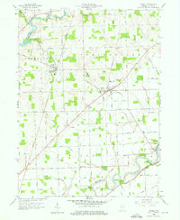
 1956 Cedarville1958 Print · USGSAllen County’s river valleys and growing suburbs come into focus during the mid-fifties as infrastructure like the Cedarville Reservoir transformed the local landscape. Genealogists and historians can trace institutional sites like Sr Concordia College and old family-named landmarks like Viberg Ch Cem.
 - 1958 Map of Grabill, 1959 Print
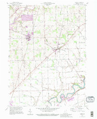
 1958 Grabill1959 Print · USGSAllen County farm country and small-town life are documented here in the late fifties. Genealogists and researchers can trace family roots through Grabill, Harlan, and the Salem Cem Ch, or follow the path of the old Wabash and Erie Canal.3 unique versions available
 - 1963 Map of Cedarville, 1965 Print
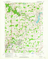 1963 Cedarville1965 Print · USGSIn the early sixties, the Allen County countryside northeast of Fort Wayne was rapidly evolving from agricultural land to residential neighborhoods. Trace family roots and land use near Cedarville and Leo at sites like Robinson Chapel, Viberg Chapel, and the Concordia Senior College campus.3 unique versions available
 - 1984 Map of Fort Wayne, 1985 Print
 1984 Fort Wayne1985 Print · USGSNortheast Indiana in the mid-1980s reveals a complex landscape of glacial lakes, thriving college towns, and heavy rail infrastructure. Researchers can trace the development of Winona Lake, locate Manchester College in North Manchester, and find rural landmarks like Oakwood Cem or the Tri-County State Fish and Game Area.
 - 1986 Map of Defiance, 1992 Print
 1986 Defiance1992 Print · USGSNorthwest Ohio and Eastern Indiana appear in the late eighties as a landscape shaped by significant river confluences and rail corridors. Researchers can trace the layout of local towns and landmarks like Defiance College, Forest Hill Cem, and the path of the Norfolk and Western RR.
 - 1992 Map of Grabill, 1995 Print
 1992 Grabill1995 Print · USGSNortheast Indiana's agricultural heartland is documented here in the final decade of the twentieth century, showing the established rail and river towns of Allen County. Family historians can locate family-named sites like Barnett Cem and rural centers such as Grabill and Milan Center.
 - 1994 Map of Fort Wayne
 1994 Fort Wayne1994 Print · USGSNortheast Indiana in the mid-nineties shows a landscape deeply tied to its glacial lakes and early rail networks. Genealogists and historians can trace old transit lines like the Old Ind RR and explore lakeside settlements such as Enchanted Hills and Syracuse.
End of results
Showing maps 1-9 of 9
Top cities near Leo-Cedarville
- Fort Wayne historical maps
- New Haven historical maps
- Auburn historical maps
- Kendallville historical maps
- Garrett historical maps
- Butler historical maps
See more
Frequently asked questions
- What are the different types of historical maps available for Leo-Cedarville?
- What is the oldest map of Leo-Cedarville?
- Where can I purchase historical maps of Leo-Cedarville for my home or office?
- Where can I download high-res historical maps of Leo-Cedarville?
- Are there historical topographic maps available for Leo-Cedarville?
- Is there historical aerial imagery available for Leo-Cedarville?
- Where are historical maps of Leo-Cedarville sourced from?