1900s (20th Century) Maps of Garden City, Indiana
Explore 6 historic maps of Garden City from the 1900s (20th Century). These maps offer a rare glimpse into what life looked like during the 1900s — showing old roads, neighborhoods, homes, and landmarks that have changed or disappeared over time.
Whether you're researching your family's past, planning a metal detecting trip, or studying how Garden City's landscape evolved across the 1900s, these high-resolution maps are a powerful tool for exploring the history of this region.
- Focus on a specific era: All maps on this page are from the 1900s, giving you a focused view of this time period.
- See what’s changed: Compare century-old streets, trails, and buildings to today's modern landscape using overlays and satellite layers.
- Research with precision: Use these maps for genealogy, historical research, land use analysis, or educational projects.
- View, download, or print: Maps are fully viewable online in high resolution, and can be downloaded or printed for your own records.
Start exploring Garden City's history through authentic maps from the 1900s. This is your window into the past.
Garden City, IN maps
(6)- 1942 Map of Columbus
 1942 Columbus1942 Print · USGSBartholomew and Shelby counties are shown during the early years of the war, as military installations and rail lines reshaped the rural Indiana landscape. Genealogists can trace family-named sites and established communities like St Louis Crossing, Hope, and the sprawling Camp Atterbury.
 - 1953 Map of Cincinnati, 1965 Print
 1953 Cincinnati1965 Print · USGSThe Ohio River valley and the industrial heartland of Indiana and Ohio are captured here during the mid-century peak of rail and river commerce. Genealogists and historians can trace connections between Cincinnati and outlying military sites like Camp Atterbury and Bakalar AFB.3 unique versions available
 - 1957 Map of Cincinnati
 1957 Cincinnati1957 Print · USGSThe Ohio River valley and its surrounding highlands thrived during the mid-fifties industrial peak, centered on the bustling Cincinnati and Dayton metropolitan hubs. Researchers can trace the extensive rail networks and military sites like Wright-Patterson AFB and Camp Atterbury.
 - 1958 Map of Columbus, 1959 Print
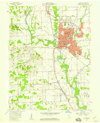 1958 Columbus1959 Print · USGSBartholomew County comes into focus in the late fifties as its river-and-rail hub expands toward the surrounding prairies. Genealogists and historians can trace the urban footprint of Columbus out to rural landmarks like Mt Pleasant Ch, Daugherty Cem, and the Booth-Setser Sch.
 - 1962 Map of Columbus, 1964 Print
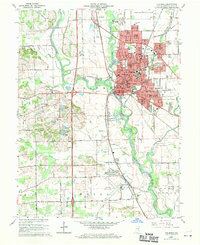 1962 Columbus1964 Print · USGSBartholomew County experiences a period of significant mid-century growth as the urban center of Columbus expands toward Bakalar Air Force Base. Genealogists and local historians can locate several family burial sites including Carter Cem and trace the path of the Pennsylvania railroad past Walesboro.6 unique versions available
 - 1986 Map of Greensburg
 1986 Greensburg1986 Print · USGSSoutheastern Indiana in the mid-eighties shows a balance of growing industrial centers and deeply rooted rural communities. Family historians can trace landmarks like the Highland Center School, South Park Cemetery, and the Bartholomew County Courthouse among the river forks.2 unique versions available
End of results
Showing maps 1-6 of 6
Top cities near Garden City
- Columbus historical maps
- Seymour historical maps
- Nineveh historical maps
- Hope historical maps
- Princes Lakes historical maps
- Trafalgar historical maps
See more
Frequently asked questions
- What are the different types of historical maps available for Garden City?
- What is the oldest map of Garden City?
- Where can I purchase historical maps of Garden City for my home or office?
- Where can I download high-res historical maps of Garden City?
- Are there historical topographic maps available for Garden City?
- Is there historical aerial imagery available for Garden City?
- Where are historical maps of Garden City sourced from?