2020s Maps of Boone County, Indiana
Explore 15 historic maps of Boone County from the 2020s. These maps offer a rare glimpse into what life looked like during the 2020s — showing old roads, neighborhoods, homes, and landmarks that have changed or disappeared over time.
Whether you're researching your family's past, planning a metal detecting trip, or studying how Boone County's landscape evolved across the 2020s, these high-resolution maps are a powerful tool for exploring the history of this region.
- Focus on a specific era: All maps on this page are from the 2020s, giving you a focused view of this time period.
- See what’s changed: Compare century-old streets, trails, and buildings to today's modern landscape using overlays and satellite layers.
- Research with precision: Use these maps for genealogy, historical research, land use analysis, or educational projects.
- View, download, or print: Maps are fully viewable online in high resolution, and can be downloaded or printed for your own records.
Start exploring Boone County's history through authentic maps from the 2020s. This is your window into the past.
Boone County, IN maps
(15)- 2022 Map of Fayette, 2022 Print
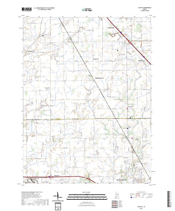 2022 Fayette2022 Print · USGSThe borderlands of Boone and Hendricks counties are captured here during a time of suburban expansion and agricultural continuity. Researchers can trace family sites at Mount Union Cem, locate the old settlement of Fayette, or follow the waters of White Lick Cr.
 - 2022 Map of Shannondale, 2022 Print
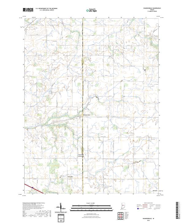 2022 Shannondale2022 Print · USGSCrossing the Montgomery and Boone county line in the early 2020s, this area reflects the deep agricultural roots of central Indiana. Genealogists can locate small family landmarks and rural burial grounds like Pisgah Cem, Log Cabin Crossroads, and the settlement of Beckville.
 - 2022 Map of Lizton, 2022 Print
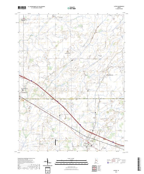 2022 Lizton2022 Print · USGSThe crossroads of Hendricks and Boone Counties are captured here in the early 2020s, showing a landscape shaped by prairie farming and small-town commerce. Genealogists can trace family heritage at the Lizton Knights of Pythias Cem or explore the history of New Brunswick and Raintown.
 - 2022 Map of Kirklin, 2022 Print
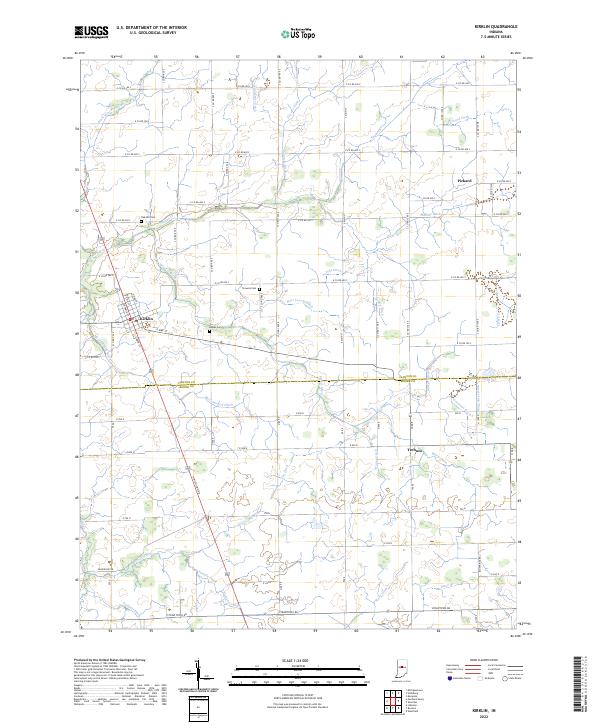 2022 Kirklin2022 Print · USGSThe borderlands of Clinton and Boone counties are shown here in the 2020s, revealing a landscape deeply transformed for modern agriculture. Researchers can trace family roots at Oak Hill Cem or locate the rural crossroads of Pickard and Terhune.
 - 2022 Map of Thorntown, 2022 Print
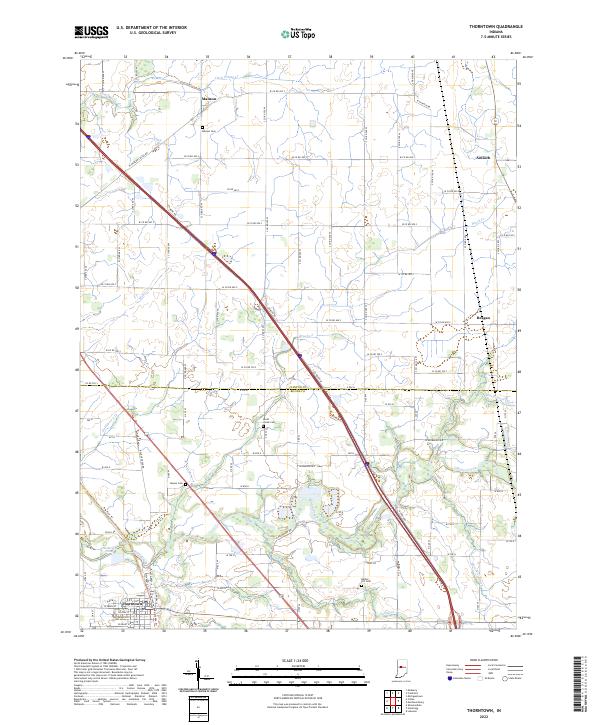 2022 Thorntown2022 Print · USGSThorntown and its surrounding rural hamlets are mapped here in the early 2020s at the intersection of Boone and Clinton Counties. Researchers can locate several family-named burial grounds like Gipson Cem and Manson Cem alongside the waters of Sugar Creek.
 - 2022 Map of Sheridan, 2022 Print
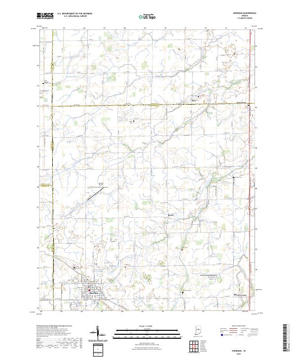 2022 Sheridan2022 Print · USGSCentral Indiana's agricultural landscape is captured here as it appeared in 2022 at the intersection of four counties. Genealogists can trace family connections through numerous rural burial sites like Union Cem, Phillips Cem, and Spicewood Cem near the town of Sheridan.
 - 2022 Map of Lebanon, 2022 Print
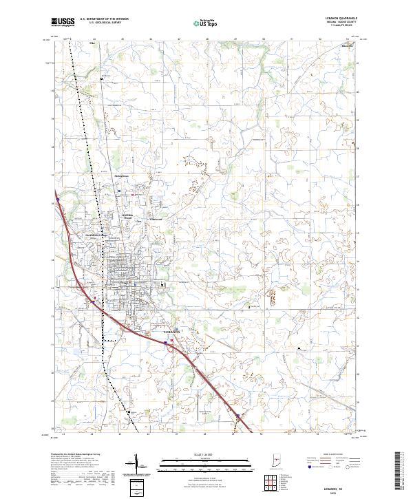 2022 Lebanon2022 Print · USGSLebanon and its surrounding townships are shown here as the county seat continues to grow alongside its deep agricultural roots. Trace family lineage at Oak Hill Cem and follow the rail-to-trail conversion of the Big Four Trl.
 - 2022 Map of Hazelrigg, 2022 Print
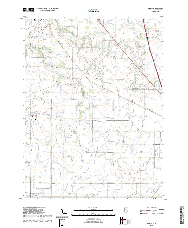 2022 Hazelrigg2022 Print · USGSBoone County farmland is captured here in the early 2020s, showing the intersection of historic rail corridors and rural life. Genealogists can locate Maple Lawn Cem and Dover Cem or trace the Big Four Trl past Hazelrigg.
 - 2022 Map of Mechanicsburg, 2022 Print
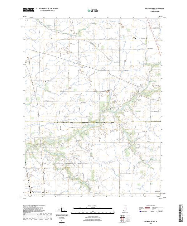 2022 Mechanicsburg2022 Print · USGSClinton and Boone counties are captured in this modern survey of Indiana's rural agricultural landscape. Genealogists and local historians can trace family roots through several legacy burial sites like McIntire Cemetery and Buntin Cemetery, or locate the historic centers of Mechanicsburg and Cyclone.
 - 2022 Map of Rosston, 2022 Print
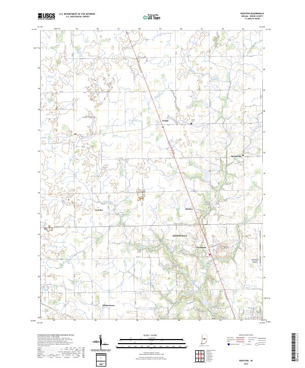 2022 Rosston2022 Print · USGSBoone County enters a period of modern growth in the early 2020s as suburban reaches meet historic farming communities. Genealogists and researchers can trace the landscape around Zionsville and Whitestown, locating landmarks like Bethel Cem and the Big Four Trl.
 - 2022 Map of Westfield, 2022 Print
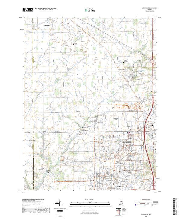 2022 Westfield2022 Print · USGSHamilton County at the start of the 2020s shows a unique blend of modern growth and deep-seated history. Researchers can trace Quaker heritage and early transport via the Anti-Slavery Friends Cem, the Monon Trl, and Union Bible College.
 - 2022 Map of Colfax, 2022 Print
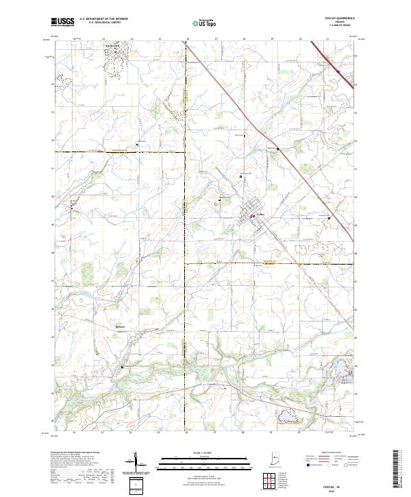 2022 Colfax2022 Print · USGSIndiana's rural heartland is meticulously documented in this survey of the four-county junction area involving Clinton, Montgomery, Boone, and Tippecanoe Counties. Researchers can locate family heritage sites like Shiloh Cem, trace the route of the Big Four Trl, and explore the layout of Colfax.
 - 2022 Map of New Ross, 2022 Print
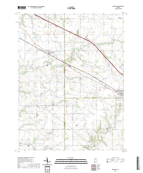 2022 New Ross2022 Print · USGSIndiana's rural heartland is meticulously documented here during the early twenty-first century, centered on the tri-county junction. Genealogists can locate numerous family burial sites like Kidd Farm Cem, Porter Cem, and Hypes Cem along the banks of Big Raccoon Creek.
 - 2022 Map of Zionsville, 2022 Print
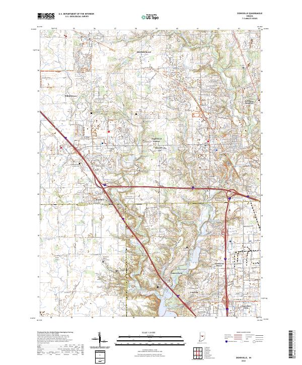 2022 Zionsville2022 Print · USGSZionsville and the Boone County borderlands are captured here in their contemporary layout of suburban growth and preserved history. Researchers can trace the heritage of local families and settlements through the Lincoln Memory Gardens Cem, Traders Point, and the Zionsville Rail Trail.
 - 2022 Map of Carmel, 2022 Print
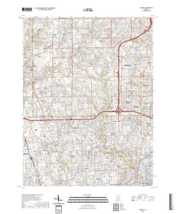 2022 Carmel2022 Print · USGSThe northern suburbs of Indianapolis are captured in a period of intense growth as agricultural land gives way to dense residential planning. Local historians can trace the paths of Little Eagle Creek and the Monon Rail Trl past landmarks like Poplar Ridge Cem and Eagle Village.
End of results
Showing maps 1-15 of 15
Top cities of Boone County
- Lebanon historical maps
- Zionsville historical maps
- Thorntown historical maps
- Jamestown historical maps
- Whitestown historical maps
- Advance historical maps
See more
Frequently asked questions
- What are the different types of historical maps available for Boone County?
- What is the oldest map of Boone County?
- Where can I purchase historical maps of Boone County for my home or office?
- Where can I download high-res historical maps of Boone County?
- Are there historical topographic maps available for Boone County?
- Is there historical aerial imagery available for Boone County?
- Where are historical maps of Boone County sourced from?