Old Maps of Alton, Indiana for Academic Research
Study the evolution of Alton with 23 high-resolution historic maps. Whether you're teaching, researching, or modeling changes in land use, these maps provide essential visual documentation of urban, environmental, and geographic change.
- Analyze long-term change: Track patterns in development, transportation, and natural features.
- Ideal for environmental or urban studies: Support academic projects with primary historical map data.
- Use in the classroom or lab: Educators and researchers rely on these maps to bring historical context to life.
These maps are a powerful tool for teaching, research, and visualizing how Alton has changed over the decades.
Alton, IN maps
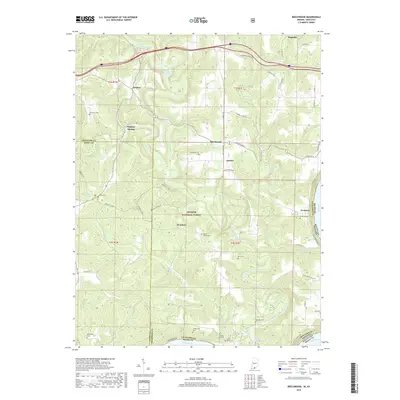
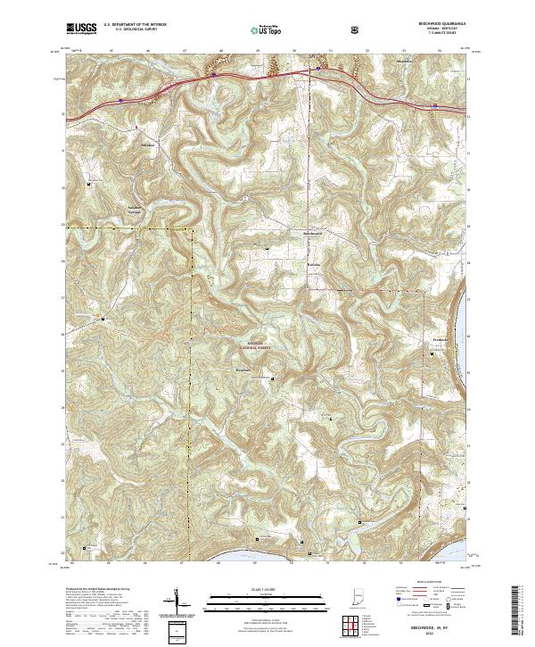
(23)- 1950 Map of Beechwood, 1952 Print
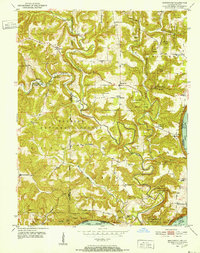 1950 Beechwood1952 Print · USGSThe Indiana-Kentucky borderlands along the Ohio River appear in high detail during the early fifties. Genealogists and hikers can trace remote landmarks like the Buzzard Roost Fire Tower, Old Union Ch, and the Wiseman Cem.3 unique versions available
 - 1950 Map of Alton, 1959 Print
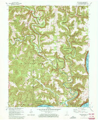
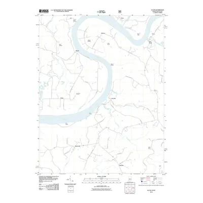
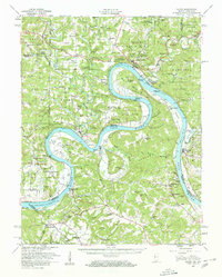 1950 Alton1959 Print · USGSThe Ohio River loops through the Indiana and Kentucky borderlands at mid-century, following the deep curves of Big Bend and Oxbow Bend. Genealogists and local historians can trace family roots through numerous rural landmarks like St Theresa Academy, Beechland Sch, and the historic town of Leavenworth.2 unique versions available
 - 1950 Map of Alton, 1962 Print
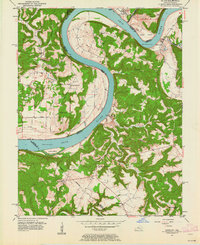 1950 Alton1962 Print · USGSThe Ohio River borderlands between Indiana and Kentucky are captured here in the early fifties, showing a landscape defined by ferries and small river landings. Researchers can trace family roots at St Theresa Academy, the Boyer Ferry, and the remote Stephenson Cem.
 - 1951 Map of Alton
 1951 Alton1951 Print · USGSThe Indiana and Kentucky borderlands meet along the winding Ohio River in the early fifties. Genealogists can trace family names and rural institutions at St Theresa Academy, the Boyer Ferry, and Stony Point Sch.2 unique versions available
 - 1956 Map of Vincennes, 1967 Print
 1956 Vincennes1967 Print · USGSSouthern Indiana and the Illinois borderlands are captured here in the mid-fifties, showing the region's dense network of river towns and rail lines. Researchers can trace historic river crossings along the Wabash River or locate landmarks like Wyandotte Cave and Lincoln State Park.4 unique versions available
 - 1957 Map of Vincennes
 1957 Vincennes1957 Print · USGSSouthwest Indiana and the Illinois borderlands come alive in the late 1950s, a period of heavy rail traffic and expanding state forests. Genealogists and historians can trace the riverfronts and rail lines of Vincennes, New Harmony, and the vast Crane Naval Ammunition Depot.
 - 1958 Map of Vincennes
 1958 Vincennes1958 Print · USGSSouthern Indiana and the Illinois borderlands are captured during a mid-century period of heavy rail traffic and military activity. Researchers can trace the sprawling bounds of the Crane Naval Ammunition Depot or locate historic settlements like New Harmony and French Lick.2 unique versions available
 - 1970 Map of Alton, 1972 Print
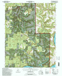
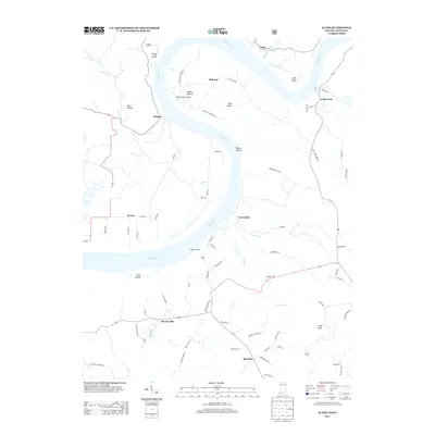
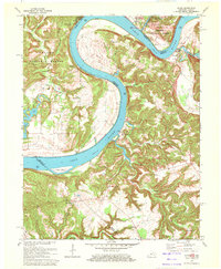 1970 Alton1972 Print · USGSThe Ohio River meanders between Indiana and Kentucky in the 1970s, shaping the life of riverfront towns and upland forests. Genealogists and historians can trace riverside settlements like Alton and Concordia, or find family landmarks such as St Theresa Academy and Owens Cem.
 - 1970 Map of Beechwood, 1972 Print
 1970 Beechwood1972 Print · USGSSouthern Indiana's river bends and deep forests are captured here just as modern highway expansions were being planned in the early seventies. Local historians can trace family roots through numerous remote sites like Old Union Ch, Riddle Cem, and the Buzzard Roost Lookout Tower.2 unique versions available
 - 1986 Map of Jasper
 1986 Jasper1986 Print · USGSSouthern Indiana in the 1980s is defined by the expansive Patoka Lake and the dense timber of the Hoosier National Forest. Researchers can trace the Southern RR through the hills or locate historic sites like Saint Meinrad and Sulphur Springs.
 - 1993 Map of Beechwood, 1998 Print
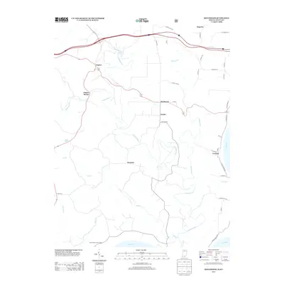
 1993 Beechwood1998 Print · USGSCrawford County in the 1990s remained a landscape of deep forests and river valleys shaped by the Blue River. Researchers can locate several rural landmarks including Old Union Ch, the Wiseman Cem, and the riverfront settlement of Fredonia.
 - 1993 Map of Alton, 1998 Print
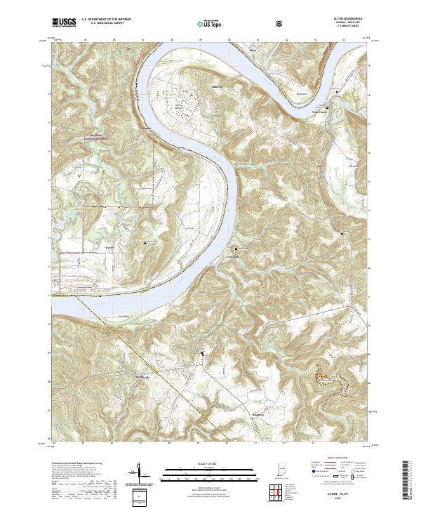
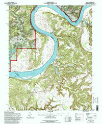 1993 Alton1998 Print · USGSThe Ohio River loops between Indiana and Kentucky in the early nineties, revealing a rugged borderland of high bluffs and deep creek hollows. Researchers can locate small riverside settlements like Magnet and Concordia, or trace family sites such as Barr Cem and the St Theresa Academy.
 - 1994 Map of Jasper
 1994 Jasper1994 Print · USGSSouthern Indiana and the Kentucky borderlands are captured here in the mid-nineties, showing a landscape defined by the Ohio River and dense state forests. Genealogists can locate family landmarks like Saint Meinrad Archabbey, Saint Anthony, and the historic Lincoln Boyhood National Memorial.
 - 2010 Map of Beechwood, 2010 Print
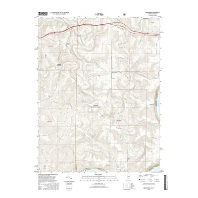
 2010 Beechwood2010 Print · USGSCovers Alton, including Beechwood, Sulphur Springs, and other nearby areas
 - 2010 Map of Alton, 2010 Print
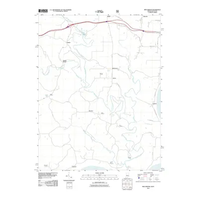
 2010 Alton2010 Print · USGSCovers Alton, including Mooleyville, Concordia, and other nearby areas
 - 2013 Map of Alton, 2013 Print
 2013 Alton2013 Print · USGSCovers Alton, including Mooleyville, Concordia, and other nearby areas
 - 2013 Map of Beechwood, 2013 Print
 2013 Beechwood2013 Print · USGSCovers Alton, including Beechwood, Sulphur Springs, and other nearby areas
 - 2016 Map of Beechwood, 2016 Print
 2016 Beechwood2016 Print · USGSCovers Alton, including Beechwood, Sulphur Springs, and other nearby areas
 - 2016 Map of Alton, 2016 Print
 2016 Alton2016 Print · USGSCovers Alton, including Mooleyville, Concordia, and other nearby areas
 - 2019 Map of Alton, 2019 Print
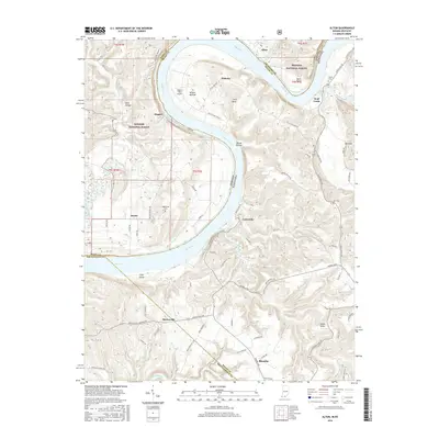
 2019 Alton2019 Print · USGSCovers Alton, including Mooleyville, Concordia, and other nearby areas
 - 2019 Map of Beechwood, 2019 Print
 2019 Beechwood2019 Print · USGSCovers Alton, including Beechwood, Sulphur Springs, and other nearby areas
 - 2022 Map of Alton, 2022 Print
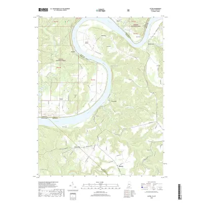
 2022 Alton2022 Print · USGSThe Ohio River oxbow dominates this landscape at the Indiana-Kentucky border, where riverfront hamlets and upland forests meet. Researchers can trace family history through sites like Saint Theresa Cem and the Flannery Family Cem or explore the terrain of Jarbo Sinks and Little Bend.
 - 2022 Map of Beechwood, 2022 Print
 2022 Beechwood2022 Print · USGSCrawford County and the forest lands of southern Indiana are shown here just as the new decade began. Researchers can trace numerous family burial grounds like Bloom Riddle Cem and Wiseman Cem or locate the riverside settlement of Fredonia.
End of results
Showing maps 1-23 of 23
Top cities near Alton
- Brandenburg historical maps
- Leopold historical maps
- English historical maps
- Leavenworth historical maps
- Mauckport historical maps
- New Amsterdam historical maps
Frequently asked questions
- What are the different types of historical maps available for Alton?
- What is the oldest map of Alton?
- Where can I purchase historical maps of Alton for my home or office?
- Where can I download high-res historical maps of Alton?
- Are there historical topographic maps available for Alton?
- Is there historical aerial imagery available for Alton?
- Where are historical maps of Alton sourced from?