1990s Maps of Franklin County, Indiana
Explore 4 historic maps of Franklin County from the 1990s. These maps offer a rare glimpse into what life looked like during the 1990s — showing old roads, neighborhoods, homes, and landmarks that have changed or disappeared over time.
Whether you're researching your family's past, planning a metal detecting trip, or studying how Franklin County's landscape evolved across the 1990s, these high-resolution maps are a powerful tool for exploring the history of this region.
- Focus on a specific era: All maps on this page are from the 1990s, giving you a focused view of this time period.
- See what’s changed: Compare century-old streets, trails, and buildings to today's modern landscape using overlays and satellite layers.
- Research with precision: Use these maps for genealogy, historical research, land use analysis, or educational projects.
- View, download, or print: Maps are fully viewable online in high resolution, and can be downloaded or printed for your own records.
Start exploring Franklin County's history through authentic maps from the 1990s. This is your window into the past.
Franklin County, IN maps
(4)- 1992 Map of College Corner, 1995 Print
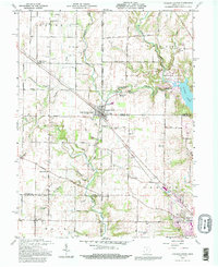 1992 College Corner1995 Print · USGSCollege Corner and the surrounding rural townships of Indiana and Ohio are shown here in the early nineties, centered on the state line. Researchers can trace historic cemeteries such as Keiffer Cem and Crawfords Cem alongside the waters of Acton Lake.
 - 1992 Map of Reily, 1995 Print
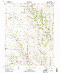 1992 Reily1995 Print · USGSThe Indiana-Ohio borderlands come into focus in the early nineties, showing a landscape defined by winding creeks and rural townships. Genealogists can trace family footprints through numerous local landmarks, including the Mathew-Smith Cem, Wesley Chapel, and the community of Mixersville.
 - 1992 Map of Harrison, 1995 Print
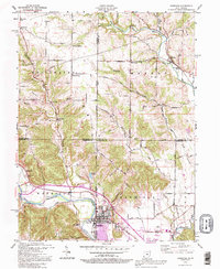 1992 Harrison1995 Print · USGSThe Ohio-Indiana borderlands come alive in the early nineties as the communities of Harrison and West Harrison grow along the Whitewater River. Researchers can trace rural school sites like Township Sch and family burial grounds including Snow Cem and Braysville Cem.
 - 1996 Map of Harrison, 1999 Print
 1996 Harrison1999 Print · USGSThe border country of Ohio and Indiana comes alive in this survey, centering on the river towns and rural townships during the late nineties. Genealogists and local historians can trace family plots at Snow Cem, locate the old Township Sch, or find the historic Covered Bridge spanning the Johnson Fork.
End of results
Showing maps 1-4 of 4
Top cities of Franklin County
- Brookville historical maps
- Blooming Grove historical maps
- Oldenburg historical maps
- Laurel historical maps
- Bath historical maps
- Metamora historical maps
See more
Frequently asked questions
- What are the different types of historical maps available for Franklin County?
- What is the oldest map of Franklin County?
- Where can I purchase historical maps of Franklin County for my home or office?
- Where can I download high-res historical maps of Franklin County?
- Are there historical topographic maps available for Franklin County?
- Is there historical aerial imagery available for Franklin County?
- Where are historical maps of Franklin County sourced from?