Old Maps of Franklin County, Indiana for Academic Research
Study the evolution of Franklin County with 113 high-resolution historic maps. Whether you're teaching, researching, or modeling changes in land use, these maps provide essential visual documentation of urban, environmental, and geographic change.
- Analyze long-term change: Track patterns in development, transportation, and natural features.
- Ideal for environmental or urban studies: Support academic projects with primary historical map data.
- Use in the classroom or lab: Educators and researchers rely on these maps to bring historical context to life.
These maps are a powerful tool for teaching, research, and visualizing how Franklin County has changed over the decades.
Franklin County, IN maps
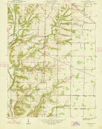
(113)- 1915 Map of College Corner
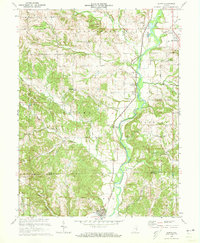
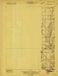 1915 College Corner1915 Print · USGSThe Indiana-Ohio borderlands at the start of the twentieth century are defined here by rail hubs and rural townships. Trace family roots and vanished landmarks near College Corner, Concord Church, and the winding Fourmile Creek.
 - 1915 Map of Harrison
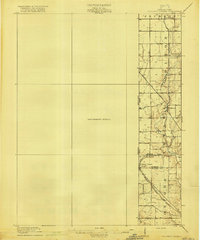
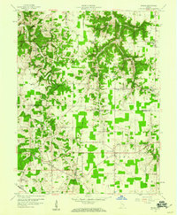
 1915 Harrison1915 Print · USGSThe Indiana-Ohio borderlands come into focus during the mid-teens, showing a landscape of river-valley settlements and rural school districts. Genealogists can locate family landmarks like Vannatta School, Davis School, and the village of Okeana along the Dry Fork.
 - 1918 Map of College Corner
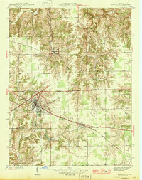
 1918 College Corner1918 Print · USGSThe Indiana-Ohio borderlands come into focus during the Great War era, showing the intersection of rail and road commerce. Genealogists and historians can trace the early layout of College Corner, the grounds of Tallawanda Springs, and rural landmarks like School No 3.4 unique versions available
 - 1946 Map of Batesville
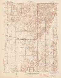
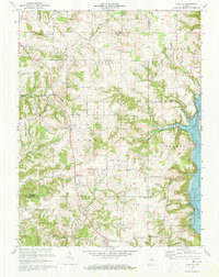
 1946 Batesville1946 Print · USGSSoutheastern Indiana in the mid-forties reveals a landscape of ridge-top farms and rail-oriented commerce along the county line. Genealogy researchers can trace family lands near Oldenburg or locate early industrial footprints in Batesville and Morris.2 unique versions available
 - 1946 Map of New Point
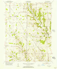
 1946 New Point1946 Print · USGSThe Decatur and Franklin county lines meet here in the 1940s, centered on the vital New York Central rail corridor. Genealogy researchers can locate rural family landmarks like Maple Cem, Zion Ch, and the Lipp Sch at the edge of Salt Creek.2 unique versions available
 - 1948 Map of Fairfield
 1948 Fairfield1948 Print · USGSEastern Indiana agriculture and river valley life are captured here in the late forties, just before major landscape shifts. Genealogists can trace family roots through sites like Sims Cem, Dunlapsville, and the Old Townhouse Sch.
 - 1953 Map of Cincinnati, 1965 Print
 1953 Cincinnati1965 Print · USGSThe Ohio River valley and the industrial heartland of Indiana and Ohio are captured here during the mid-century peak of rail and river commerce. Genealogists and historians can trace connections between Cincinnati and outlying military sites like Camp Atterbury and Bakalar AFB.3 unique versions available
 - 1955 Map of Harrison, 1956 Print
 1955 Harrison1956 Print · USGSThe borderlands of Ohio and Indiana are captured here in the mid-fifties as the villages of Harrison and West Harrison thrive along the river. Researchers can trace family roots through numerous sites like Glen Haven Cem and the Township School.5 unique versions available
 - 1955 Map of Reily, 1956 Print
 1955 Reily1956 Print · USGSThe Indiana-Ohio borderlands come into focus in the mid-1950s, showing a landscape defined by the First Principal Meridian. Genealogists and historians can trace small settlements like Mixersville and Scipio, and locate old burial sites including Springdale Cemetery and Asbury Cemetery.3 unique versions available
 - 1955 Map of Mount Carmel, 1956 Print
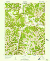
 1955 Mount Carmel1956 Print · USGSFranklin County's river valleys and rural uplands are shown in detail during the mid-fifties, capturing the region's agricultural and transit network. Genealogists can locate family landmarks such as James Cem, the Township Sch, and the community of Mount Carmel.2 unique versions available
 - 1955 Map of Cedar Grove, 1957 Print
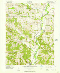
 1955 Cedar Grove1957 Print · USGSThe Whitewater River valley in the mid-1950s reveals a network of riverside rail towns and upland farmsteads. Trace the paths of the New York Central Line through New Trenton and locate family landmarks like St Paul Cem Ch.
 - 1956 Map of Everton, 1957 Print
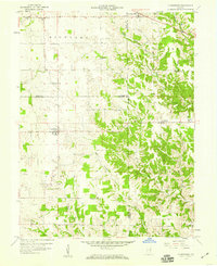
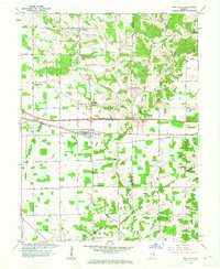
 1956 Everton1957 Print · USGSThe crossroads of Fayette and Franklin counties are frozen in time here during the mid-fifties, capturing a landscape of established family farms and creek-bottom timber. Genealogists can locate family landmarks like Pettigrew Cem, the Duck Creek Stone Chapel, and the historic Greenville Treaty Line.
 - 1956 Map of Alpine, 1957 Print
 1956 Alpine1957 Print · USGSFayette and Franklin Counties come into focus in the mid-1950s as the river-and-rail economy defined the Whitewater Valley. Researchers can trace family history at Tullis Chapel Cem and Webb Cem, or locate rural school sites like Nulltown Sch.
 - 1956 Map of Metamora, 1957 Print
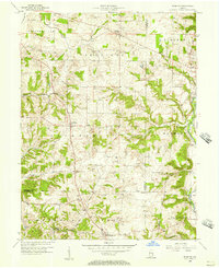
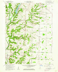
 1956 Metamora1957 Print · USGSFranklin County's river-and-rail corridor is captured here in the mid-fifties, centered on the vital valley of the Whitewater River. Researchers can trace the legacy of canal transport and early settlement through landmarks like the Aqueduct, Wiley Indian Mound, and Stipps Hill Ch.
 - 1956 Map of Brookville, 1957 Print
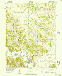
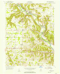
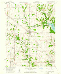
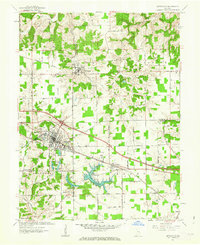
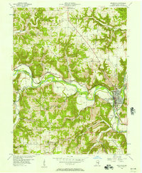 1956 Brookville1957 Print · USGSFranklin County in the mid-1950s was a landscape defined by the convergence of the Whitewater forks and the legacy of the canal era. Researchers can trace historic family burial sites at Maple Grove Cemetery and St Michaels Cem, or locate landmarks like the Whitewater Canal Memorial Lock and Covered Bridge.
 - 1957 Map of Cincinnati
 1957 Cincinnati1957 Print · USGSThe Ohio River valley and its surrounding highlands thrived during the mid-fifties industrial peak, centered on the bustling Cincinnati and Dayton metropolitan hubs. Researchers can trace the extensive rail networks and military sites like Wright-Patterson AFB and Camp Atterbury.
 - 1958 Map of Spades, 1959 Print
 1958 Spades1959 Print · USGSSoutheastern Indiana in the late fifties was a patchwork of parish settlements and historic boundaries, notably the Greenville Treaty Line. Genealogists can trace family footprints through numerous landmarks like Klemmes Corner, St Stephens Ch, and the town of Spades.3 unique versions available
 - 1958 Map of Clarksburg, 1959 Print
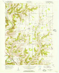
 1958 Clarksburg1959 Print · USGSSoutheastern Indiana farmland and creek valleys meet in the late fifties at the junction of three counties. Genealogists can trace family names and sites at Clarksburg, Hamburg, and cemeteries like Old Brick Cem and Mt Carmel Cem.4 unique versions available
 - 1959 Map of New Salem, 1960 Print
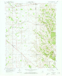 1959 New Salem1960 Print · USGSThe rural landscape of Rush County in the late fifties is defined by its small farming settlements and pioneer-era legacy. Genealogists can trace family roots through numerous burial grounds like Heaton Cem and Orange North Cem or locate the historic Indian Treaty Boundary.3 unique versions available
 - 1960 Map of College Corner, 1961 Print
 1960 College Corner1961 Print · USGSCollege Corner sits at the crossroads of Indiana and Ohio at the start of the 1960s, a landscape defined by intersecting railroads and state lines. Genealogists can trace family roots through College Corner Cemetery, Hopewell Ch, and the rural settlement of Charlottesville.4 unique versions available
 - 1960 Map of Fairfield, 1962 Print
 1960 Fairfield1962 Print · USGSThe Whitewater River valley in the early sixties remains a landscape of covered bridges and dispersed farmsteads before major modern changes. Genealogists can trace family footprints at Old Bath Springs Cem, the community of Fairfield, and several rural churches like Salem Ch.2 unique versions available
 - 1961 Map of Batesville, 1963 Print
 1961 Batesville1963 Print · USGSBatesville and the surrounding Ripley County countryside are captured here in the early sixties, showing a landscape defined by its German Catholic heritage and rail connections. Researchers can locate family landmarks like Holy Family Ch, St Marys Cem, and the rural junction of Cross Roads.5 unique versions available
 - 1961 Map of New Point, 1963 Print
 1961 New Point1963 Print · USGSSoutheastern Indiana's agricultural heartland is documented here in the early sixties, centered on the railroad town of New Point. Researchers can trace the New York Central line through Rossburg and locate rural landmarks like Zion Ch and Enochsburg.4 unique versions available
 - 1971 Map of Alpine, 1973 Print
 1971 Alpine1973 Print · USGSFayette and Franklin Counties come together along the river valley in the early seventies, where rail and water dominate the landscape. Researchers can trace the Penn Central tracks through Nulltown, Alpine, and Laurel, or locate family sites at Tullis Chapel Cem.3 unique versions available
 - 1972 Map of Everton, 1973 Print
 1972 Everton1973 Print · USGSThe rural borderlands of Fayette, Franklin, and Union counties are detailed here during the early seventies. Genealogists can locate family-named landmarks like Mt Garrison Cem and the Little Children Home, or trace the path of Village Creek.4 unique versions available
Showing maps 1-25 of 113
Top cities of Franklin County
- Brookville historical maps
- Blooming Grove historical maps
- Oldenburg historical maps
- Laurel historical maps
- Bath historical maps
- Metamora historical maps
See more
Frequently asked questions
- What are the different types of historical maps available for Franklin County?
- What is the oldest map of Franklin County?
- Where can I purchase historical maps of Franklin County for my home or office?
- Where can I download high-res historical maps of Franklin County?
- Are there historical topographic maps available for Franklin County?
- Is there historical aerial imagery available for Franklin County?
- Where are historical maps of Franklin County sourced from?