1960s Maps of Van Buren, Indiana
Explore 2 historic maps of Van Buren from the 1960s. These maps offer a rare glimpse into what life looked like during the 1960s — showing old roads, neighborhoods, homes, and landmarks that have changed or disappeared over time.
Whether you're researching your family's past, planning a metal detecting trip, or studying how Van Buren's landscape evolved across the 1960s, these high-resolution maps are a powerful tool for exploring the history of this region.
- Focus on a specific era: All maps on this page are from the 1960s, giving you a focused view of this time period.
- See what’s changed: Compare century-old streets, trails, and buildings to today's modern landscape using overlays and satellite layers.
- Research with precision: Use these maps for genealogy, historical research, land use analysis, or educational projects.
- View, download, or print: Maps are fully viewable online in high resolution, and can be downloaded or printed for your own records.
Start exploring Van Buren's history through authentic maps from the 1960s. This is your window into the past.
Van Buren, IN maps
(2)- 1962 Map of Roll, 1963 Print
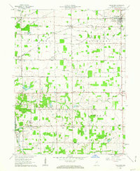
 1962 Roll1963 Print · USGSBlackford and Wells counties in the early sixties remained a deeply rural landscape of grain fields and drainage canals. Family historians can trace ancestral sites like Oak Chapel, the Township Sch, and local burial grounds such as Balsley Cem and Center Cem.3 unique versions available
 - 1962 Map of Van Buren, 1963 Print
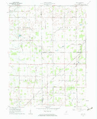
 1962 Van Buren1963 Print · USGSGrant County is captured in the early sixties as a structured grid of family farms and railroad hamlets. Researchers can trace the legacy of small-town Indiana through landmarks like Landess, Roosevelt Sch, and the Locust Chapel.2 unique versions available
End of results
Showing maps 1-2 of 2
Top cities near Van Buren
- Marion historical maps
- Hartford City historical maps
- Gas City historical maps
- Upland historical maps
- Fairmount historical maps
- Montpelier historical maps
See more
Frequently asked questions
- What are the different types of historical maps available for Van Buren?
- What is the oldest map of Van Buren?
- Where can I purchase historical maps of Van Buren for my home or office?
- Where can I download high-res historical maps of Van Buren?
- Are there historical topographic maps available for Van Buren?
- Is there historical aerial imagery available for Van Buren?
- Where are historical maps of Van Buren sourced from?