1960s Maps of Cicero, Indiana
Explore 3 historic maps of Cicero from the 1960s. These maps offer a rare glimpse into what life looked like during the 1960s — showing old roads, neighborhoods, homes, and landmarks that have changed or disappeared over time.
Whether you're researching your family's past, planning a metal detecting trip, or studying how Cicero's landscape evolved across the 1960s, these high-resolution maps are a powerful tool for exploring the history of this region.
- Focus on a specific era: All maps on this page are from the 1960s, giving you a focused view of this time period.
- See what’s changed: Compare century-old streets, trails, and buildings to today's modern landscape using overlays and satellite layers.
- Research with precision: Use these maps for genealogy, historical research, land use analysis, or educational projects.
- View, download, or print: Maps are fully viewable online in high resolution, and can be downloaded or printed for your own records.
Start exploring Cicero's history through authentic maps from the 1960s. This is your window into the past.
Cicero, IN maps
(3)- 1960 Map of Noblesville, 1961 Print
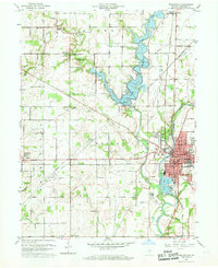 1960 Noblesville1961 Print · USGSNoblesville and the White River valley are captured in the early sixties as new landmarks like Morse Reservoir began to reshape the landscape. Local historians can trace old community centers such as Deming or locate family plots at Riverside Cem and Crownland Cem.2 unique versions available
 - 1961 Map of Arcadia, 1963 Print
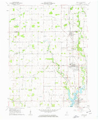 1961 Arcadia1963 Print · USGSNorth of the newly developed Morse Reservoir, the early 1960s landscape of Hamilton County centers on the busy rail towns of Arcadia and Atlanta. Genealogists and historians can trace family roots through several local landmarks like Taylor Cemetery, Roberts Chapel, and the Indiana Academy.4 unique versions available
 - 1969 Map of Noblesville, 1971 Print
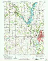 1969 Noblesville1971 Print · USGSHamilton County experienced a mix of traditional agriculture and expanding suburban life during the late sixties. Genealogists can trace family names and sites through Riverside Cem, the Gray Friends Ch, and the historic Potter Bridge near the White River.3 unique versions available
End of results
Showing maps 1-3 of 3
Top cities near Cicero
- Indianapolis historical maps
- Carmel historical maps
- Fishers historical maps
- Noblesville historical maps
- Westfield historical maps
- Lawrence historical maps
See more
Frequently asked questions
- What are the different types of historical maps available for Cicero?
- What is the oldest map of Cicero?
- Where can I purchase historical maps of Cicero for my home or office?
- Where can I download high-res historical maps of Cicero?
- Are there historical topographic maps available for Cicero?
- Is there historical aerial imagery available for Cicero?
- Where are historical maps of Cicero sourced from?