
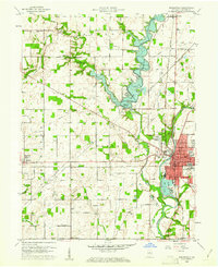
1960 Map of Noblesville
USGS Topo · Published 1961About this map
The White River anchors the eastern landscape of Hamilton County, flowing past the urban center of Noblesville and the crossing at Potter Bridge. This mid-century view documents a transition in water management and recreation with the presence of the Morse Reservoir, including its spillway and the nearby Indianapolis Boys Club Camp. The map provides detailed layouts of the county seat, showing institutions like Riverview Hospital, the High School, and City Hall.
Find a feature on this map
69 named features on this map. Tap any name to fly to it.
Don’t see what you’re looking for? This feature index may not catch every label — zoom into the map to look around manually.
Map Details
Editions of this 1960 Noblesville Map
2 editions found
Other maps of this area

1952 · Fishers
USGS Topo · 1:24,000

1952 · Carmel
USGS Topo · 1:24,000

1952 · Mc Cordsville
USGS Topo · 1:24,000

1953 · Westfield
USGS Topo · 1:24,000

1953 · Riverwood
USGS Topo · 1:24,000

1953 · Noblesville
USGS Topo · 1:24,000

1953 · Cincinnati
USGS Topo · 1:250,000

1953 · Danville
USGS Topo · 1:250,000

1953 · Indianapolis
USGS Topo · 1:250,000

1953 · Muncie
USGS Topo · 1:250,000