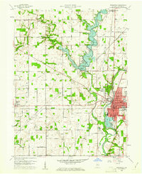
1960 Map of Noblesville
USGS Topo · Published 1969About this map
The Morse Reservoir dominates the landscape north of the Hamilton County seat, following the creation of its spillway at an elevation of 810 feet. This 1960 revision documents the expansion of Noblesville toward the White River, where the Riverview Hospital and Federal Hill mark the western edge of the developed town center. The map captures a transition from traditional agrarian layouts to mid-century suburbanization, evidenced by the clustered housing of Monterey Village and the proximity of the Indianapolis Boys Club Camp to the new reservoir shoreline.
Find a feature on this map
64 named features on this map. Tap any name to fly to it.
Don’t see what you’re looking for? This feature index may not catch every label — zoom into the map to look around manually.
Map Details
Editions of this 1960 Noblesville Map
2 editions found

Other maps of this area

1952 · Fishers
USGS Topo · 1:24,000

1952 · Carmel
USGS Topo · 1:24,000

1952 · Mc Cordsville
USGS Topo · 1:24,000

1953 · Westfield
USGS Topo · 1:24,000

1953 · Riverwood
USGS Topo · 1:24,000

1953 · Noblesville
USGS Topo · 1:24,000

1953 · Cincinnati
USGS Topo · 1:250,000

1953 · Danville
USGS Topo · 1:250,000

1953 · Indianapolis
USGS Topo · 1:250,000

1953 · Muncie
USGS Topo · 1:250,000