2020s Maps of Harrison County, Indiana
Explore 17 historic maps of Harrison County from the 2020s. These maps offer a rare glimpse into what life looked like during the 2020s — showing old roads, neighborhoods, homes, and landmarks that have changed or disappeared over time.
Whether you're researching your family's past, planning a metal detecting trip, or studying how Harrison County's landscape evolved across the 2020s, these high-resolution maps are a powerful tool for exploring the history of this region.
- Focus on a specific era: All maps on this page are from the 2020s, giving you a focused view of this time period.
- See what’s changed: Compare century-old streets, trails, and buildings to today's modern landscape using overlays and satellite layers.
- Research with precision: Use these maps for genealogy, historical research, land use analysis, or educational projects.
- View, download, or print: Maps are fully viewable online in high resolution, and can be downloaded or printed for your own records.
Start exploring Harrison County's history through authentic maps from the 2020s. This is your window into the past.
Harrison County, IN maps
(17)- 2022 Map of Crandall, 2022 Print
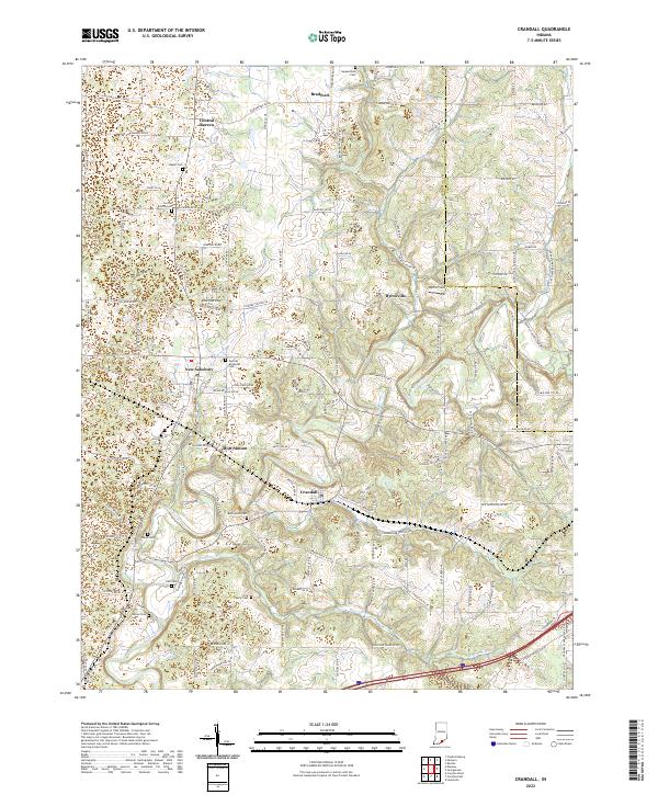 2022 Crandall2022 Print · USGSHarrison and Floyd counties come into focus in the early 2020s, showing a well-connected network of rural settlements along the Norfolk Southern railroad. Researchers can trace genealogical roots through numerous family landmarks like the Flock Family Cem and Bethlehem Cem.
 - 2022 Map of Milltown, 2022 Print
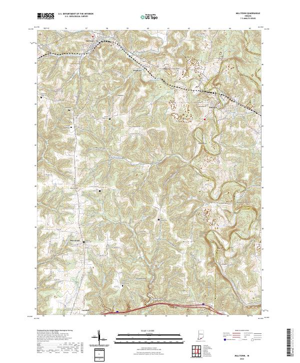 2022 Milltown2022 Print · USGSCrawford County's rural uplands and the winding Blue River valley are shown here in the early twenty-first century. Genealogists and local historians can locate numerous burial sites and small settlements, such as Batman Ridge Cem, Hogtown, and Carefree.
 - 2022 Map of Kosmosdale, 2022 Print
 2022 Kosmosdale2022 Print · USGSThe riverfront south of Louisville comes alive in this modern survey of the Kentucky-Indiana border. Genealogists can trace local roots through several burial grounds like McNutt Cemetery and Mill Creek Cemetery or explore the ridges of Rosewood.
 - 2022 Map of Mauckport, 2022 Print
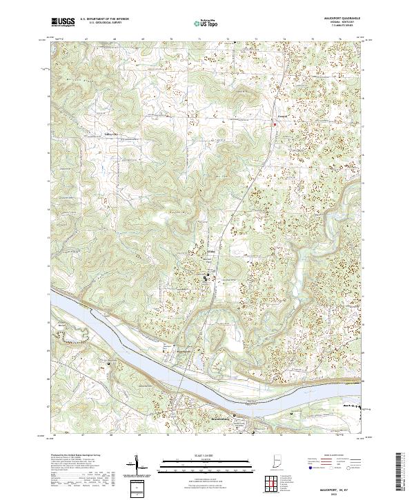 2022 Mauckport2022 Print · USGSThe Indiana-Kentucky borderlands along the Ohio River are shown here as they appeared in the early 2020s. Researchers can trace local lineage through sites like Old Mauckport Cemetery or locate the Meade County Courthouse in Brandenburg.
 - 2022 Map of New Amsterdam, 2022 Print
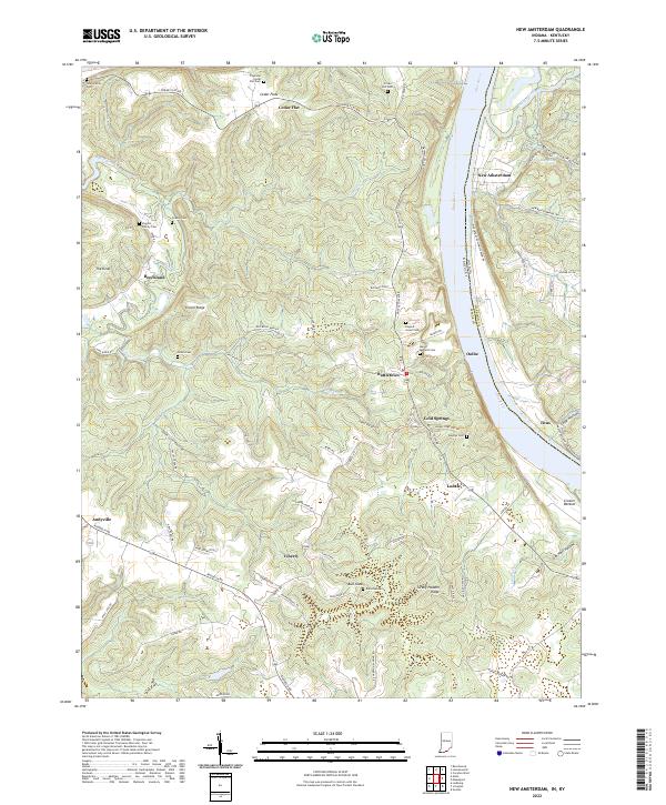 2022 New Amsterdam2022 Print · USGSThe Ohio River corridor comes to life in the early 2020s, showing the crossing between Indiana and Kentucky. Trace family roots through Crown Hill Cem or explore river-bluff settlements like New Amsterdam and Battletown.
 - 2022 Map of Hardinsburg, 2022 Print
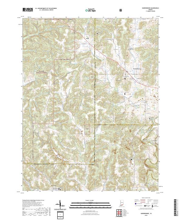 2022 Hardinsburg2022 Print · USGSSouthern Indiana's karst landscape is captured in high detail during the early 2020s, showing the rural communities near the Hoosier National Forest. Researchers can trace family roots at Hardinsburg Cemetery, Totten Cemetery, or the old settlement of Rego.
 - 2022 Map of Corydon West, 2022 Print
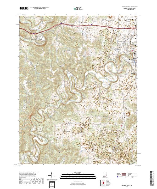 2022 Corydon West2022 Print · USGSHarrison County, Indiana, is captured here in the early twenty-first century as modern roads and trails traverse its historic limestone hills. Researchers can locate numerous family burial sites and landmarks like Conrad Hottel Cem, White Cloud, and the Harrison County Courthouse.
 - 2022 Map of Laconia, 2022 Print
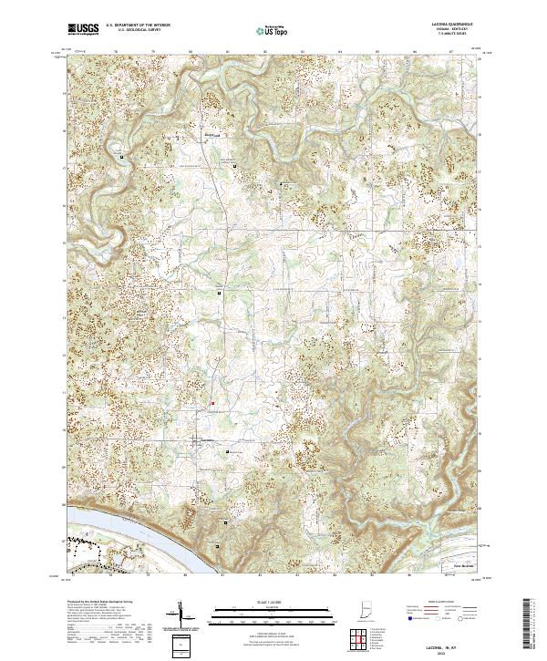 2022 Laconia2022 Print · USGSSouthern Harrison County rural life is captured here in the early 2020s, anchored by the settlement of Laconia and the Ohio River border. Genealogists can trace family heritage through numerous sites including Old Goshen Cem, King Cem, and Crown Hill Cem.
 - 2022 Map of Corydon East, 2022 Print
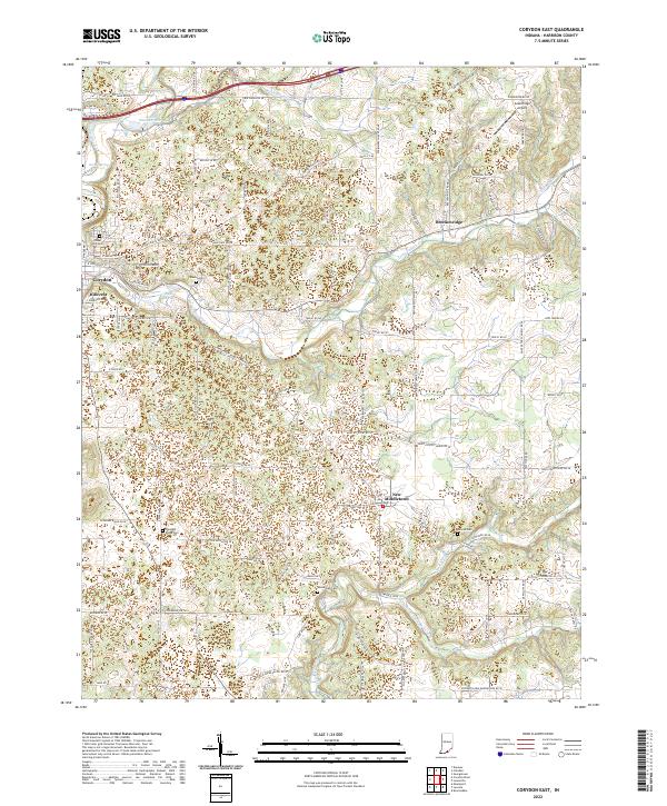 2022 Corydon East2022 Print · USGSHarrison County settlement and rural life are detailed here in the early twenty-first century, centered on the expansion east of Corydon. Local historians can trace family ties at Shuck Cem and Sharon Cem or locate landmarks like Greenridge Airport.
 - 2022 Map of Fredericksburg, 2022 Print
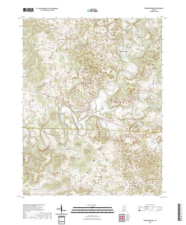 2022 Fredericksburg2022 Print · USGSFredericksburg and the surrounding hills of Washington and Harrison Counties are mapped here in the early twenty-first century. Genealogists and local historians can trace family-named landmarks like Hancock Hill, Stout Hill, and the Reno Cem.
 - 2022 Map of Depauw, 2022 Print
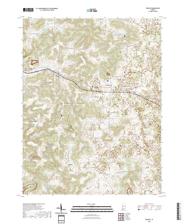 2022 Depauw2022 Print · USGSHarrison County settlement patterns and ridge-top life are documented here in the early 2020s. Genealogists and local historians can trace family locations through Saint Bernard Catholic Cem and rural centers like Little Saint Louis and Moberly.
 - 2022 Map of Lanesville, 2022 Print
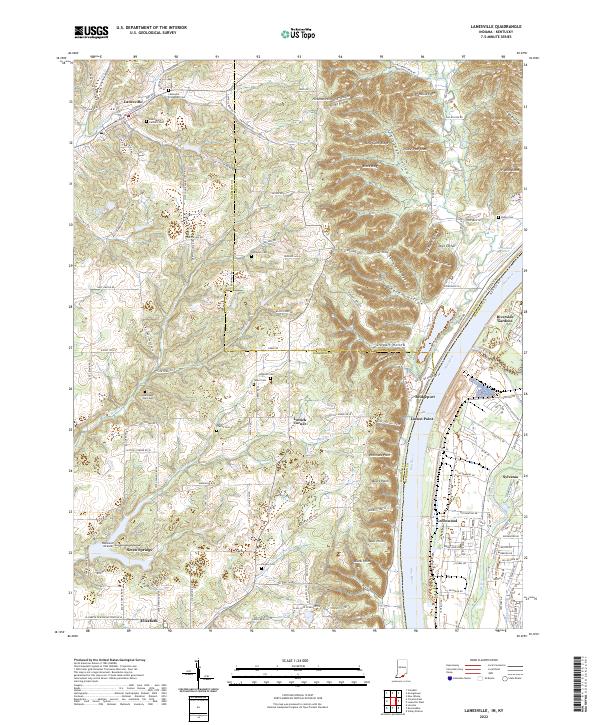 2022 Lanesville2022 Print · USGSThe Indiana-Kentucky borderlands along the Ohio River appear here in the early 2020s, showing a landscape of deep ridges and rural family homesteads. Genealogists can locate numerous burial sites such as Tabler Cem and Saint Marys Catholic Cem near Lanesville.
 - 2022 Map of Georgetown, 2022 Print
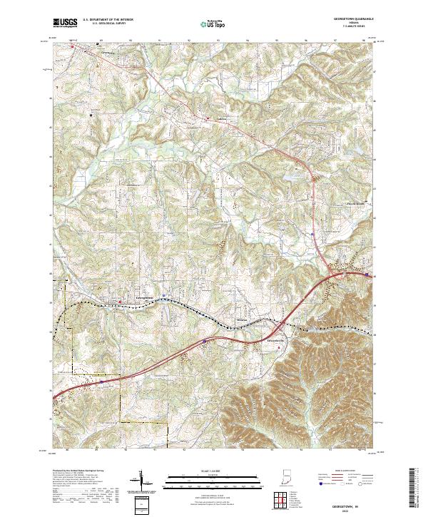 2022 Georgetown2022 Print · USGSFloyd County, Indiana, is captured here in the early 2020s, showcasing the intricate ridge-and-valley terrain west of New Albany. Genealogists can locate family landmarks like Green Lawn Cem and trace the winding paths of Middle Fork Indian Cr through Galena.
 - 2022 Map of Leavenworth, 2022 Print
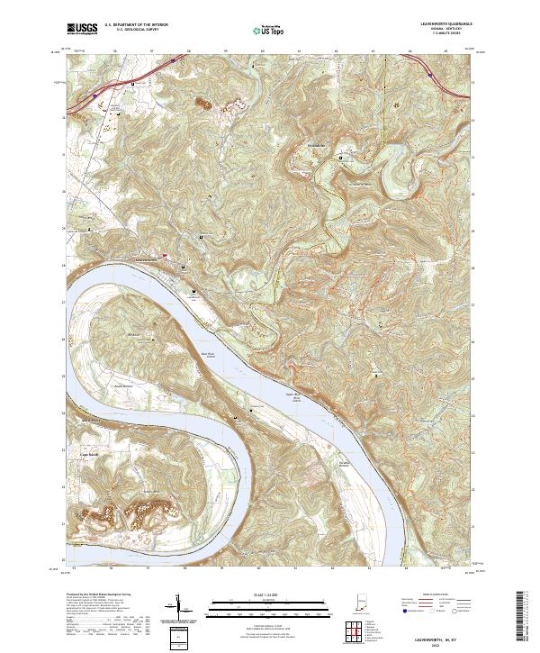 2022 Leavenworth2022 Print · USGSThe Indiana-Kentucky borderlands along the Ohio River come to life here during the early twenty-first century. Genealogists and local historians can trace family roots at the Foster Family Cemetery or explore the river bottoms of Round Bottom and Paradise Bottom.
 - 2022 Map of Palmyra, 2022 Print
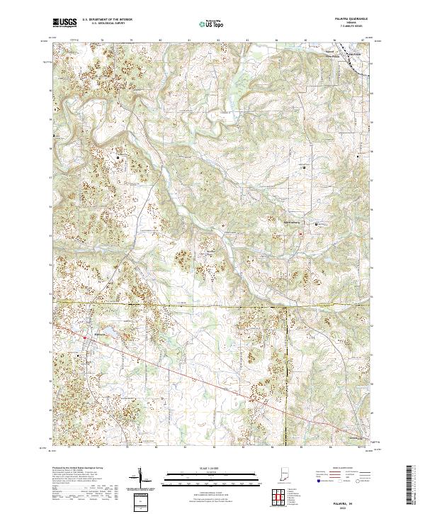 2022 Palmyra2022 Print · USGSSouthern Indiana's rural crossroads and limestone plains are documented here in the early twenty-first century. Researchers can locate family heritage sites like David Voyles Cem and Martinsburg Cem or trace waterways from Palmyra Lake to Bear Cr.
 - 2022 Map of Rock Haven, 2022 Print
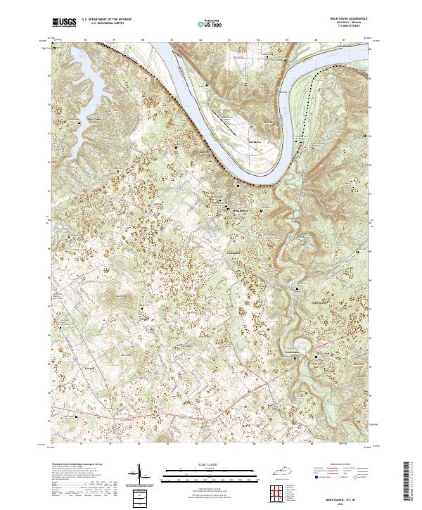 2022 Rock Haven2022 Print · USGSMeade County and the Indiana borderlands are captured here in a period of transition along the Ohio River. Genealogists and researchers can trace numerous family and community sites, from Garnettsville Cem to the old crossroads at Lickskillet and Garrett.
 - 2022 Map of Fort Knox, 2022 Print
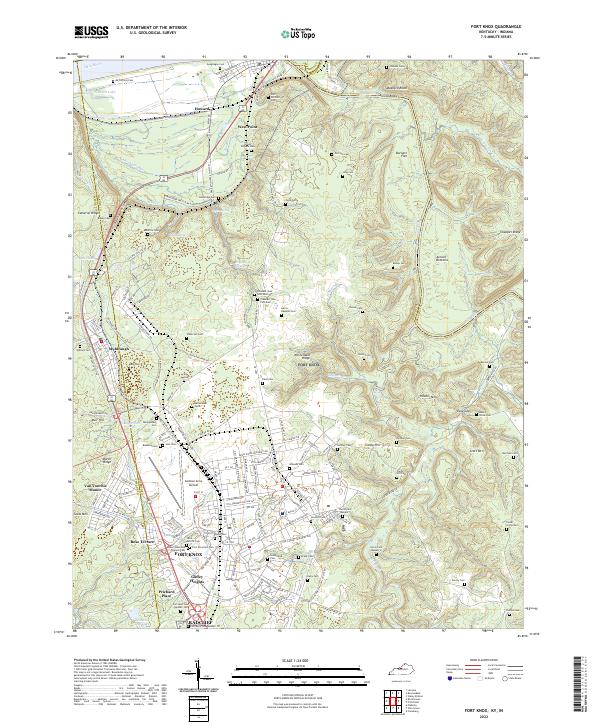 2022 Fort Knox2022 Print · USGSThe military landscape of Hardin County and the confluence of the Ohio and Salt Rivers are seen here in the early 2020s. Genealogists can locate family burial sites like Geoghegan Cem and the Fort Knox Post Cem alongside Godman Army Airfield.
End of results
Showing maps 1-17 of 17
Top cities of Harrison County
- Corydon historical maps
- Palmyra historical maps
- Lanesville historical maps
- Elizabeth historical maps
- Crandall historical maps
- New Middletown historical maps
See more
Frequently asked questions
- What are the different types of historical maps available for Harrison County?
- What is the oldest map of Harrison County?
- Where can I purchase historical maps of Harrison County for my home or office?
- Where can I download high-res historical maps of Harrison County?
- Are there historical topographic maps available for Harrison County?
- Is there historical aerial imagery available for Harrison County?
- Where are historical maps of Harrison County sourced from?