Old Maps of Harrison County, Indiana for Metal Detecting
Plan your next treasure hunt with 165 historic maps of Harrison County. Find old homesites, ghost towns, trails, and gathering spots that may be lost to time — perfect for identifying promising metal detecting locations.
- Locate forgotten sites: Uncover places like long-lost settlements, abandoned rail lines, or gathering spots.
- Plan better hunts: Use map overlays combined with LiDAR or satellite views to narrow in on historically rich areas.
- Made for detectorists: Thousands of hobbyists use these maps to discover relics, coins, and hidden history.
Use these historic maps to boost your research and find new opportunities beneath the surface of Harrison County.
Harrison County, IN maps
(165)- 1909 Map of Kosmosdale
 1909 Kosmosdale1909 Print · USGSSouthwest of Louisville at the turn of the century, the river valley meets the steep slopes of Muldraughs Hill. Researchers can trace early rural life through several family-named schoolhouses and small settlements like Kosmosdale, Valley Sta, and the County Infirmary.
 - 1912 Map of Kosmosdale
 1912 Kosmosdale1912 Print · USGSThe Ohio River valley and the Kentucky Knobs come alive in this pre-war survey, showing the expansion of southern Louisville and the rural hills of Jefferson and Bullitt counties. Researchers can locate vanished landmarks like Locust Point P.O. and the County Infirmary, or trace the old riverboat stops at Stewarts Landing.4 unique versions available
 - 1931 Map of Corydon
 1931 Corydon1931 Print · USGSThe Kentucky-Indiana borderlands along the Ohio River are captured here during the late Prohibition era. Local researchers can trace the riverbank settlement of Brandenburg or locate landmarks like the Oak Grove Sch and Hamilton Hill.4 unique versions available
 - 1936 Map of Vine Grove
 1936 Vine Grove1936 Print · USGSHardin and Bullitt counties are shown here during a period of massive military expansion before the mid-century. Researchers can trace the development of Fort Knox alongside established communities like Vine Grove and old rural landmarks like Stovall Chapel or the Glenbeddis Sch.
 - 1939 Map of Georgetown
 1939 Georgetown1939 Print · USGSSouthern Indiana's Floyd County highlands are captured here in the late 1930s, showing the early road and rail networks before modern expansion. Genealogists and local historians can trace family roots through Swartz Cem, Salem Ch, and the landmark Mt St Francis Seminary.
 - 1941 Map of Ekron
 1941 Ekron1941 Print · USGSNorthern Kentucky and the Ohio River shoreline are captured here in the early 1940s, showing the rural communities of Meade and Hardin Counties. Genealogists can trace family locations near Ekron, Shumate School, and the historic Sherman Landing.
 - 1943 Map of Vine Grove
 1943 Vine Grove1943 Print · USGSHardin and Meade Counties appear here during a period of massive mid-century growth at Fort Knox. Genealogists can trace family homesteads near landmarks like Stovall Chapel, Red Hill, and the many rural schools including Hays Sch and Deckard Sch.
 - 1944 Map of Corydon West, 1955 Print
 1944 Corydon West1955 Print · USGSHarrison County's rural landscape at the end of the Second World War is defined by the winding paths of Indian Creek and the Blue River. Researchers can trace old family footprints at Jordan Cem or locate former schoolhouses like Bickel Sch and Blair Sch.
 - 1946 Map of Rock Haven
 1946 Rock Haven1946 Print · USGSMeade County, Kentucky, is shown here in the immediate post-war era, where the Ohio River valley meets the expanding military footprint of the time. Genealogists and historians can trace the foundations of Garnettsville, locate Doe Run Mill, and find family landmarks like Buck Grove Ch or Rockridge Sch.
 - 1946 Map of Leavenworth
 1946 Leavenworth1946 Print · USGSThe Indiana-Kentucky borderlands come into focus in the mid-1940s as the river economy of the Ohio Valley transitions toward modern infrastructure. Trace family homesteads and local history through rural anchors like Blue River Chapel, Sunshine Sch, and the riverside community of Leavenworth.
 - 1946 Map of Fort Knox
 1946 Fort Knox1946 Print · USGSFort Knox and the surrounding Kentucky riverlands are captured just after the war as the military installation reached its modern maturity. Researchers can trace the layout of Godman Field, locate the famous Bullion Depository, and find family landmarks like Montgomery Cem or the town of West Point.
 - 1946 Map of Depauw
 1946 Depauw1946 Print · USGSHarrison County communities grew along the SOUTHERN railroad during the mid-1940s, balancing river-valley life with upland farming. Genealogists can trace family footprints at Smith Cem, Mt Tabor Church, and the village of Frenchtown.2 unique versions available
 - 1946 Map of Vine Grove, 1959 Print
 1946 Vine Grove1959 Print · USGSMid-century Hardin County is defined by the massive expansion of the Fort Knox Military Reservation and its surrounding rail-and-highway hubs. Researchers can trace dozens of family cemeteries and vanished landmarks like the Woolridge Ferry Bridge, Sherrard Sch, and the community of Pitts Point.
 - 1947 Map of Leavenworth
 1947 Leavenworth1947 Print · USGSSouthern Indiana and northern Kentucky are captured here in the late 1940s as the Ohio River trade still defined life in these border counties. Researchers can locate vanished landmarks like Schooner Point Landing and the rural Precinct Sch or explore the early environs of Wyandotte Cave.2 unique versions available
 - 1947 Map of Georgetown
 1947 Georgetown1947 Print · USGSFloyd County just after the war was a landscape of ridge-top farms and rail-connected hamlets like Georgetown and Edwardsville. Researchers can trace old family burial grounds at Buttontown Cem or locate rural landmarks like the Mt St Francis Seminary.2 unique versions available
 - 1947 Map of Corydon West
 1947 Corydon West1947 Print · USGSHarrison County's river-cut landscape is shown here in the late 1940s, as the community centered around Corydon and the surrounding farmsteads. Genealogists and local historians can trace rural roots through landmarks like Jordan Cem, Heidelberg Ch, and Bickel Sch.2 unique versions available
 - 1947 Map of Mauckport
 1947 Mauckport1947 Print · USGSHarrison County's riverfront and rural uplands are shown here in the years following the war, centered on the historic river town of Mauckport. Genealogists and historians can locate vanished local institutions like Hillgrove Sch, Wesley Chapel, and the landing at Morvins Landing.2 unique versions available
 - 1947 Map of Ekron, 1959 Print
 1947 Ekron1959 Print · USGSMeade County and the riverfronts of the Ohio Valley come alive in this late 1940s survey. Genealogists and historians can trace the foundations of Garnettsville, locate rural landmarks like Doe Run Mill, or search for family connections at Cedar Farm Cem and St Martins Sch.
 - 1947 Map of Hardinsburg, 1966 Print
 1947 Hardinsburg1966 Print · USGSSouthern Indiana's rural landscape is captured here in the late 1940s, showing a patchwork of small farms and family-named creek crossings. Genealogists can trace family roots at Oak Grove Ch, Walton Cem, and early schools like School No 6.
 - 1948 Map of Corydon East
 1948 Corydon East1948 Print · USGSHarrison County's rural heartland is captured here in the late 1940s, centered on the historic seat of Corydon. Researchers can trace old family lines at Warren Cem or locate vanished landmarks like Getz School and Kings Store.2 unique versions available
 - 1948 Map of Milltown
 1948 Milltown1948 Print · USGSCrawford and Harrison Counties appear here in the late 1940s, showing a landscape of deep river bends and rural Indiana rail towns. Genealogists can locate family landmarks like Archibald Sch, Thompson Chapel, and the cemetery at St Joseph Cem.2 unique versions available
 - 1948 Map of Laconia, 1959 Print
 1948 Laconia1959 Print · USGSHarrison County, Indiana, sits along a winding stretch of the Ohio River in the late 1940s, serving as a vital borderland of small farms and river landings. Genealogists can locate over a dozen burial sites including Dunkard Cem and Brown Cem, alongside local hubs like Dogwood and St Michaels Ch.
 - 1949 Map of Hardinsburg
 1949 Hardinsburg1949 Print · USGSSouthern Indiana at the end of the 1940s reveals a patchwork of rural school districts and county-line settlements. Genealogists can trace family footprints across Hardinsburg and Marengo or find ancestral sites like Old Unity Cem and Baptist Hill Ch.2 unique versions available
 - 1949 Map of Georgetown, 1965 Print
 1949 Georgetown1965 Print · USGSFloyd County's ridge-and-valley landscape is captured here in the years following the war, showing a network of rural townships and rail-side villages. Researchers can locate family landmarks like Greenlawn Cem, Salem Ch, and the Southern railroad line through Georgetown.
 - 1950 Map of Fort Knox
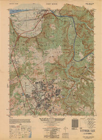 1950 Fort Knox1950 Print · USGSFort Knox and its surroundings in the years following the war show a landscape transformed by military necessity and river valley geography. Researchers can trace the layout of the US Bullion Depository and Godman Field alongside older communities like West Point and Goldville.
Showing maps 1-25 of 165
Top cities of Harrison County
- Corydon historical maps
- Palmyra historical maps
- Lanesville historical maps
- Elizabeth historical maps
- Crandall historical maps
- New Middletown historical maps
See more
Frequently asked questions
- What are the different types of historical maps available for Harrison County?
- What is the oldest map of Harrison County?
- Where can I purchase historical maps of Harrison County for my home or office?
- Where can I download high-res historical maps of Harrison County?
- Are there historical topographic maps available for Harrison County?
- Is there historical aerial imagery available for Harrison County?
- Where are historical maps of Harrison County sourced from?