Old Maps of Henry County, Indiana for Academic Research
Study the evolution of Henry County with 84 high-resolution historic maps. Whether you're teaching, researching, or modeling changes in land use, these maps provide essential visual documentation of urban, environmental, and geographic change.
- Analyze long-term change: Track patterns in development, transportation, and natural features.
- Ideal for environmental or urban studies: Support academic projects with primary historical map data.
- Use in the classroom or lab: Educators and researchers rely on these maps to bring historical context to life.
These maps are a powerful tool for teaching, research, and visualizing how Henry County has changed over the decades.
Henry County, IN maps
(84)- 1948 Map of Lewisville, 1966 Print
 1948 Lewisville1966 Print · USGSHenry County and the surrounding farm country are captured here in the late 1940s as the rail-line communities of Lewisville and Straughn thrived. Genealogists can locate family-named landmarks and rural congregations like Rich Square Ch and Hopewell Ch.
 - 1949 Map of New Castle West
 1949 New Castle West1949 Print · USGSWestern Henry County is captured here in the late 1940s, showing a landscape of productive farms and burgeoning rail-side villages. Genealogists can locate several rural burial sites and churches including Quaker Cem, Sugar Grove Ch, and the South Mound Cemetery.2 unique versions available
 - 1950 Map of New Castle East
 1950 New Castle East1950 Print · USGSMid-century Henry County centers on the industrial growth of New Castle and the unique institutional landscape of the Indiana Village for Epileptics. Genealogists can trace family landmarks like South Mound Cem, Batson Ch, and several rural schoolhouses.2 unique versions available
 - 1950 Map of Dunreith
 1950 Dunreith1950 Print · USGSSouthern Henry County in the mid-twentieth century reveals a landscape defined by the intersection of major rail lines and rural townships. Researchers can trace family history through several local burial sites like Shiloh Cem or locate the industrial works at Stone Quarry Mills.
 - 1950 Map of Lewisville
 1950 Lewisville1950 Print · USGSEast-central Indiana farmland is documented here in the mid-twentieth century, centered on the railroad corridor through Lewisville. Genealogists can trace family roots through rural landmarks like Rich Square Ch, Ebenezer Ch, and the small settlement of Beacon.2 unique versions available
 - 1953 Map of Cincinnati, 1965 Print
 1953 Cincinnati1965 Print · USGSThe Ohio River valley and the industrial heartland of Indiana and Ohio are captured here during the mid-century peak of rail and river commerce. Genealogists and historians can trace connections between Cincinnati and outlying military sites like Camp Atterbury and Bakalar AFB.3 unique versions available
 - 1953 Map of Muncie, 1966 Print
 1953 Muncie1966 Print · USGSIndiana and Ohio borderlands thrive in the early fifties, showing a landscape defined by manufacturing cities and an intensive railroad network. Genealogists can trace family roots across the Indiana-Ohio line through Muncie, Celina, and Portland via the Pennsylvania railroad.5 unique versions available
 - 1956 Map of Muncie
 1956 Muncie1956 Print · USGSEastern Indiana and western Ohio are shown at a peak of rail-driven industry in the mid-fifties. Genealogists and rail historians can trace the paths of the Pennsylvania RR through Muncie or locate landmarks like Lake Saint Marys (Grand Lake Reservoir) and Frances Slocum State Forest.
 - 1957 Map of Cincinnati
 1957 Cincinnati1957 Print · USGSThe Ohio River valley and its surrounding highlands thrived during the mid-fifties industrial peak, centered on the bustling Cincinnati and Dayton metropolitan hubs. Researchers can trace the extensive rail networks and military sites like Wright-Patterson AFB and Camp Atterbury.
 - 1960 Map of New Castle West, 1961 Print
 1960 New Castle West1961 Print · USGSHenry County is captured here at a mid-century peak of rail and road connectivity, centered on the growing city of New Castle. Genealogists and local historians can trace family plots at South Mound Cemetery or locate old landmarks like Sugar Grove Sch and the Drive-In Theater.3 unique versions available
 - 1960 Map of New Castle East, 1961 Print
 1960 New Castle East1961 Print · USGSHenry County in the early sixties reveals a landscape shaped by the institutional presence of the Indiana Village for Epileptics and the industrial hub of New Castle. Researchers can locate vanished rural landmarks like Ashland Sch, the Batson Ch, and the rail lines of the Central Indiana Road.3 unique versions available
 - 1960 Map of Middletown, 1961 Print
 1960 Middletown1961 Print · USGSThe rural landscapes of Madison, Delaware, and Henry counties are captured here at the dawn of the sixties. Genealogists can trace family names at Bronnenberg Cem or Painter Cem, and locate rural landmarks like the Allen-Bethel Ch and Valley Grove Sch.4 unique versions available
 - 1960 Map of Mount Pleasant, 1961 Print
 1960 Mount Pleasant1961 Print · USGSIndiana's rural heartland is captured in the early sixties as a network of crossroads settlements and small farmsteads. Local historians can trace the foundations of Mount Pleasant, Luray, and Rogersville alongside historic sites like Buck Creek Ch and Lebanon Cem.4 unique versions available
 - 1960 Map of Sulphur Springs, 1961 Print
 1960 Sulphur Springs1961 Print · USGSThe crossroads of Delaware and Henry counties are captured here at the dawn of the 1960s, showing a landscape defined by rail and agriculture. Researchers can trace family roots at Sunderland Cemetery or follow the New York Chicago and St Louis RR through Oakville and Springport.4 unique versions available
 - 1960 Map of Hagerstown, 1961 Print
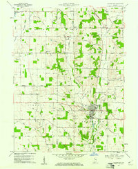 1960 Hagerstown1961 Print · USGSHagerstown and the surrounding Wayne County farmland are captured here in the early sixties, showing a landscape defined by the Whitewater River and the Pennsylvania Railroad. Genealogists can locate specific sites like the Wilbur Wright Memorial, Township School, and West Lawn Cemetery.2 unique versions available
 - 1960 Map of Knightstown, 1961 Print
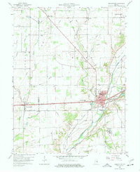 1960 Knightstown1961 Print · USGSKnightstown and the Big Blue River valley are captured in the early sixties as major rail lines and the historic National Road still defined local commerce. Researchers can trace family sites like Glencove Cem, the Morton Sch, and the small community of Raysville.3 unique versions available
 - 1960 Map of Shirley, 1961 Print
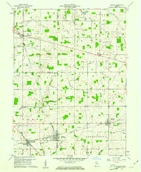 1960 Shirley1961 Print · USGSEast-central Indiana farmland is captured here in the early sixties, centered on the tri-county junction where Shirley meets the NEW YORK CENTRAL line. Local historians can trace family-named landmarks and rural hubs like McCray Cem, Harlan Ch, and the Township High Sch.2 unique versions available
 - 1960 Map of Modoc, 1961 Print
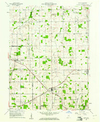 1960 Modoc1961 Print · USGSRandolph and Henry Counties appear here in the early sixties, centered on the vital rail junctions of the eastern Indiana plains. Genealogists and local historians can trace the locations of Bronson, Blountsville, and rural sites like Grace Chapel.
 - 1960 Map of Cambridge City, 1961 Print
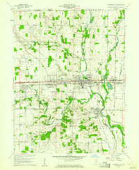 1960 Cambridge City1961 Print · USGSThe Whitewater Valley and the historic National Road are captured here during the early sixties, showing a landscape defined by rail and river. Researchers can trace the layout of Cambridge City and Milton, locating family sites near Locust Grove Cem or Zion Ch.2 unique versions available
 - 1969 Map of Modoc, 1970 Print
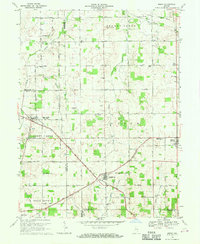 1969 Modoc1970 Print · USGSRandolph and Henry Counties are captured here in the late sixties, showing a landscape defined by intersecting railroads and rural crossroads. Genealogists and local historians can locate family landmarks like Poplar Run Cem, Union Ch, and the settlement of Blountsville.
 - 1970 Map of Dunreith, 1972 Print
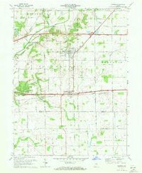 1970 Dunreith1972 Print · USGSHenry and Rush counties are captured here in the early 1970s, showcasing a landscape defined by historic transit and rural industry. Trace the intersections of the National Road with several rail lines and find local landmarks like Beard Sch and Stone Quarry Mills.3 unique versions available
 - 1970 Map of Lewisville, 1973 Print
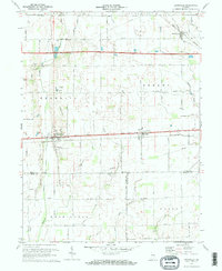 1970 Lewisville1973 Print · USGSEastern Indiana farmland transitions from the steam era to the late twentieth century in this detailed survey of Henry County. Researchers can trace historic family landmarks such as Ebenezer Cem, Rich Square Ch, and the corridor of the Penn Central railroad.2 unique versions available
 - 1986 Map of Muncie
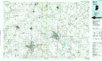 1986 Muncie1986 Print · USGSEast Central Indiana was a hub of manufacturing and higher education in the mid-eighties. Genealogists and historians can trace the streets of Muncie, locate rural Cem sites, and explore landmarks like Mounds State Park and Taylor Univ.3 unique versions available
 - 1986 Map of New Castle
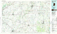 1986 New Castle1986 Print · USGSEast Central Indiana remains a patchwork of thriving county seats and rail-side hamlets in the mid-eighties. Genealogists and historians can locate family landmarks such as East Hill Cemetery, Little Blue River Church, and the transit lines of the CONRAIL railroad.2 unique versions available
 - 2010 Map of Cambridge City, 2010 Print
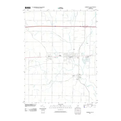 2010 Cambridge City2010 Print · USGSEastern Indiana settlements thrive along the Whitewater River corridor at the start of the twenty-first century. Genealogists and historians can trace family lines through several local burial sites like Friends Cemetery, Beard Cemetery, and Riverside Cemetery.
Showing maps 1-25 of 84
Top cities of Henry County
- New Castle historical maps
- Middletown historical maps
- Knightstown historical maps
- Spiceland historical maps
- Kennard historical maps
- Mooreland historical maps
See more
Frequently asked questions
- What are the different types of historical maps available for Henry County?
- What is the oldest map of Henry County?
- Where can I purchase historical maps of Henry County for my home or office?
- Where can I download high-res historical maps of Henry County?
- Are there historical topographic maps available for Henry County?
- Is there historical aerial imagery available for Henry County?
- Where are historical maps of Henry County sourced from?