2020s Maps of Brownstown, Indiana
Explore 2 historic maps of Brownstown from the 2020s. These maps offer a rare glimpse into what life looked like during the 2020s — showing old roads, neighborhoods, homes, and landmarks that have changed or disappeared over time.
Whether you're researching your family's past, planning a metal detecting trip, or studying how Brownstown's landscape evolved across the 2020s, these high-resolution maps are a powerful tool for exploring the history of this region.
- Focus on a specific era: All maps on this page are from the 2020s, giving you a focused view of this time period.
- See what’s changed: Compare century-old streets, trails, and buildings to today's modern landscape using overlays and satellite layers.
- Research with precision: Use these maps for genealogy, historical research, land use analysis, or educational projects.
- View, download, or print: Maps are fully viewable online in high resolution, and can be downloaded or printed for your own records.
Start exploring Brownstown's history through authentic maps from the 2020s. This is your window into the past.
Brownstown, IN maps
(2)- 2022 Map of Brownstown, 2022 Print
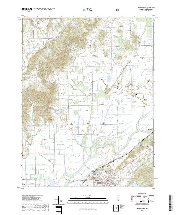 2022 Brownstown2022 Print · USGSJackson County at the start of the 2020s shows a landscape defined by the winding East Fork White River and the seat of local government. Researchers can trace historic family burials at Wayman Cemetery and explore the rural settlements of Surprise and Acme.
 - 2022 Map of Vallonia, 2022 Print
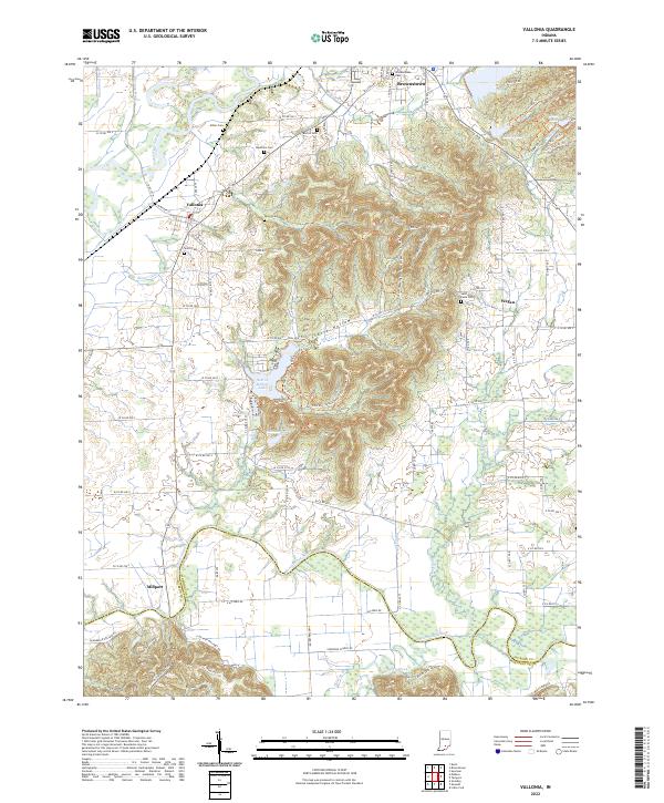 2022 Vallonia2022 Print · USGSVallonia and the river bottoms of southern Indiana are shown here in the early 2020s, highlighting the area's deep agricultural roots. Researchers can trace rural lineages through numerous local sites like Miller Cem, Saint Pauls Cem, and the old settlement at Millport.
End of results
Showing maps 1-2 of 2
Top cities near Brownstown
- Seymour historical maps
- Austin historical maps
- Crothersville historical maps
- Campbellsburg historical maps
- Medora historical maps
- Jonesville historical maps
See more
Top neighborhoods of Brownstown
Frequently asked questions
- What are the different types of historical maps available for Brownstown?
- What is the oldest map of Brownstown?
- Where can I purchase historical maps of Brownstown for my home or office?
- Where can I download high-res historical maps of Brownstown?
- Are there historical topographic maps available for Brownstown?
- Is there historical aerial imagery available for Brownstown?
- Where are historical maps of Brownstown sourced from?