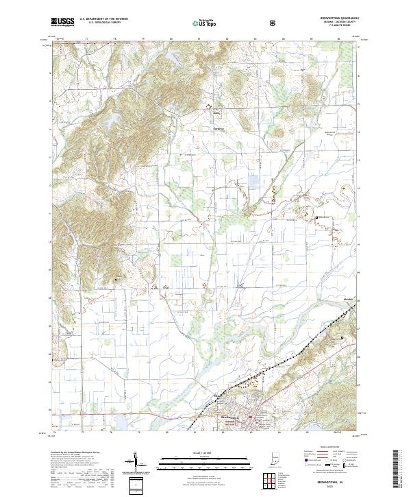
2022 Map of Brownstown
USGS Topo · Published 2022About this map
Brownstown serves as the focal point of this Jackson County landscape, anchored by the Jackson County Courthouse and the Jackson County Superior Court II Courthouse. The town is situated just south of the East Fork White River, a major waterway that dominates the southern half of the map with its meandering course and numerous tributaries like Hough Creek and Ball Richard Ditch. The transition from the flat river valley to the more varied terrain of the Hoosier National Forest is evident in the northwestern corner, where Parker Hill rises near the banks of Little Salt Creek. Genealogists will find several family-named burial sites including Wayman Cemetery and Smallwood Cemetery. Small rural settlements like Acme, Surprise, and Shields are connected by a grid of county roads, reflecting the enduring agricultural and residential patterns of southern Indiana.
Find a feature on this map
92 named features on this map. Tap any name to fly to it.
Don’t see what you’re looking for? This feature index may not catch every label — zoom into the map to look around manually.
Map Details
Editions of this 2022 Brownstown Map
This is the sole edition of this map. No revisions or reprints were ever made.
Other maps of this area

1942 · Franklin
USGS Topo · 1:125,000

1942 · Columbus
USGS Topo · 1:125,000

1948 · Waymansville
USGS Topo · 1:24,000

1953 · Cincinnati
USGS Topo · 1:250,000

1953 · Indianapolis
USGS Topo · 1:250,000

1956 · Indianapolis
USGS Topo · 1:250,000

1956 · Story
USGS Topo · 1:24,000

1956 · Vincennes
USGS Topo · 1:250,000

1956 · Louisville
USGS Topo · 1:250,000

1957 · Indianapolis
USGS Topo · 1:250,000