Old Maps of Jay County, Indiana
Explore 84 old maps of Jay County, spanning from 1911 to today. These high-resolution historic maps reveal how streets, neighborhoods, landmarks, and natural features evolved over time — perfect for genealogy, metal detecting, research, and local history exploration.
What you can do with these maps:
- See how Jay County changed over time: Compare historical maps to modern-day views to trace roads, homesites, rail lines & more.
- View detailed metadata: Each map includes creators, publishers, year, scale, and archive source.
- Overlay maps with satellite & LiDAR: Visualize the past alongside modern tools to explore terrain & human change.
- Trusted historical sources: Maps sourced from the USGS, Library of Congress, and other archives.
- Access maps your way: View online, download high-res files, or order prints for personal or research use.
Start exploring old maps of Jay County to uncover forgotten places, hidden landmarks, and the deep history beneath your feet.
Jay County, IN maps
(84)- 1911 Map of Berne
 1911 Berne1911 Print · USGSThe Ohio-Indiana borderlands come to life in this pre-war survey of the rural landscape between the St. Marys and Wabash rivers. Genealogists can trace family footprints through numerous district sites like Duck Creek School No 4, St Anthony, and Zion Church.
 - 1915 Map of Fort Recovery
 1915 Fort Recovery1915 Print · USGSThe Indiana-Ohio borderlands come into focus during the mid-1910s, showing the agricultural and rail-dependent landscape around Fort Recovery. Genealogists and historians can trace the exact locations of numerous rural institutions like Oak Grove School, Mt Zion School, and the Lake Erie and Western railroad corridor.2 unique versions available
 - 1918 Map of Fort Recovery, 1922 Print
 1918 Fort Recovery1922 Print · USGSFort Recovery and the surrounding Mercer County farmsteads are documented here in the early twentieth century, just years after the turn of the century. Genealogists can trace family connections through a high density of rural schoolhouses like Mt Zion School and settlements such as Macedon and Buck Corners.
 - 1953 Map of Muncie, 1966 Print
 1953 Muncie1966 Print · USGSIndiana and Ohio borderlands thrive in the early fifties, showing a landscape defined by manufacturing cities and an intensive railroad network. Genealogists can trace family roots across the Indiana-Ohio line through Muncie, Celina, and Portland via the Pennsylvania railroad.5 unique versions available
 - 1956 Map of Muncie
 1956 Muncie1956 Print · USGSEastern Indiana and western Ohio are shown at a peak of rail-driven industry in the mid-fifties. Genealogists and rail historians can trace the paths of the Pennsylvania RR through Muncie or locate landmarks like Lake Saint Marys (Grand Lake Reservoir) and Frances Slocum State Forest.
 - 1960 Map of Pennville, 1961 Print
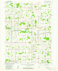
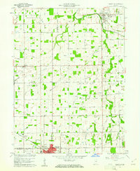 1960 Pennville1961 Print · USGSIndiana's eastern farmland is documented here in the early sixties, showing the vital rail and river networks of Jay and Blackford counties. Researchers can locate family landmarks like Maple Lawn Cem, the crossroads of Ridertown, and the Pennsylvania Railroad corridor.2 unique versions available
 - 1960 Map of Fort Recovery, 1961 Print
 1960 Fort Recovery1961 Print · USGSThe Indiana-Ohio borderlands come into focus during the early sixties, centered on the historic village of Fort Recovery. Genealogists and historians can trace the Old Indian Treaty Road and locate numerous family burial grounds like Old Pioneer Cem and Limber Cem.2 unique versions available
 - 1960 Map of Blaine, 1961 Print
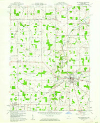
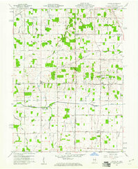
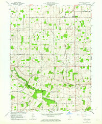
 1960 Blaine1961 Print · USGSJay County's rural townships are shown here during a period of steady mid-century growth along the river and rail lines. Genealogists and researchers can trace family-named sites like Whiteman Cem, visit country landmarks like Sugar Grove Ch, or locate the old Drive-in Theater.3 unique versions available
 - 1960 Map of Portland, 1961 Print
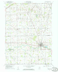
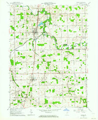
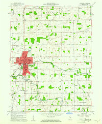 1960 Portland1961 Print · USGSThe Jay County seat of Portland is shown in the early sixties as a thriving rail hub and agricultural center. Local historians can trace the legacy of neighborhood schools like Haynes Sch and Lincoln Sch or locate family sites near Liber Cem.2 unique versions available
 - 1960 Map of Cosmos, 1961 Print
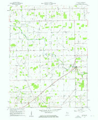
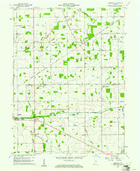
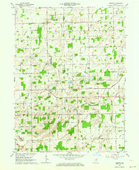
 1960 Cosmos1961 Print · USGSThe Indiana-Ohio borderlands at the start of the sixties were a grid of productive farmland and small rural parishes. Researchers can trace ancestral sites and local landmarks like Salem, Raper Chapel, and Mt Zion Cem Ch across the state line.4 unique versions available
 - 1960 Map of Ridgeville, 1961 Print
 1960 Ridgeville1961 Print · USGSEast-central Indiana is captured here at the start of the sixties, showing a landscape defined by the Mississinewa River and rail lines. Genealogists can locate family sites at Odd Fellows Cem and Powers Cem or trace the early Indian Treaty Boundary.3 unique versions available
 - 1960 Map of Deerfield, 1961 Print
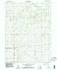
 1960 Deerfield1961 Print · USGSRandolph and Jay counties appear here in the early sixties, a landscape defined by the Old Indian Treaty Boundary and the winding Mississinewa River. Genealogists can locate several historic burial sites like Lawn Dale Cem, Neimer Cem, and the community of New Pittsburg.
 - 1960 Map of Redkey, 1962 Print
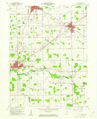 1960 Redkey1962 Print · USGSEastern Indiana in the early sixties shows a landscape where industrial rail hubs meet the agricultural heartland. Genealogists and local historians can trace family roots through sites like Cherry Grove Sch, Shedville, and the Strong Cem near the Mississinewa River.2 unique versions available
 - 1960 Map of New Corydon, 1962 Print
 1960 New Corydon1962 Print · USGSThe Indiana-Ohio borderlands come to life in this early 1960s survey of the Wabash River valley. Genealogists and researchers can trace family roots through numerous country landmarks like Jefferson Sch, Liberty Cem, and the small community of New Corydon.3 unique versions available
 - 1962 Map of Petroleum, 1964 Print
 1962 Petroleum1964 Print · USGSEast-central Indiana's rural landscape is captured here in the early sixties, showing the intersection of three counties along the Salamonie River. Researchers can trace old property lines and community landmarks like Petroleum Sch, Gilead Ch, and the namesake Oil Wells of the region.
 - 1962 Map of Geneva, 1964 Print
 1962 Geneva1964 Print · USGSNortheast Indiana in the early sixties reveals a landscape of drainage-fed farmland and literary history near the Ohio border. Trace the legacy of Gene Stratton-Porter at the Limberlost State Memorial or locate family plots at Gravel Hill Cem and Snow Cem.2 unique versions available
 - 1962 Map of Domestic, 1964 Print
 1962 Domestic1964 Print · USGSIndiana’s borderlands between Wells, Adams, and Jay Counties are mapped here in the early sixties as agricultural drainage transformed the landscape. Genealogists can trace family sites at Alberson Cemetery or locate old schoolhouses like Township School near Poling.
 - 1986 Map of Piqua
 1986 Piqua1986 Print · USGSThe western Ohio and eastern Indiana borderlands appear here in the mid-1980s, showcasing a landscape of river-valley industry and fertile plains. Researchers can trace historic rail lines like Conrail and Norfolk and Western through towns like Greenville and Winchester.3 unique versions available
 - 1986 Map of Wabash
 1986 Wabash1986 Print · USGSThe Wabash Valley and surrounding Indiana farm country are captured here in the mid-eighties, showing a landscape reshaped by major reservoirs. Genealogists and local historians can trace the paths of the Old Indian Trail and the industrial reach of the Conrail line through towns like Lagro and Warren.2 unique versions available
 - 1986 Map of Muncie
 1986 Muncie1986 Print · USGSEast Central Indiana was a hub of manufacturing and higher education in the mid-eighties. Genealogists and historians can trace the streets of Muncie, locate rural Cem sites, and explore landmarks like Mounds State Park and Taylor Univ.3 unique versions available
 - 1986 Map of Lima
 1986 Lima1986 Print · USGSWest Ohio and East Indiana are captured here in the mid-1980s, showcasing a landscape of productive farmland and industrial transit hubs. Genealogists and historians can trace the development of Lima and Van Wert or locate landmarks like Woodland Chapel and the Lima Ordnance Modification Center.3 unique versions available
 - 1992 Map of Deerfield, 1995 Print
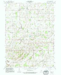
 1992 Deerfield1995 Print · USGSThe rural borderlands of Jay and Randolph Counties were documented in the 1990s as a landscape of river-fed farms and diagonal treaty lines. Genealogists can trace family roots through numerous sites like Lawn Dale Cemetery and Zion Church near the Mississinewa River.
 - 1992 Map of Portland, 1995 Print
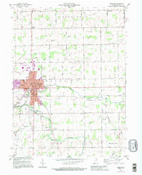 1992 Portland1995 Print · USGSMid-century Indiana life meets late-century updates in this detailed look at Portland and its surrounding townships. Genealogists and local historians can trace family roots at Green Park Cemetery or explore the rural schoolhouses like Miller Sch and Haynes Sch.
 - 1992 Map of Domestic, 1995 Print
 1992 Domestic1995 Print · USGSJay and Wells County crossroads are captured here in the early nineties, showing a landscape shaped by rural industry and drainage engineering. Genealogists can locate family sites near Domestic, Perryville, and the West Grove Cem or trace the early Oil Wells near Twin Hills.
 - 2010 Map of Deerfield, 2010 Print
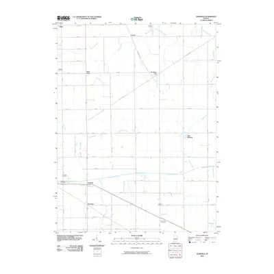 2010 Deerfield2010 Print · USGSCovers Jay County, including Antioch, Randolph, and other nearby areas
Showing maps 1-25 of 84
Top cities of Jay County
- Portland historical maps
- Redkey historical maps
- Greene historical maps
- Pennville historical maps
- Noble historical maps
- Bryant historical maps
See more
Frequently asked questions
- What are the different types of historical maps available for Jay County?
- What is the oldest map of Jay County?
- Where can I purchase historical maps of Jay County for my home or office?
- Where can I download high-res historical maps of Jay County?
- Are there historical topographic maps available for Jay County?
- Is there historical aerial imagery available for Jay County?
- Where are historical maps of Jay County sourced from?