2020s Maps of Jay County, Indiana
Explore 12 historic maps of Jay County from the 2020s. These maps offer a rare glimpse into what life looked like during the 2020s — showing old roads, neighborhoods, homes, and landmarks that have changed or disappeared over time.
Whether you're researching your family's past, planning a metal detecting trip, or studying how Jay County's landscape evolved across the 2020s, these high-resolution maps are a powerful tool for exploring the history of this region.
- Focus on a specific era: All maps on this page are from the 2020s, giving you a focused view of this time period.
- See what’s changed: Compare century-old streets, trails, and buildings to today's modern landscape using overlays and satellite layers.
- Research with precision: Use these maps for genealogy, historical research, land use analysis, or educational projects.
- View, download, or print: Maps are fully viewable online in high resolution, and can be downloaded or printed for your own records.
Start exploring Jay County's history through authentic maps from the 2020s. This is your window into the past.
Jay County, IN maps
(12)- 2022 Map of Redkey, 2022 Print
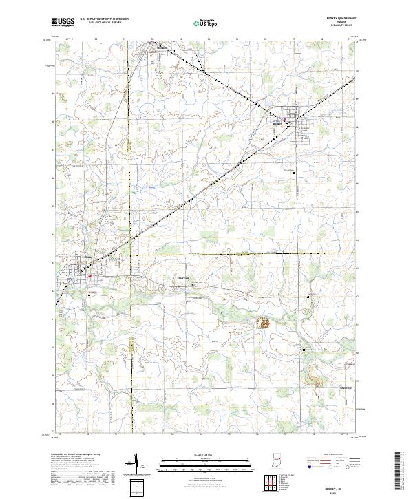 2022 Redkey2022 Print · USGSJay and Delaware counties are documented here in the early 2020s, showing the settled farmland between the Mississinewa River and the towns of Dunkirk and Redkey. Researchers can trace local heritage through several rural cemeteries like Caylor Cem and Cherry Grove Cem.
 - 2022 Map of Deerfield, 2022 Print
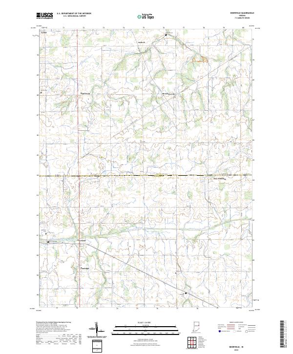 2022 Deerfield2022 Print · USGSThe rural border of Jay and Randolph counties remains a landscape of small crossroads and family cemeteries in the early twenty-first century. Genealogists can trace family names at Old Prospect Cem or locate the quiet hamlets of Deerfield and Boundary City.
 - 2022 Map of Pennville, 2022 Print
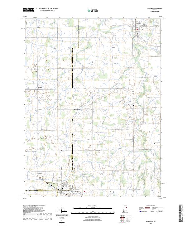 2022 Pennville2022 Print · USGSThe rural borders of Jay and Blackford Counties are revealed in this study of the Indiana heartland during the early twenty-first century. Genealogists can trace family names at sites like Maple Lawn Cem, Mount Tabor Cem, and the Independent Order of Odd Fellows Cem.
 - 2022 Map of Geneva, 2022 Print
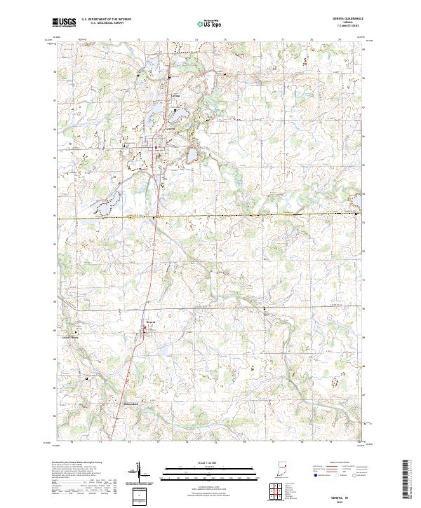 2022 Geneva2022 Print · USGSThe borderlands of Adams and Jay counties are captured here in the early twenty-first century, centered on the historic Geneva and Bryant communities. Researchers can trace rural lineages through numerous local sites including Westlawn Cem, Gravel Hill Cem, and the path of the Wabash River.
 - 2022 Map of Portland, 2022 Print
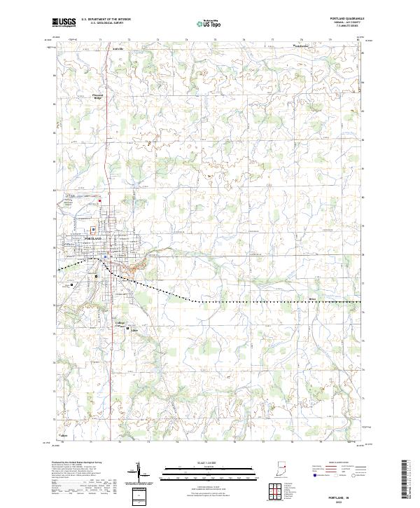 2022 Portland2022 Print · USGSJay County's seat and its surrounding farming townships are captured in this recent survey. Researchers can locate family heritage sites like Liber Cem and Jaque Cem or trace the rural crossroads of Antiville and Collett.
 - 2022 Map of Blaine, 2022 Print
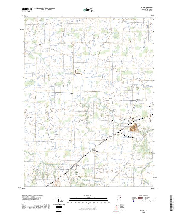 2022 Blaine2022 Print · USGSJay County farmland near the Salamonie River is shown here in the early 2020s, reflecting a landscape defined by generational agriculture and historic crossroads. Genealogists can trace family roots at Whiteman Cem, Stratton Cem, and the small settlements of Blaine and Como.
 - 2022 Map of Domestic, 2022 Print
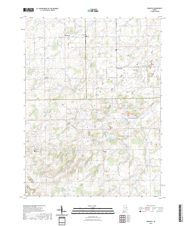 2022 Domestic2022 Print · USGSJay County's rural agricultural landscape and drainage history are on full display in this modern survey of the Indiana countryside. Researchers can trace the heritage of local families at Hartford Cem and Alberson Cem or explore the wetlands near Loblolly Cr.
 - 2022 Map of Ridgeville, 2022 Print
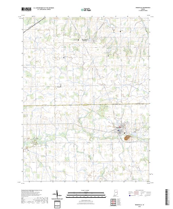 2022 Ridgeville2022 Print · USGSEastern Indiana farming life is centered on Ridgeville and the Mississinewa River in this recent survey. Genealogists can trace several local burial grounds, including Bost Cem, Flesher Cem, and Veterans Cem.
 - 2022 Map of Petroleum, 2022 Print
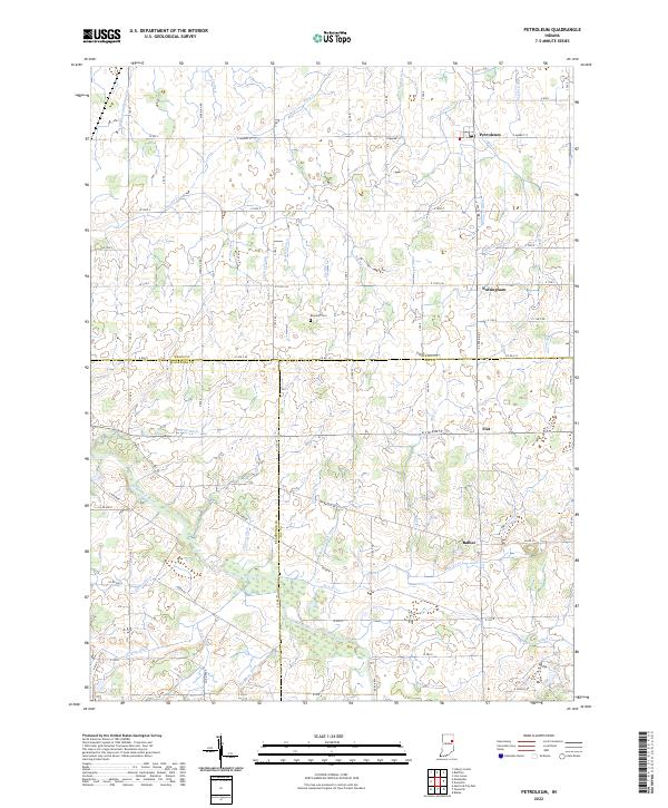 2022 Petroleum2022 Print · USGSEast-central Indiana farmland near the intersection of Wells, Jay, and Blackford counties is shown here in the 2020s. Trace local family history at Bloxsom Cem and the small settlements of Petroleum, Nottingham, and Balbec.
 - 2022 Map of New Corydon, 2022 Print
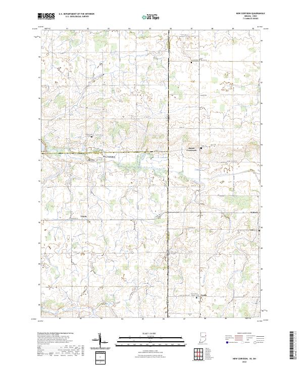 2022 New Corydon2022 Print · USGSThe Indiana-Ohio borderlands come into focus in the early 2020s, showing a landscape shaped by the Wabash River and an extensive network of drainage ditches. Local historians can trace established crossroad settlements like New Corydon and Skeels Crossroads alongside numerous burial sites like Lufborrow Cem.
 - 2023 Map of Fort Recovery, 2023 Print
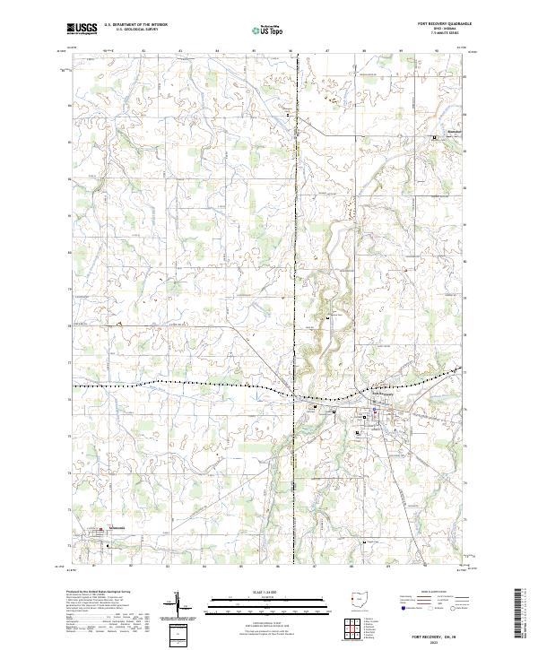 2023 Fort Recovery2023 Print · USGSThe Ohio-Indiana border comes alive in this contemporary survey of the Wabash River headwaters and the village of Fort Recovery. Genealogists and local historians can locate numerous rural burial sites including Old Pioneer Cem and Spring Hill Cem.
 - 2023 Map of Cosmos, 2023 Print
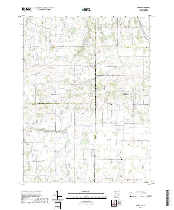 2023 Cosmos2023 Print · USGSDarke County and the Indiana borderlands are captured here in a period of settled agricultural continuity. Genealogists and local historians can trace family plots at Raper Chapel Cem and Mount Zion Cem, or follow the headwaters of the Wabash River and Mississinewa River.
End of results
Showing maps 1-12 of 12
Top cities of Jay County
- Portland historical maps
- Redkey historical maps
- Greene historical maps
- Pennville historical maps
- Noble historical maps
- Bryant historical maps
See more
Frequently asked questions
- What are the different types of historical maps available for Jay County?
- What is the oldest map of Jay County?
- Where can I purchase historical maps of Jay County for my home or office?
- Where can I download high-res historical maps of Jay County?
- Are there historical topographic maps available for Jay County?
- Is there historical aerial imagery available for Jay County?
- Where are historical maps of Jay County sourced from?