Old Maps of Oaktown, Indiana for Genealogy
Trace your family roots with 20 historic maps of Oaktown. These high-res maps reveal old neighborhoods, homesites, landmarks, and streets — helping you uncover where your ancestors lived and how the area evolved over time.
- Explore historic neighborhoods: Identify where your relatives may have lived in the 1800s or 1900s.
- Compare maps over time: Trace the changes in streets, buildings, and landmarks for multi-generational research.
- Perfect for genealogy & ancestry research: Used by family historians and researchers to map out lineage and migration.
These maps are an incredible resource for exploring your personal connection to Oaktown's past.
Oaktown, IN maps
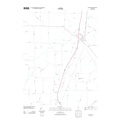
(20)- 1943 Map of Carlisle
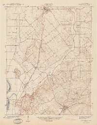
 1943 Carlisle1943 Print · USGSSouthern Sullivan County was a landscape of rail-linked towns and quiet country cemeteries in the years following the Great Depression. Genealogists and local historians can trace family roots through sites like Odd Fellows Cem or locate the old Shaker Prairie Ch along the Vincennes Tract.2 unique versions available
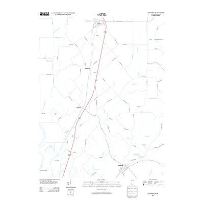
 - 1943 Map of Oaktown
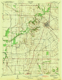
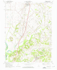
 1943 Oaktown1943 Print · USGSKnox County and the Illinois borderlands come alive in the early 1940s as steam-era railroads connect the farming communities of Oaktown and Bruceville. Local historians can trace family roots through numerous sites like Ocheltree Cem, Price Cem, and the Maria Creek Ch.2 unique versions available
 - 1956 Map of Vincennes, 1967 Print
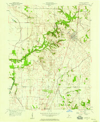
 1956 Vincennes1967 Print · USGSSouthern Indiana and the Illinois borderlands are captured here in the mid-fifties, showing the region's dense network of river towns and rail lines. Researchers can trace historic river crossings along the Wabash River or locate landmarks like Wyandotte Cave and Lincoln State Park.4 unique versions available
 - 1957 Map of Vincennes
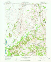
 1957 Vincennes1957 Print · USGSSouthwest Indiana and the Illinois borderlands come alive in the late 1950s, a period of heavy rail traffic and expanding state forests. Genealogists and historians can trace the riverfronts and rail lines of Vincennes, New Harmony, and the vast Crane Naval Ammunition Depot.
 - 1957 Map of Carlisle, 1958 Print
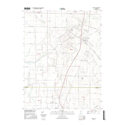
 1957 Carlisle1958 Print · USGSMid-century Sullivan and Knox counties are captured here as agriculture and energy infrastructure shape the land. Genealogists can locate numerous burial sites like Odd Fellows Cem and Ledgerwood Cem near the Vincennes Tract Boundary.
 - 1958 Map of Vincennes
 1958 Vincennes1958 Print · USGSSouthern Indiana and the Illinois borderlands are captured during a mid-century period of heavy rail traffic and military activity. Researchers can trace the sprawling bounds of the Crane Naval Ammunition Depot or locate historic settlements like New Harmony and French Lick.2 unique versions available
 - 1958 Map of Oaktown, 1959 Print
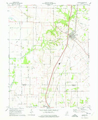
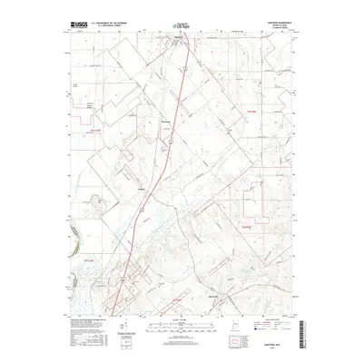
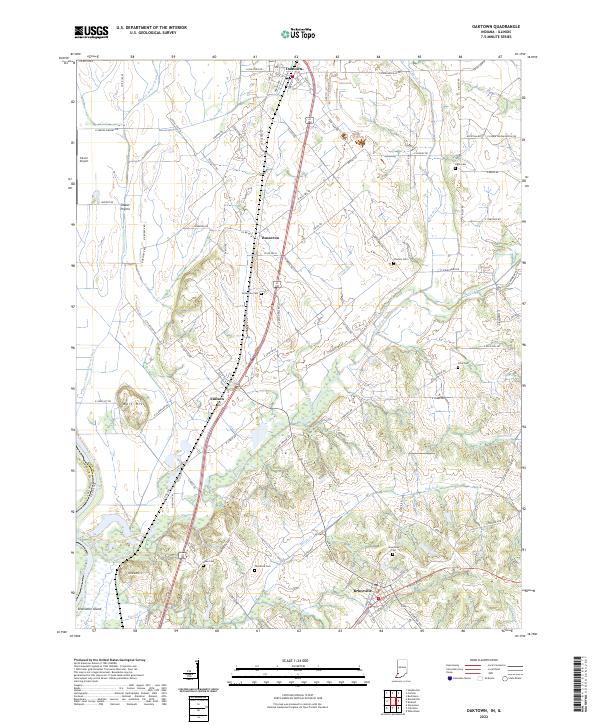
 1958 Oaktown1959 Print · USGSKnox County, Indiana, at the end of the fifties reveals a landscape of established rail towns and rural cemeteries. Genealogists and local historians can locate Oaktown and Bruceville, while tracing family sites like Ocheltree Cem and the Maria Creek Ch.2 unique versions available
 - 1974 Map of Oaktown, 1975 Print
 1974 Oaktown1975 Print · USGSKnox County agricultural life and transportation networks are well-defined in the mid-1970s. Genealogists and historians can trace family locations through rural burial sites like Ocheltree Cem and the school at North Knox West Sch.2 unique versions available
 - 1974 Map of Carlisle, 1975 Print
 1974 Carlisle1975 Print · USGSCarlisle and Oaktown are captured in the mid-1970s at the junction of two major rail lines. Genealogists can locate numerous burial sites like Old Town Cem and Haddon Cem, or trace the path of the Old Indian Treaty Boundary across the countryside.2 unique versions available
 - 1986 Map of Vincennes
 1986 Vincennes1986 Print · USGSThe Wabash River valley in the mid-1980s shows a landscape defined by deep-rooted river towns and heavy industry. Researchers can trace the legacy of regional rail lines like the Conrail system or locate landmarks such as Vincennes University and St Francisville Church.2 unique versions available
 - 2010 Map of Carlisle, 2010 Print
 2010 Carlisle2010 Print · USGSCovers Oaktown, including Carlisle, Knox County, and other nearby areas
 - 2010 Map of Oaktown, 2010 Print
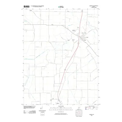
 2010 Oaktown2010 Print · USGSCovers Oaktown, including Busseron, Bruceville, and other nearby areas
 - 2013 Map of Carlisle, 2013 Print
 2013 Carlisle2013 Print · USGSCovers Oaktown, including Carlisle, Knox County, and other nearby areas
 - 2013 Map of Oaktown, 2013 Print
 2013 Oaktown2013 Print · USGSCovers Oaktown, including Busseron, Bruceville, and other nearby areas
 - 2016 Map of Carlisle, 2016 Print
 2016 Carlisle2016 Print · USGSCovers Oaktown, including Carlisle, Knox County, and other nearby areas
 - 2016 Map of Oaktown, 2016 Print
 2016 Oaktown2016 Print · USGSCovers Oaktown, including Busseron, Bruceville, and other nearby areas
 - 2019 Map of Carlisle, 2019 Print
 2019 Carlisle2019 Print · USGSCovers Oaktown, including Carlisle, Knox County, and other nearby areas
 - 2019 Map of Oaktown, 2019 Print
 2019 Oaktown2019 Print · USGSCovers Oaktown, including Busseron, Bruceville, and other nearby areas
 - 2022 Map of Carlisle, 2022 Print
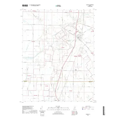
 2022 Carlisle2022 Print · USGSSullivan and Knox counties at the start of the 2020s show a landscape deeply rooted in its pioneer-era cemeteries and agricultural drainage networks. Genealogists can trace family names at Carlisle Old Town Cem, Ledgerwood Cem, or along the historic S Old Buffalo Trl.
 - 2022 Map of Oaktown, 2022 Print
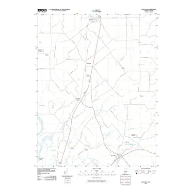
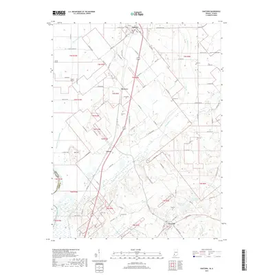
 2022 Oaktown2022 Print · USGSKnox County, Indiana, is captured here in the early twenty-first century, showing a landscape of fertile prairies and traditional settlements. Researchers can trace family history through local sites like Charley Cem, Ocheltree Cem, and the village of Emison.
End of results
Showing maps 1-20 of 20
Top cities near Oaktown
- Vincennes historical maps
- Lawrenceville historical maps
- Sullivan historical maps
- Bicknell historical maps
- Cass historical maps
- Busseron historical maps
See more
Frequently asked questions
- What are the different types of historical maps available for Oaktown?
- What is the oldest map of Oaktown?
- Where can I purchase historical maps of Oaktown for my home or office?
- Where can I download high-res historical maps of Oaktown?
- Are there historical topographic maps available for Oaktown?
- Is there historical aerial imagery available for Oaktown?
- Where are historical maps of Oaktown sourced from?