2020s Maps of Cedar Creek Township, Indiana
Explore 4 historic maps of Cedar Creek Township from the 2020s. These maps offer a rare glimpse into what life looked like during the 2020s — showing old roads, neighborhoods, homes, and landmarks that have changed or disappeared over time.
Whether you're researching your family's past, planning a metal detecting trip, or studying how Cedar Creek Township's landscape evolved across the 2020s, these high-resolution maps are a powerful tool for exploring the history of this region.
- Focus on a specific era: All maps on this page are from the 2020s, giving you a focused view of this time period.
- See what’s changed: Compare century-old streets, trails, and buildings to today's modern landscape using overlays and satellite layers.
- Research with precision: Use these maps for genealogy, historical research, land use analysis, or educational projects.
- View, download, or print: Maps are fully viewable online in high resolution, and can be downloaded or printed for your own records.
Start exploring Cedar Creek Township's history through authentic maps from the 2020s. This is your window into the past.
Cedar Creek Township, IN maps
(4)- 2022 Map of Leroy, 2022 Print
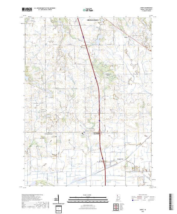 2022 Leroy2022 Print · USGSSouthern Lake County's agricultural heartland is documented here in the early twenty-first century. Genealogists and local historians can trace the rural communities of Leroy, Dinwiddie, and Orchard Grove, alongside family landmarks like Plum Grove Cem.
 - 2022 Map of Shelby, 2022 Print
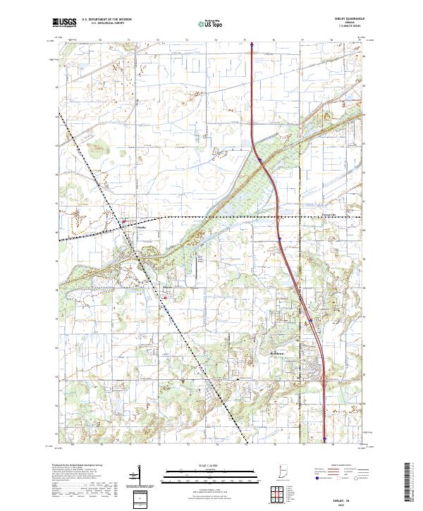 2022 Shelby2022 Print · USGSThe Kankakee River lowlands of Lake and Newton counties appear here in the early twenty-first century, showing a landscape defined by industrial-scale drainage and small-town roots. Researchers can trace the layout of Shelby, locate the Roselawn Cem, or follow the path of the historic Monon Rd.
 - 2022 Map of Schneider, 2022 Print
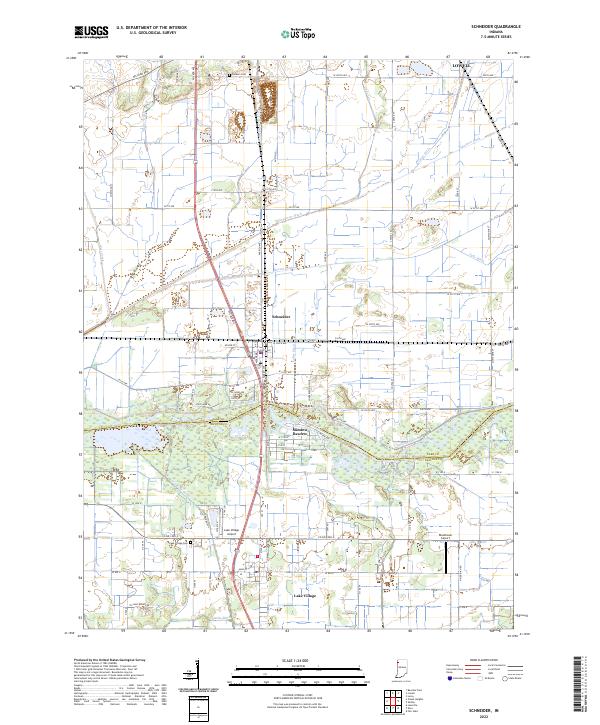 2022 Schneider2022 Print · USGSNorthwest Indiana's marshy lowlands are mapped here in the early 2020s, showing the intersection of agricultural engineering and rural settlement. Genealogists can locate Sanders Cem and Lake Village Cem among the many drainage works like Singleton Ditch.
 - 2022 Map of Lowell, 2022 Print
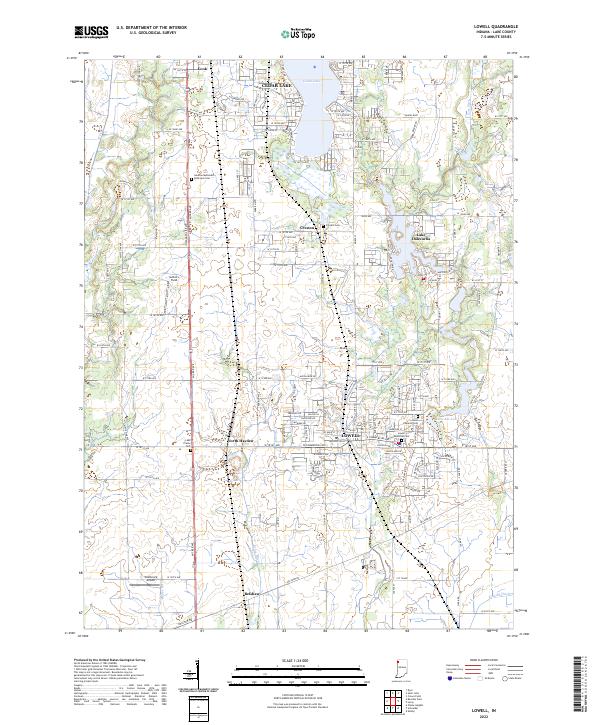 2022 Lowell2022 Print · USGSSouthern Lake County at the start of the 2020s shows a landscape of established towns and growing lakefront communities. Genealogists and local historians can trace family plots at German Methodist Episcopal Cem or Lowell Memorial Cem and locate landmarks like Wietbrock Airport.
End of results
Showing maps 1-4 of 4
Top cities near Cedar Creek Township
- Merrillville historical maps
- Schererville historical maps
- Hobart historical maps
- Crown Point historical maps
- Cedar Lake historical maps
- Sauk Village historical maps
See more
Top neighborhoods of Cedar Creek Township
- Orchard Grove historical maps
- Lake Dalecarlia historical maps
- Shelby historical maps
- Lowell historical maps
- Cedar Creek Heights historical maps
Frequently asked questions
- What are the different types of historical maps available for Cedar Creek Township?
- What is the oldest map of Cedar Creek Township?
- Where can I purchase historical maps of Cedar Creek Township for my home or office?
- Where can I download high-res historical maps of Cedar Creek Township?
- Are there historical topographic maps available for Cedar Creek Township?
- Is there historical aerial imagery available for Cedar Creek Township?
- Where are historical maps of Cedar Creek Township sourced from?