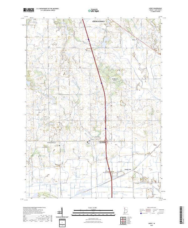
2022 Map of Leroy
USGS Topo · Published 2022About this map
Crown Point and the surrounding township lands of southern Lake County are characterized by a dense grid of rural roads and an extensive network of water management channels. In this agrarian landscape, historic clusters such as Leroy, Southeast Grove, and Orchard Grove mark the intersection of long-established section lines. The drainage systems, including Singleton Ditch, Griesel Ditch, and Bryant Ditch, underscore the engineering required to maintain the productivity of these prairie lands. For those tracing family histories in the region, the map identifies specific burial sites such as Orchard Grove Cem and Plum Grove Cem, located south of Belshaw Rd. The southern edge of the survey transitions toward the Kankakee River basin, where the landscape is increasingly defined by straightened waterways like Little Ditch and Ebert Ditch.
Find a feature on this map
55 named features on this map. Tap any name to fly to it.
Don’t see what you’re looking for? This feature index may not catch every label — zoom into the map to look around manually.
Map Details
Editions of this 2022 Leroy Map
This is the sole edition of this map. No revisions or reprints were ever made.
Other maps of this area

1953 · Leroy
USGS Topo · 1:24,000

1953 · St. John
USGS Topo · 1:24,000

1953 · Palmer
USGS Topo · 1:24,000

1953 · Crown Point
USGS Topo · 1:24,000

1953 · Hebron
USGS Topo · 1:24,000

1953 · Lowell
USGS Topo · 1:24,000

1953 · Chicago
USGS Topo · 1:250,000

1957 · Chicago
USGS Topo · 1:250,000

1957 · DeMotte
USGS Topo · 1:24,000

1959 · Schneider
USGS Topo · 1:24,000
Featured Places
- Crown Point, IN
- Cedar Creek Township, IN
- Winfield Township, IN
- Center Township, IN
- Eagle Creek Township, IN