Old Maps of Peoria, Indiana for Academic Research
Study the evolution of Peoria with 10 high-resolution historic maps. Whether you're teaching, researching, or modeling changes in land use, these maps provide essential visual documentation of urban, environmental, and geographic change.
- Analyze long-term change: Track patterns in development, transportation, and natural features.
- Ideal for environmental or urban studies: Support academic projects with primary historical map data.
- Use in the classroom or lab: Educators and researchers rely on these maps to bring historical context to life.
These maps are a powerful tool for teaching, research, and visualizing how Peoria has changed over the decades.
Peoria, IN maps
(10)- 1953 Map of Peoria, 1955 Print
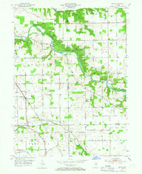 1953 Peoria1955 Print · USGSIn the early 1950s, the Mississinewa River valley remained a landscape of dense state forest and small farming hamlets. Researchers can trace the heritage of local settlements like Peoria and Santa Fe, or locate family burial sites at Slocum Cem and Keyes Cem.3 unique versions available
 - 1953 Map of Muncie, 1966 Print
 1953 Muncie1966 Print · USGSIndiana and Ohio borderlands thrive in the early fifties, showing a landscape defined by manufacturing cities and an intensive railroad network. Genealogists can trace family roots across the Indiana-Ohio line through Muncie, Celina, and Portland via the Pennsylvania railroad.5 unique versions available
 - 1956 Map of Muncie
 1956 Muncie1956 Print · USGSEastern Indiana and western Ohio are shown at a peak of rail-driven industry in the mid-fifties. Genealogists and rail historians can trace the paths of the Pennsylvania RR through Muncie or locate landmarks like Lake Saint Marys (Grand Lake Reservoir) and Frances Slocum State Forest.
 - 1969 Map of Peoria, 1971 Print
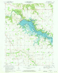 1969 Peoria1971 Print · USGSNear the end of the 1960s, this portion of Indiana saw its river valleys reshaped by the rising Mississinewa Reservoir. Genealogists can locate family landmarks like Slocum Cem and Township Sch alongside the rail lines of the Chesapeake and Ohio.3 unique versions available
 - 1986 Map of Wabash
 1986 Wabash1986 Print · USGSThe Wabash Valley and surrounding Indiana farm country are captured here in the mid-eighties, showing a landscape reshaped by major reservoirs. Genealogists and local historians can trace the paths of the Old Indian Trail and the industrial reach of the Conrail line through towns like Lagro and Warren.2 unique versions available
 - 2010 Map of Peoria, 2010 Print
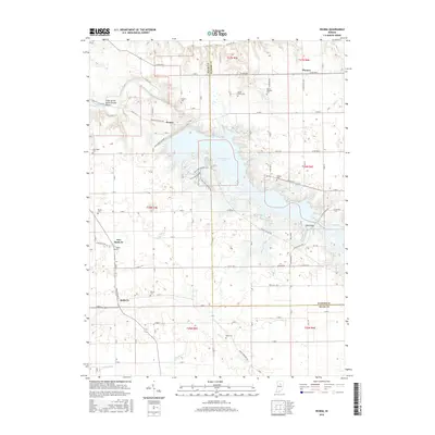
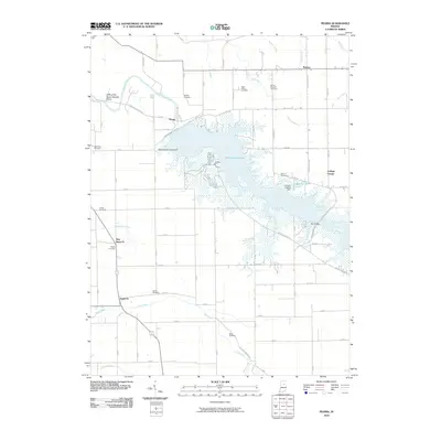 2010 Peoria2010 Print · USGSCovers Peoria, including Santa Fe, Pioneer, and other nearby areas
 - 2013 Map of Peoria, 2013 Print
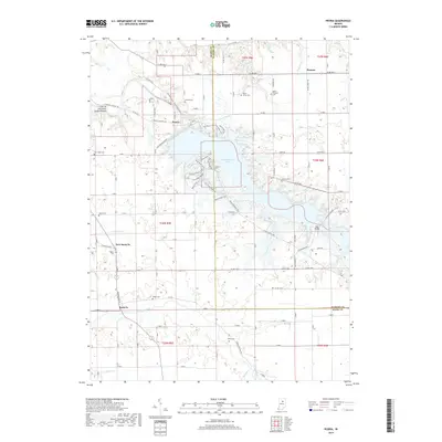
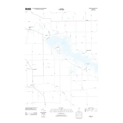 2013 Peoria2013 Print · USGSCovers Peoria, including Santa Fe, Pioneer, and other nearby areas
 - 2016 Map of Peoria, 2016 Print
 2016 Peoria2016 Print · USGSCovers Peoria, including Santa Fe, Pioneer, and other nearby areas
 - 2019 Map of Peoria, 2019 Print
 2019 Peoria2019 Print · USGSCovers Peoria, including Santa Fe, Pioneer, and other nearby areas
 - 2022 Map of Peoria, 2022 Print
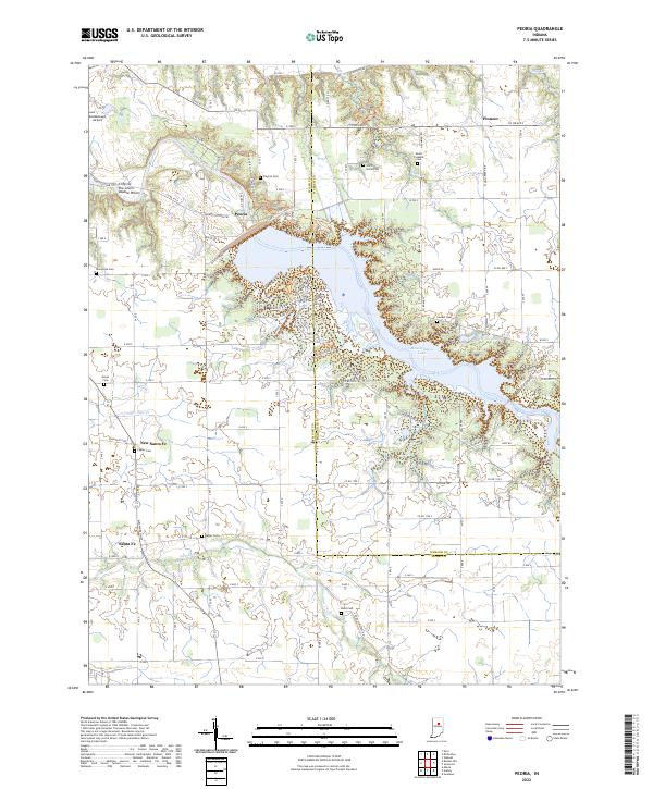 2022 Peoria2022 Print · USGSMiami and Wabash counties are defined by the winding waters of the Mississinewa in the early 2020s. Researchers can trace rural lineages through numerous local burial grounds like Slocum Cem and explore landmarks such as the Cliffs of the Seven Double Pillars.
End of results
Showing maps 1-10 of 10
Top cities near Peoria
- Kokomo historical maps
- Peru historical maps
- Wabash historical maps
- Sims historical maps
- Galveston historical maps
- Bunker Hill historical maps
See more
Frequently asked questions
- What are the different types of historical maps available for Peoria?
- What is the oldest map of Peoria?
- Where can I purchase historical maps of Peoria for my home or office?
- Where can I download high-res historical maps of Peoria?
- Are there historical topographic maps available for Peoria?
- Is there historical aerial imagery available for Peoria?
- Where are historical maps of Peoria sourced from?