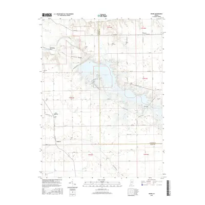
2016 Map of Peoria
USGS Topo · Published 2016About this map
Mississinewa Lake dominates the central landscape of this Miami County region, its fingers reaching into the surrounding rural townships. The settlement of Peoria sits just north of the Mississinewa Dam Rd, while further south, the adjacent communities of Santa Fe and New Santa Fe represent the enduring agricultural character of the area. A striking natural landmark, the Cliffs of the Seven Double Pillars, overlooks the Mississinewa River in the northwest, offering a unique geological contrast to the flat farmlands. This 2016 record shows a landscape shaped by both water management and generations of settlement, documented through numerous family-named burial grounds like Ramer Cem and Fegley Cem. The proximity of Lake Niconzah and various camp grounds near the larger reservoir highlights the area's role as a regional destination for recreation and conservation.
Find a feature on this map
116 named features on this map. Tap any name to fly to it.
Don’t see what you’re looking for? This feature index may not catch every label — zoom into the map to look around manually.
Map Details
Editions of this 2016 Peoria Map
This is the sole edition of this map. No revisions or reprints were ever made.
Other maps of this area

1951 · Peru
USGS Topo · 1:24,000

1951 · Bunker Hill
USGS Topo · 1:24,000

1951 · Richvalley
USGS Topo · 1:24,000

1952 · Wabash
USGS Topo · 1:24,000

1953 · Somerset
USGS Topo · 1:24,000

1953 · Peoria
USGS Topo · 1:24,000

1953 · Danville
USGS Topo · 1:250,000

1953 · Muncie
USGS Topo · 1:250,000

1955 · Danville
USGS Topo · 1:250,000

1956 · Muncie
USGS Topo · 1:250,000