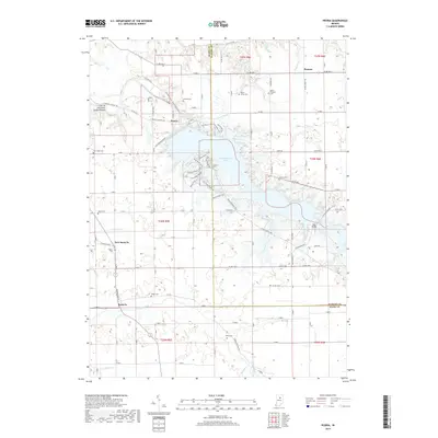
2019 Map of Peoria
USGS Topo · Published 2019About this map
Peoria and the small settlements of Santa Fe and New Santa Fe anchor this portion of the Miami and Wabash County line, where the landscape is defined by the managed waters of Mississinewa Lake. The area's geological character is most striking at the Cliffs of the Seven Double Pillars, which rise along the Mississinewa River northwest of the Mississinewa Dam Rd. This 2019 survey documents a network of recreational paths including the Frances Slocum State Forest Trails and the Miami SRA Bike Trail, weaving through the timber and along the lake's fingers. Genealogists will find a significant distribution of family and community burial grounds, from the Clayton Cem and Ramer Cem to the Slocum Cem and Fegley Cem. The map also details small crossroads such as Pioneer and the Red Bridge area, reflecting the modern layout of rural Indiana before the terrain slopes toward Pipe Creek and Walnut Cr.
Find a feature on this map
50 named features on this map. Tap any name to fly to it.
Don’t see what you’re looking for? This feature index may not catch every label — zoom into the map to look around manually.
Map Details
Editions of this 2019 Peoria Map
This is the sole edition of this map. No revisions or reprints were ever made.
Other maps of this area

1951 · Peru
USGS Topo · 1:24,000

1951 · Bunker Hill
USGS Topo · 1:24,000

1951 · Richvalley
USGS Topo · 1:24,000

1952 · Wabash
USGS Topo · 1:24,000

1953 · Somerset
USGS Topo · 1:24,000

1953 · Peoria
USGS Topo · 1:24,000

1953 · Danville
USGS Topo · 1:250,000

1953 · Muncie
USGS Topo · 1:250,000

1955 · Danville
USGS Topo · 1:250,000

1956 · Muncie
USGS Topo · 1:250,000