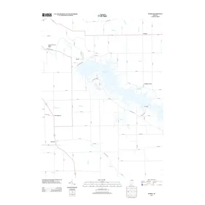
2013 Map of Peoria
USGS Topo · Published 2013About this map
Mississinewa Lake dominates this central Indiana landscape, a sprawling reservoir created by the Mississinewa Dam that reshaped the local topography. Along the northern banks of the Mississinewa River, the striking Cliffs of the Seven Double Pillars stand as a prominent landmark just west of the small settlement of Peoria. The map captures a transition between the hydraulic engineering of the reservoir and the traditional agricultural grid of Miami County, where small communities like New Santa Fe and Santa Fe are linked by rural routes such as the S Frances Slocum Trl. Local history is preserved in the names of drainage systems like Unger Ditch and the winding course of Pipe Cr, while the presence of S Bond Cemetery Rd provides a specific point of interest for genealogists tracing family roots in this river valley region.
Find a feature on this map
83 named features on this map. Tap any name to fly to it.
Don’t see what you’re looking for? This feature index may not catch every label — zoom into the map to look around manually.
Map Details
Editions of this 2013 Peoria Map
This is the sole edition of this map. No revisions or reprints were ever made.
Other maps of this area

1951 · Peru
USGS Topo · 1:24,000

1951 · Bunker Hill
USGS Topo · 1:24,000

1951 · Richvalley
USGS Topo · 1:24,000

1952 · Wabash
USGS Topo · 1:24,000

1953 · Somerset
USGS Topo · 1:24,000

1953 · Peoria
USGS Topo · 1:24,000

1953 · Danville
USGS Topo · 1:250,000

1953 · Muncie
USGS Topo · 1:250,000

1955 · Danville
USGS Topo · 1:250,000

1956 · Muncie
USGS Topo · 1:250,000