Old Maps of Waveland, Indiana for Genealogy
Trace your family roots with 18 historic maps of Waveland. These high-res maps reveal old neighborhoods, homesites, landmarks, and streets — helping you uncover where your ancestors lived and how the area evolved over time.
- Explore historic neighborhoods: Identify where your relatives may have lived in the 1800s or 1900s.
- Compare maps over time: Trace the changes in streets, buildings, and landmarks for multi-generational research.
- Perfect for genealogy & ancestry research: Used by family historians and researchers to map out lineage and migration.
These maps are an incredible resource for exploring your personal connection to Waveland's past.
Waveland, IN maps
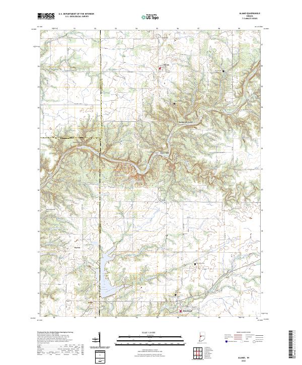
(18)- 1949 Map of Alamo
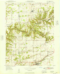 1949 Alamo1949 Print · USGSThe rugged valleys of Montgomery and Parke counties are documented here in the late 1940s, just as the area's natural landmarks gained prominence. Researchers can locate long-standing rural institutions like Liberty Sch, Freedom Ch, and the old grounds of Deer Mill.
 - 1953 Map of Indianapolis, 1965 Print
 1953 Indianapolis1965 Print · USGSCentral Indiana and the Illinois borderlands are captured in the mid-sixties, showing the growth of Indianapolis and its industrial rail corridors. Genealogists and historians can trace the development of outlying towns like Zionsville or Beech Grove and find landmarks such as Atterbury AAF and Turkey Run State Park.4 unique versions available
 - 1956 Map of Indianapolis
 1956 Indianapolis1956 Print · USGSCentral Indiana in the mid-fifties is captured during a period of industrial growth and military presence. Genealogists and historians can trace the rail networks of the New York Central or locate regional landmarks like Fort Benjamin Harrison and Camp Atterbury.
 - 1957 Map of Indianapolis
 1957 Indianapolis1957 Print · USGSCentral Indiana in the mid-fifties is captured here as a crossroads of major rail lines and nascent federal highways. Genealogists and historians can trace family-named ridges like Poplar Ridge or locate strategic sites like Camp Atterbury and Speedway.2 unique versions available
 - 1961 Map of Alamo, 1962 Print
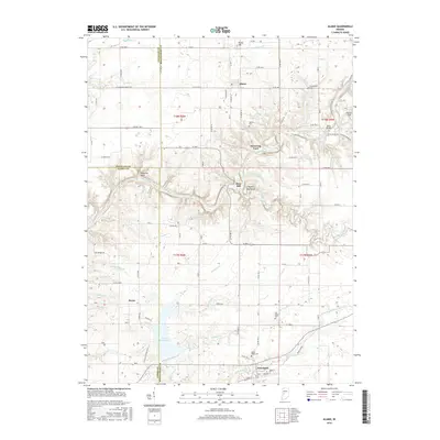
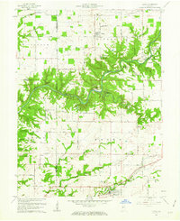 1961 Alamo1962 Print · USGSThe rural landscape of Montgomery County during the early sixties is dominated by the winding path of Sugar Creek and the southern edge of Shades State Park. Researchers can find fascinating relics of local history, from the Deer Mill and its Covered Bridge to the Pennsylvania rail line serving Waveland.3 unique versions available
 - 1962 Map of Indianapolis
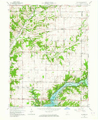
 1962 Indianapolis1962 Print · USGSCentral Indiana and the Illinois borderlands are captured here in the early sixties, showing the region's dense rail networks and growing urban centers. Genealogists and historians can locate family-named landmarks and institutions like Crown Hill Cem, Indiana University, and the Indianapolis Motor Speedway.
 - 1963 Map of Bellmore, 1964 Print
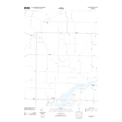
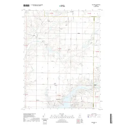
 1963 Bellmore1964 Print · USGSEastern Parke County is captured here just as the landscape was transforming with the completion of the Mansfield Reservoir. Researchers can trace old family burial grounds like Lough Cem or follow the rail lines through Guion and Milligan.3 unique versions available
 - 1986 Map of Paris
 1986 Paris1986 Print · USGSThe Illinois-Indiana borderlands thrive in the mid-1980s as a hub of river-side industry and fertile farmland. Genealogists and historians can trace rail-centered settlements like Chrisman and Metcalf, or locate family sites at the Quaker Cem and Bethel Ch.2 unique versions available
 - 2010 Map of Alamo, 2010 Print
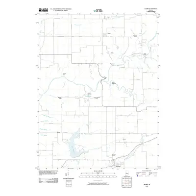 2010 Alamo2010 Print · USGSCovers Waveland, including Alamo, Byron, and other nearby areas
 - 2010 Map of Bellmore, 2010 Print
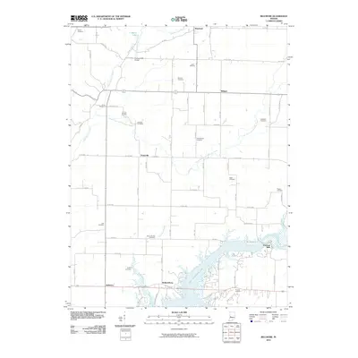 2010 Bellmore2010 Print · USGSCovers Waveland, including Milligan, Hollandsburg, and other nearby areas
 - 2013 Map of Bellmore, 2013 Print
 2013 Bellmore2013 Print · USGSCovers Waveland, including Milligan, Hollandsburg, and other nearby areas
 - 2013 Map of Alamo, 2013 Print
 2013 Alamo2013 Print · USGSCovers Waveland, including Alamo, Byron, and other nearby areas
 - 2016 Map of Alamo, 2016 Print
 2016 Alamo2016 Print · USGSCovers Waveland, including Alamo, Byron, and other nearby areas
 - 2016 Map of Bellmore, 2016 Print
 2016 Bellmore2016 Print · USGSCovers Waveland, including Milligan, Hollandsburg, and other nearby areas
 - 2019 Map of Alamo, 2019 Print
 2019 Alamo2019 Print · USGSCovers Waveland, including Alamo, Byron, and other nearby areas
 - 2019 Map of Bellmore, 2019 Print
 2019 Bellmore2019 Print · USGSCovers Waveland, including Milligan, Hollandsburg, and other nearby areas
 - 2022 Map of Alamo, 2022 Print
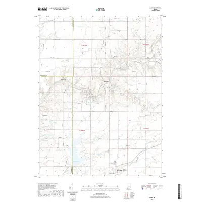
 2022 Alamo2022 Print · USGSAlamo and the surrounding creek valleys of Montgomery County are documented here in the early 2020s. Researchers can locate family sites at Maple Ridge Cemetery or trace historical landmarks like Deer Mill and Sycamore Ford along the banks of Sugar Creek.
 - 2022 Map of Bellmore, 2022 Print
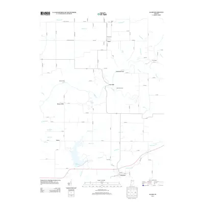
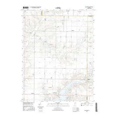
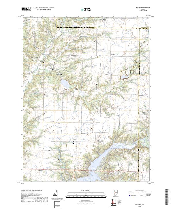 2022 Bellmore2022 Print · USGSThe borderlands of Parke and Putnam counties are documented here in recent years, centered on the waters of Cecil M Harden Lake. Researchers can trace local history through a high density of rural burial sites like Seybold Cem and Bruin Cem, alongside settlements like Portland Mills and Hollandsburg.
End of results
Showing maps 1-18 of 18
Top cities near Waveland
- Crawfordsville historical maps
- Greencastle historical maps
- Rockville historical maps
- Veedersburg historical maps
- Waynetown historical maps
- New Market historical maps
See more
Frequently asked questions
- What are the different types of historical maps available for Waveland?
- What is the oldest map of Waveland?
- Where can I purchase historical maps of Waveland for my home or office?
- Where can I download high-res historical maps of Waveland?
- Are there historical topographic maps available for Waveland?
- Is there historical aerial imagery available for Waveland?
- Where are historical maps of Waveland sourced from?