1900s (20th Century) Maps of Newton County, Indiana
Explore 33 historic maps of Newton County from the 1900s (20th Century). These maps offer a rare glimpse into what life looked like during the 1900s — showing old roads, neighborhoods, homes, and landmarks that have changed or disappeared over time.
Whether you're researching your family's past, planning a metal detecting trip, or studying how Newton County's landscape evolved across the 1900s, these high-resolution maps are a powerful tool for exploring the history of this region.
- Focus on a specific era: All maps on this page are from the 1900s, giving you a focused view of this time period.
- See what’s changed: Compare century-old streets, trails, and buildings to today's modern landscape using overlays and satellite layers.
- Research with precision: Use these maps for genealogy, historical research, land use analysis, or educational projects.
- View, download, or print: Maps are fully viewable online in high resolution, and can be downloaded or printed for your own records.
Start exploring Newton County's history through authentic maps from the 1900s. This is your window into the past.
Newton County, IN maps
(33)- 1922 Map of Momence, 1958 Print
 1922 Momence1958 Print · USGSThe Kankakee River valley in the early twenties is a landscape of river islands and busy rail junctions. Genealogists and historians can locate dozens of country schools like Frogtown School and Searls School or trace the Illinois-Indiana border at Illinoi.
 - 1924 Map of Momence
 1924 Momence1924 Print · USGSEastern Illinois and the Indiana borderlands are captured here during the 1920s, showing a landscape defined by the Kankakee River and a web of rail lines. Researchers can trace dozens of legacy district schools like Frogtown School and locate family landmarks in Momence, St Anne, and Grant Park.2 unique versions available
 - 1935 Map of Watseka
 1935 Watseka1935 Print · USGSIroquois County in the mid-1930s is a landscape of thriving rail-side villages and rural school districts connected by a dense rail network. Researchers can trace family history through dozens of landmarks like Independence Sch, Mt Taber Ch, and St Joseph Cem.
 - 1938 Map of Milford
 1938 Milford1938 Print · USGSIroquois County at the end of the Depression era is a landscape of thriving rail towns and numerous one-room schoolhouses. Researchers can locate nearly thirty distinct rural schools like White College Sch and Fidelity Sch, along with family burial grounds such as Belmont Cem.
 - 1939 Map of Watseka
 1939 Watseka1939 Print · USGSIroquois County and the Illinois-Indiana borderlands are captured here during the mid-1930s as a thriving rail and agricultural corridor. Researchers can trace dozens of country schools like Weygandt Sch, small communities like Beaverville, and the grounds of the County Farm.2 unique versions available
 - 1944 Map of Milford
 1944 Milford1944 Print · USGSIroquois County at the close of the second World War is a landscape defined by rail junctions and rural schoolhouses. Genealogists can trace family roots through numerous sites like Sugar Creek Chapel, Belmont Cem, and early schools including White College Sch.2 unique versions available
 - 1953 Map of Chicago, 1964 Print
 1953 Chicago1964 Print · USGSThe southern Lake Michigan shoreline was rapidly modernizing in the mid-fifties, balancing heavy industry with its famous academic centers. Researchers can trace the footprints of Notre Dame University or locate vanished sites like the Kingsbury Ordnance Plant and Meigs Field.5 unique versions available
 - 1953 Map of Danville, 1965 Print
 1953 Danville1965 Print · USGSIndiana and Illinois crossroads come to life in this mid-century survey as the interstate era begins to reshape the river-and-rail landscape. Genealogists and collectors can trace the historic paths of the Nickel Plate railroad or locate smaller communities like Veedersburg, Goodland, and Bismarck.3 unique versions available
 - 1955 Map of Danville
 1955 Danville1955 Print · USGSThe Indiana-Illinois borderlands during the mid-fifties reveal a landscape of thriving rail hubs and university towns. Researchers can trace the legacy of Purdue University, the Tippecanoe Battlefield, and the path of the Pennsylvania RR.
 - 1956 Map of Danville
 1956 Danville1956 Print · USGSMid-century Indiana and Illinois are captured here as the river-and-rail economy evolved into the modern highway era. Researchers can trace ancestral roots and old transport lines through Logansport, Battle Ground, and the dams at Lake Shafer.
 - 1957 Map of Chicago
 1957 Chicago1957 Print · USGSThe industrial heartland and southern Great Lakes shoreline are captured here during the peak of mid-century growth. Researchers can trace the massive Gary Steel Works, the grounds of the University of Notre Dame, and the early paths of the Tri-State Tollway.
 - 1959 Map of Schneider, 1960 Print
 1959 Schneider1960 Print · USGSThe Lake and Newton county line comes alive in the late fifties, showing a landscape defined by the drainage of the Kankakee marsh. Trace family roots and local industry at Sanders Cem, the New York Central rail lines, and the Sumava Resorts riverfront.4 unique versions available
 - 1959 Map of Shelby, 1960 Print
 1959 Shelby1960 Print · USGSThe Kankakee River valley at the turn of the 1960s was a landscape defined by rail and reclamation. Researchers can trace the Monon line through Shelby and Thayer or locate local landmarks like the Landing Strip and the Singleton Ditch.2 unique versions available
 - 1959 Map of Momence NE, 1960 Print
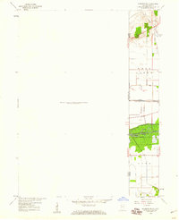 1959 Momence NE1960 Print · USGSThe Illinois-Indiana borderlands appear in the late fifties as a landscape defined by industrial rail and massive drainage projects. Genealogists and historians can trace the New York Central line and search for family roots at West Creek Cem near the banks of West Creek.
 - 1961 Map of Kentland, 1963 Print
 1961 Kentland1963 Print · USGSThe rail intersection at Kentland and the winding Iroquois River define this corner of Newton County during the early sixties. Researchers can find many family landmarks and small community sites like Mt Zion Ch, Dorn Cem, and the County Fairgrounds.2 unique versions available
 - 1961 Map of Mount Ayr, 1964 Print
 1961 Mount Ayr1964 Print · USGSNewton County's agricultural heartland in the early sixties is centered on Mount Ayr and its surrounding drainage networks. Genealogists and historians can locate rural burial grounds like North Star Cem or trace the legacy of the Old Railroad Grade.2 unique versions available
 - 1961 Map of Morocco, 1964 Print
 1961 Morocco1964 Print · USGSNewton County in the early sixties centers on the growth of Morocco and the surrounding farmland. Genealogists can trace family roots at Oakland Cem and Beaver City Cem or locate former homesteads near Beaver Creek.
 - 1962 Map of Wadena, 1963 Print
 1962 Wadena1963 Print · USGSBenton County agriculture and rail transit are captured here in the early sixties as the landscape supported a thriving grain-shipping economy. Researchers can locate the Township Sch in Wadena, the Dehner Cem, and traces of an Old Railroad Grade.2 unique versions available
 - 1962 Map of Goodland, 1964 Print
 1962 Goodland1964 Print · USGSNewton County's agricultural heartland is documented here in the early 1960s, showing the intersection of rail and river life. Researchers can trace family roots at Mt Calvary Cem, find the vanished stop at Percy Junction, or locate the historic layout of Goodland.2 unique versions available
 - 1962 Map of Fair Oaks, 1964 Print
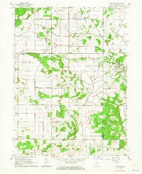 1962 Fair Oaks1964 Print · USGSNewton and Jasper counties are captured here in the early sixties as a highly engineered agricultural landscape. Genealogists and local historians can trace family lands near Fair Oaks, locate the Township Sch, and follow the path of the Monon Railroad.2 unique versions available
 - 1962 Map of Earl Park, 1964 Print
 1962 Earl Park1964 Print · USGSBenton County agriculture and rail transport intersect in the early sixties, centered on the hub of Earl Park. Researchers can trace old family sites and rural infrastructure at Raub, Yeagers Curve, and the St John Cem.2 unique versions available
 - 1962 Map of Enos, 1964 Print
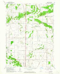 1962 Enos1964 Print · USGSNewton County's agricultural and conservation landscape is revealed in the early sixties as a network of rail and drainage. Researchers can trace the New York Central Railroad through Enos or locate the Beaver Lake Prairie Chicken Refuge.3 unique versions available
 - 1963 Map of Illiana Heights, 1965 Print
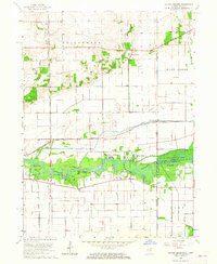 1963 Illiana Heights1965 Print · USGSThe Illinois-Indiana state line comes alive in the early sixties as riverfront life and rail junctions define the Kankakee valley. Genealogists and historians can trace riverside settlements like Garden of Eden, search for family roots at West Creek Cem, or follow the path of the NEW YORK CENTRAL railroad.3 unique versions available
 - 1963 Map of Leesville, 1965 Print
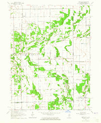 1963 Leesville1965 Print · USGSThe Illinois-Indiana borderland is captured here in the early 1960s, showing a landscape of drainage ditches and remote rural settlements. Genealogists and historians can locate Morgan Cem, the Pembroke Sch, and small community centers like Hopkins Park and Leesville.3 unique versions available
 - 1964 Map of Darrow, 1965 Print
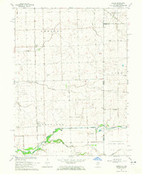 1964 Darrow1965 Print · USGSThe Illinois-Indiana borderlands are captured here in the mid-1960s, showing the quiet rail-and-river geography of Iroquois County. Researchers can trace the Milwaukee Road through Darrow or locate the Blue Ridge Cem near the state line.2 unique versions available
Showing maps 1-25 of 33
Top cities of Newton County
- Kentland historical maps
- Morocco historical maps
- Goodland historical maps
- Brook historical maps
- Mount Ayr historical maps
Frequently asked questions
- What are the different types of historical maps available for Newton County?
- What is the oldest map of Newton County?
- Where can I purchase historical maps of Newton County for my home or office?
- Where can I download high-res historical maps of Newton County?
- Are there historical topographic maps available for Newton County?
- Is there historical aerial imagery available for Newton County?
- Where are historical maps of Newton County sourced from?