2020s Maps of Newton County, Indiana
Explore 20 historic maps of Newton County from the 2020s. These maps offer a rare glimpse into what life looked like during the 2020s — showing old roads, neighborhoods, homes, and landmarks that have changed or disappeared over time.
Whether you're researching your family's past, planning a metal detecting trip, or studying how Newton County's landscape evolved across the 2020s, these high-resolution maps are a powerful tool for exploring the history of this region.
- Focus on a specific era: All maps on this page are from the 2020s, giving you a focused view of this time period.
- See what’s changed: Compare century-old streets, trails, and buildings to today's modern landscape using overlays and satellite layers.
- Research with precision: Use these maps for genealogy, historical research, land use analysis, or educational projects.
- View, download, or print: Maps are fully viewable online in high resolution, and can be downloaded or printed for your own records.
Start exploring Newton County's history through authentic maps from the 2020s. This is your window into the past.
Newton County, IN maps
(20)- 2021 Map of Illiana Heights, 2021 Print
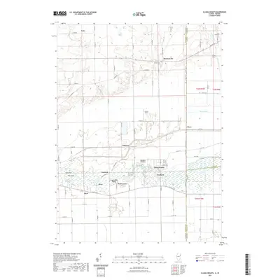 2021 Illiana Heights2021 Print · USGSCovers Newton County, including Grant Park, Shadow Lawn, and other nearby areas
 - 2021 Map of Donovan, 2021 Print
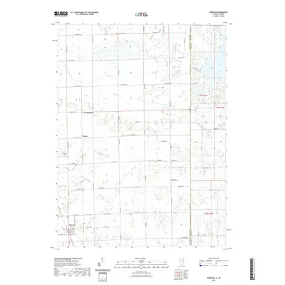 2021 Donovan2021 Print · USGSCovers Newton County, including Donovan, North Hooper, and other nearby areas
 - 2021 Map of Sheldon, 2021 Print
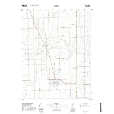 2021 Sheldon2021 Print · USGSCovers Newton County, including Sheldon, Iroquois, and other nearby areas
 - 2021 Map of Darrow, 2021 Print
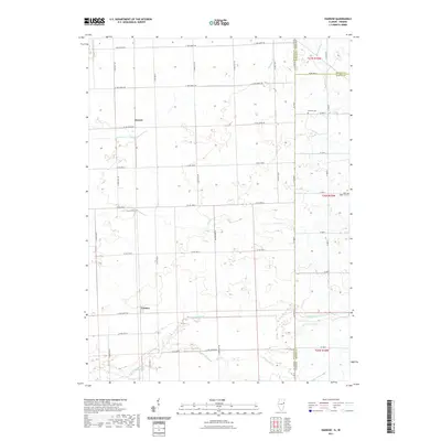 2021 Darrow2021 Print · USGSCovers Newton County, including Darrow, Cutmer, and other nearby areas
 - 2021 Map of Leesville, 2021 Print
 2021 Leesville2021 Print · USGSCovers Newton County, including Hopkins Park, Kankakee County, and other nearby areas
 - 2022 Map of Enos, 2022 Print
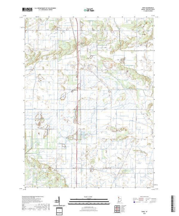 2022 Enos2022 Print · USGSNewton County's agricultural and conservation history unfolds across this recent survey of the Indiana prairie. Researchers can trace the legacy of water management through Bogus Island Ditch and follow historic routes like Old Chicago Rd near Enos.
 - 2022 Map of Earl Park, 2022 Print
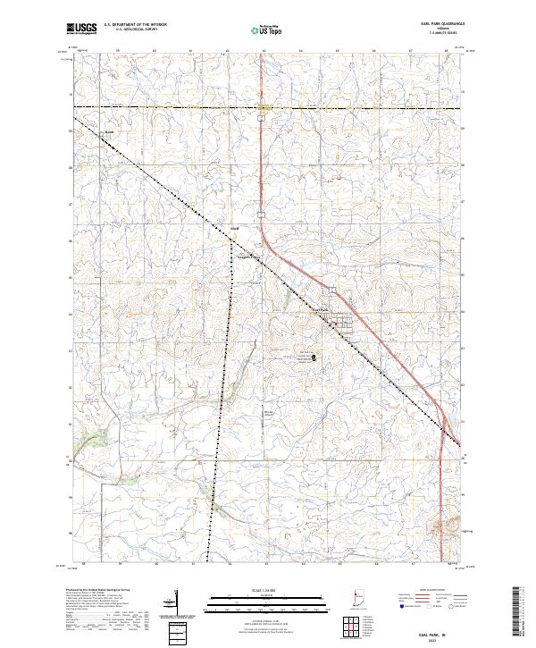 2022 Earl Park2022 Print · USGSBenton County's agricultural heartland is documented here in the early twenty-first century, showing a landscape shaped by rail and water. Researchers can locate family sites near Earl Park Cem, the small community of Raub, or the rural airfield at Rheude Airport.
 - 2022 Map of Goodland, 2022 Print
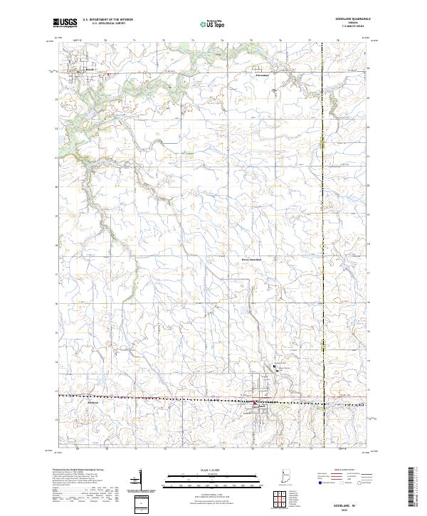 2022 Goodland2022 Print · USGSNewton County's agricultural heartland is captured here in the early 2020s, showing a landscape defined by the Iroquois River and an intricate drainage network. Trace local genealogy and history through landmarks like Mount Calvary Cem, Goodland, and the rail junction at Percy Junction.
 - 2022 Map of Kentland, 2022 Print
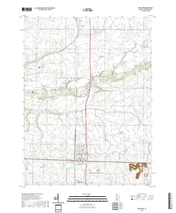 2022 Kentland2022 Print · USGSKentland and the surrounding plains of Newton County are shown in the early twenty-first century, anchored by the Newton County Courthouse. Genealogists and local historians can trace family plots at Saint Josephs Cem or Fairlawn Cem and follow the intricate path of the Iroquois River.
 - 2022 Map of Mount Ayr, 2022 Print
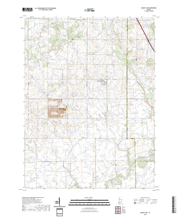 2022 Mount Ayr2022 Print · USGSThe rural landscape around the town of Mount Ayr is captured here in the early twenty-first century, showing the engineered drainage of the Indiana prairie. Family history researchers can locate Burr Oak Cem, Kennedy Cem, and the path of the Iroquois River.
 - 2022 Map of Wadena, 2022 Print
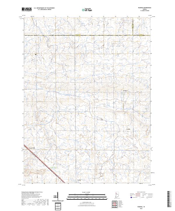 2022 Wadena2022 Print · USGSBenton County farmland is captured here in the modern era, showing the intersection of rural agriculture and traditional crossroads. Genealogists and local historians can trace family land near Lochiel, the Dehner Cem, or the small community of Wadena.
 - 2022 Map of Morocco, 2022 Print
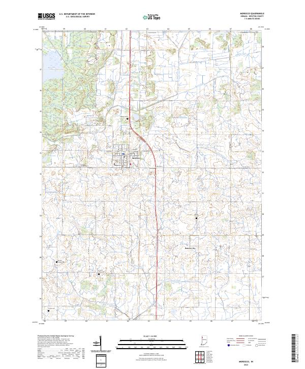 2022 Morocco2022 Print · USGSNewton County at the start of the 2020s shows a landscape defined by its agricultural roots and complex drainage history. Genealogists can locate several local burial sites like Oakland Cem and Prairie Vine Cem near the town of Morocco.
 - 2022 Map of Shelby, 2022 Print
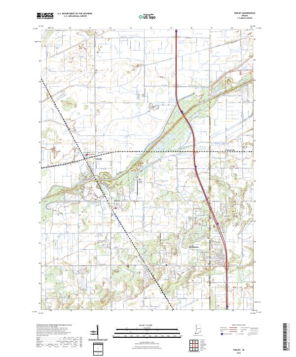 2022 Shelby2022 Print · USGSThe Kankakee River lowlands of Lake and Newton counties appear here in the early twenty-first century, showing a landscape defined by industrial-scale drainage and small-town roots. Researchers can trace the layout of Shelby, locate the Roselawn Cem, or follow the path of the historic Monon Rd.
 - 2022 Map of Schneider, 2022 Print
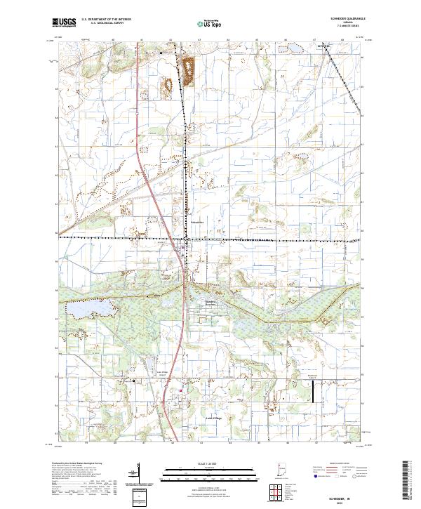 2022 Schneider2022 Print · USGSNorthwest Indiana's marshy lowlands are mapped here in the early 2020s, showing the intersection of agricultural engineering and rural settlement. Genealogists can locate Sanders Cem and Lake Village Cem among the many drainage works like Singleton Ditch.
 - 2022 Map of Fair Oaks, 2022 Print
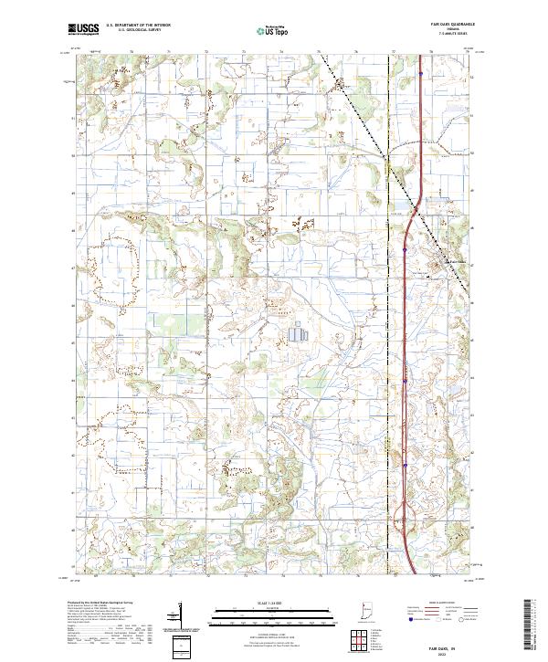 2022 Fair Oaks2022 Print · USGSNewton and Jasper Counties appear in the early 2020s as a landscape defined by its intricate drainage networks and rural settlements. Researchers can trace the legacy of land reclamation through features like Beaver Lake Ditch, Fair Oaks Cemetery, and Fair Oaks.
 - 2024 Map of Leesville, 2024 Print
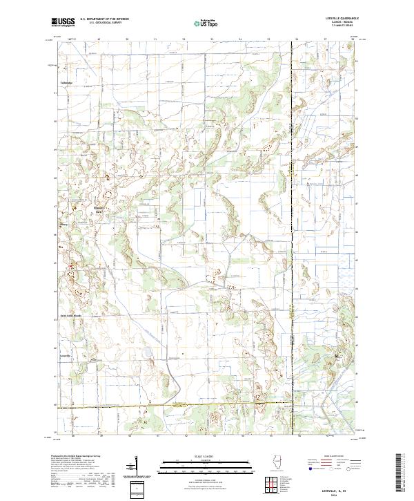 2024 Leesville2024 Print · USGSThe Illinois and Indiana state line meets in this rural landscape during the early 2020s. Genealogists and local historians can trace small communities like Hopkins Park and Leesville or locate the historic Morgan Cem.
 - 2024 Map of Donovan, 2024 Print
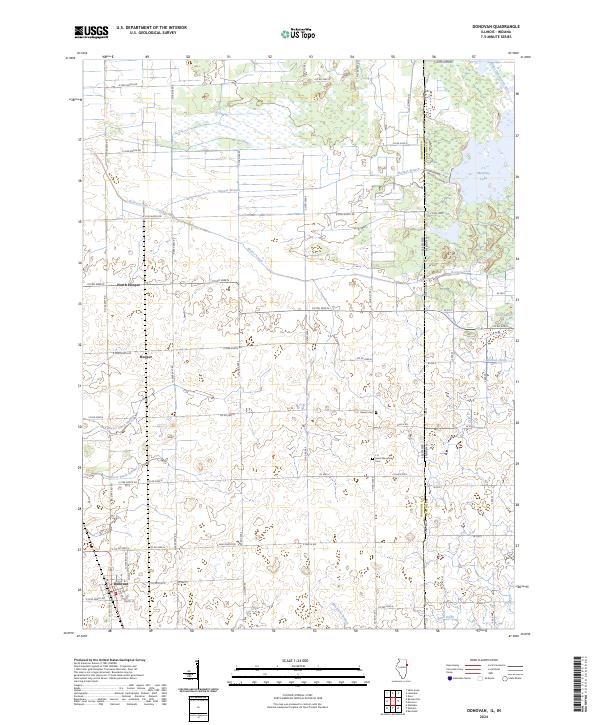 2024 Donovan2024 Print · USGSIroquois County farmland meets the Indiana border in this recent survey of a landscape defined by its prairie drainage systems. Genealogists can trace family sites near Donovan or locate the Beaver Cem and J H Grant Memorial Cem.
 - 2024 Map of Darrow, 2024 Print
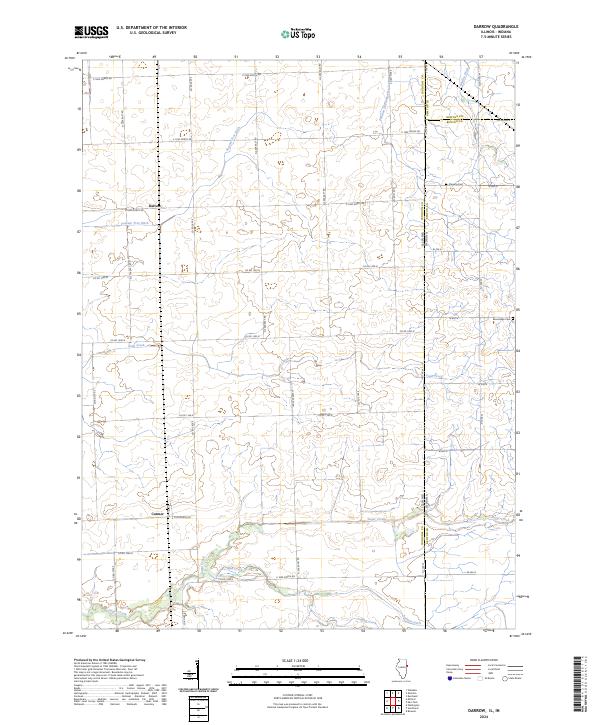 2024 Darrow2024 Print · USGSCrossing the Illinois and Indiana border in the modern day, this area preserves its deep-rooted agricultural character. Researchers can find family landmarks like Fleming Cem and Blue Ridge Cem near the settlements of Darrow and Cutmer.
 - 2024 Map of Sheldon, 2024 Print
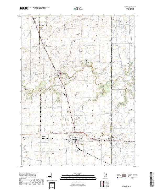 2024 Sheldon2024 Print · USGSThe Illinois-Indiana borderlands appear in detail in this recent survey, capturing the agricultural heart of Iroquois County. Genealogists and researchers can trace local family landmarks such as Gaffield Cem, the village of Sheldon, and the rural crossing at Effner.
 - 2024 Map of Illiana Heights, 2024 Print
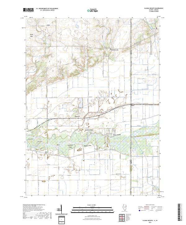 2024 Illiana Heights2024 Print · USGSThe Illinois-Indiana borderlands come into focus in this contemporary survey of the rural corridor between Kankakee and Lake counties. Researchers can trace the riverfront clusters of Illiana Heights and Garden of Eden or locate local landmarks like Sherburnville Cem and the Lowell Airport.
End of results
Showing maps 1-20 of 20
Top cities of Newton County
- Kentland historical maps
- Morocco historical maps
- Goodland historical maps
- Brook historical maps
- Mount Ayr historical maps
Frequently asked questions
- What are the different types of historical maps available for Newton County?
- What is the oldest map of Newton County?
- Where can I purchase historical maps of Newton County for my home or office?
- Where can I download high-res historical maps of Newton County?
- Are there historical topographic maps available for Newton County?
- Is there historical aerial imagery available for Newton County?
- Where are historical maps of Newton County sourced from?