2020s Maps of Perry County, Indiana
Explore 15 historic maps of Perry County from the 2020s. These maps offer a rare glimpse into what life looked like during the 2020s — showing old roads, neighborhoods, homes, and landmarks that have changed or disappeared over time.
Whether you're researching your family's past, planning a metal detecting trip, or studying how Perry County's landscape evolved across the 2020s, these high-resolution maps are a powerful tool for exploring the history of this region.
- Focus on a specific era: All maps on this page are from the 2020s, giving you a focused view of this time period.
- See what’s changed: Compare century-old streets, trails, and buildings to today's modern landscape using overlays and satellite layers.
- Research with precision: Use these maps for genealogy, historical research, land use analysis, or educational projects.
- View, download, or print: Maps are fully viewable online in high resolution, and can be downloaded or printed for your own records.
Start exploring Perry County's history through authentic maps from the 2020s. This is your window into the past.
Perry County, IN maps
(15)- 2022 Map of Tell City, 2022 Print
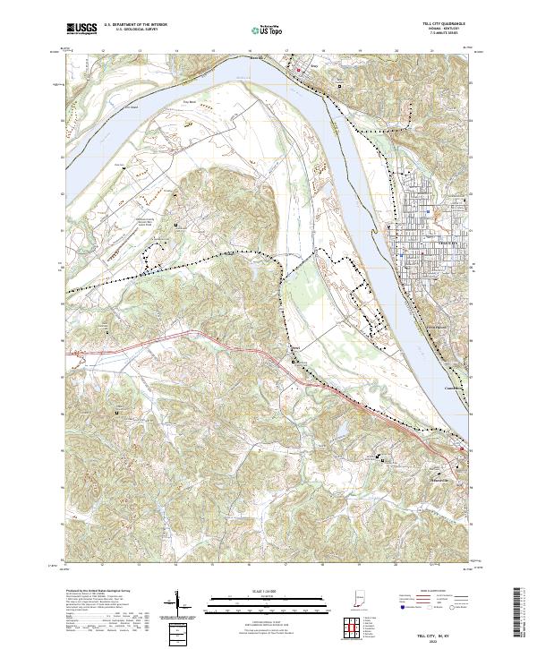 2022 Tell City2022 Print · USGSThe Ohio River borderlands between Indiana and Kentucky are showcased here at the turn of the decade. Genealogists can trace family sites like Mount Calvary Cem and Ayres Cem near Tell City and Hawesville.
 - 2022 Map of Rome, 2022 Print
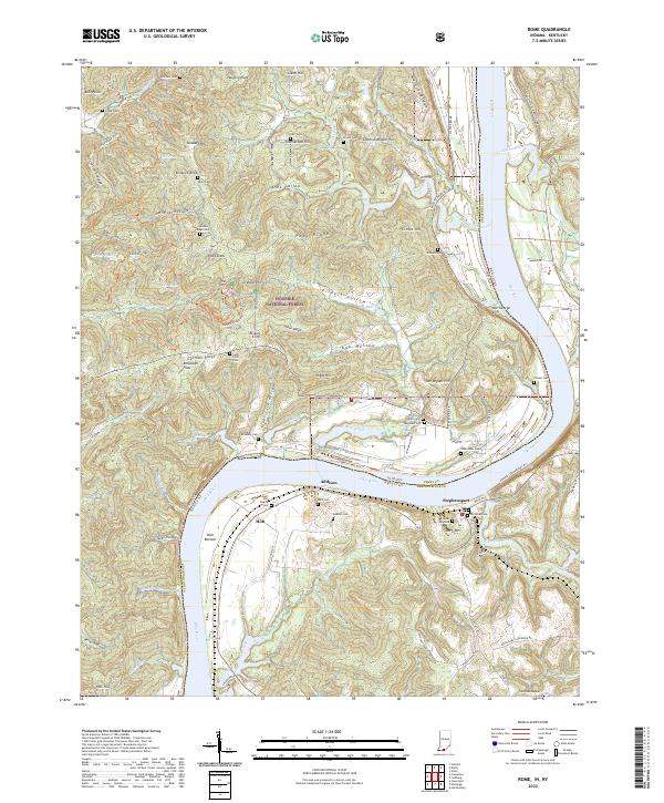 2022 Rome2022 Print · USGSThe Ohio River borderlands of Perry County and BreckINRidge County are captured here in a landscape of deep hollows and high bluffs. Local researchers can trace family names at the Holt Family Cem or explore the riverfront settlements of Stephensport and Addison.
 - 2022 Map of Saint Meinrad, 2022 Print
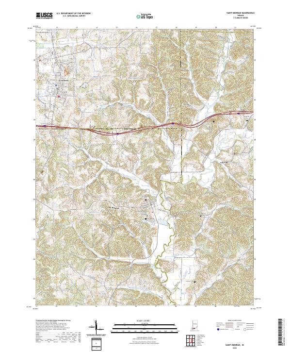 2022 Saint Meinrad2022 Print · USGSSouthern Indiana's monastic and rural heritage is preserved here in this recent survey of the Dubois, Spencer, and Perry county borders. Genealogists and historians can locate family landmarks like Saint Meinrad Archabbey Cem and trace the paths of Blackhawk Cr through St. Meinrad.
 - 2022 Map of Fulda, 2022 Print
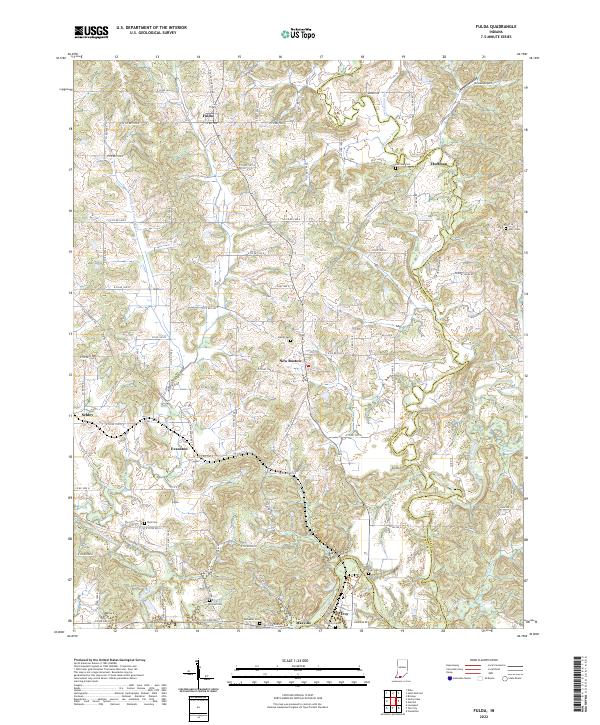 2022 Fulda2022 Print · USGSSpencer and Perry counties at the start of the 2020s remain defined by their river valleys and deep-rooted family settlements. Genealogists can trace local lineages through numerous burial sites like Butler Cem and Rust Cem or locate the quiet crossroads of Schley and Huffman.
 - 2022 Map of Gatchel, 2022 Print
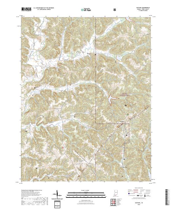 2022 Gatchel2022 Print · USGSSouthern Indiana's forested uplands are shown in this contemporary study of the Gatchel area. Researchers can trace family history through a high density of rural burial grounds, including Saint Johns Cem, Hicks Cem, and Hammack Cem.
 - 2022 Map of Alton, 2022 Print
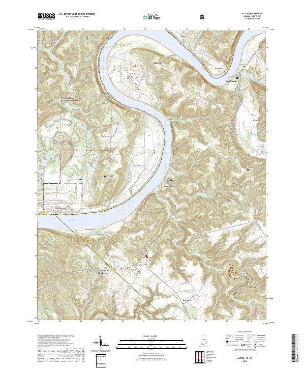 2022 Alton2022 Print · USGSThe Ohio River oxbow dominates this landscape at the Indiana-Kentucky border, where riverfront hamlets and upland forests meet. Researchers can trace family history through sites like Saint Theresa Cem and the Flannery Family Cem or explore the terrain of Jarbo Sinks and Little Bend.
 - 2022 Map of Derby, 2022 Print
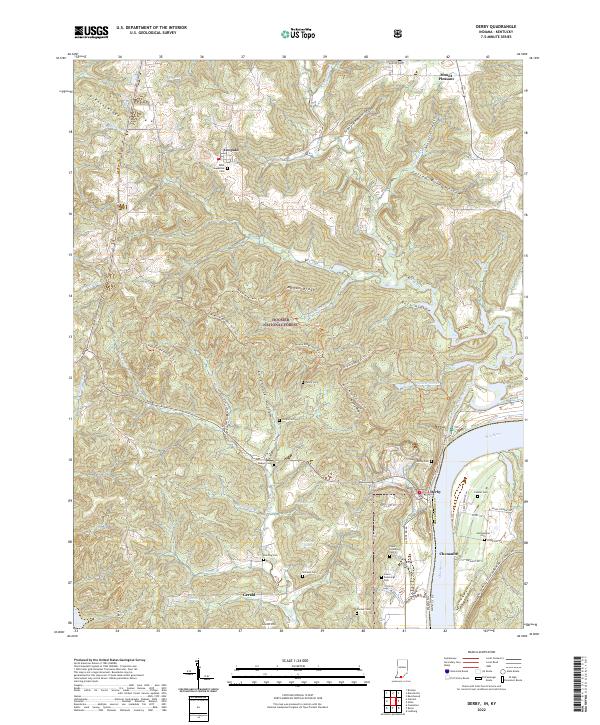 2022 Derby2022 Print · USGSThe Ohio River shoreline and the deep woods of the Hoosier National Forest meet in this modern survey of the Indiana-Kentucky border. Genealogists can trace family names through numerous remote sites like Saint Augustine Cem, Horton Cem, and the riverfront settlement of Derby.
 - 2022 Map of Beechwood, 2022 Print
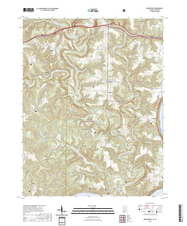 2022 Beechwood2022 Print · USGSCrawford County and the forest lands of southern Indiana are shown here just as the new decade began. Researchers can trace numerous family burial grounds like Bloom Riddle Cem and Wiseman Cem or locate the riverside settlement of Fredonia.
 - 2022 Map of Bristow, 2022 Print
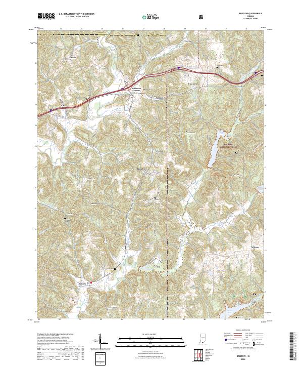 2022 Bristow2022 Print · USGSPerry County's rural character is on full display in the early 2020s, showing the enduring small settlements and forest lands of southern Indiana. Researchers can locate family landmarks like Beard Cem and trace the paths of the Middle Fork Anderson River near Bristow.
 - 2022 Map of Taswell, 2022 Print
 2022 Taswell2022 Print · USGSCrawford County's wooded ridges and small crossroads settlements are captured here in the early twenty-first century. Genealogists and local historians can locate many rural burial sites, including Eckerty Cemetery and Bethany Union Cemetery, alongside landmarks like Hemlock Cliffs and Doolittle Mills.
 - 2022 Map of Birdseye, 2022 Print
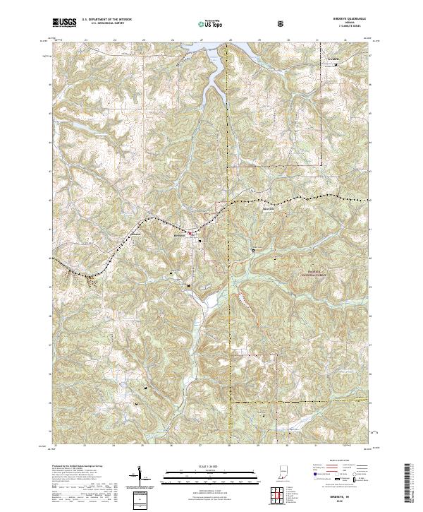 2022 Birdseye2022 Print · USGSSouthern Indiana's forested hills and the headwaters of the Anderson River define this area as it appeared in the early 2020s. Genealogists and local historians can trace legacy sites like Birdseye Cem, Blunk Cem, and the small community of Wickliffe.
 - 2022 Map of Branchville, 2022 Print
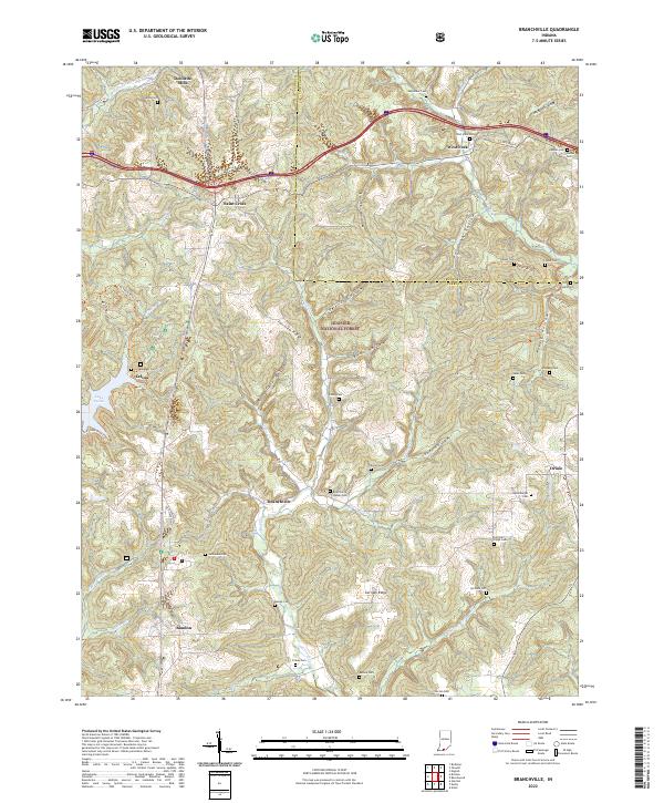 2022 Branchville2022 Print · USGSSouthern Indiana's forested ridges and hollows are captured here as they appeared in 2022, centering on the rural communities of Perry and Crawford counties. Genealogists can locate numerous small burial sites like Luxemburger Cem and Keysacker Cem alongside the historic Doolittle Mills.
 - 2022 Map of Cannelton, 2022 Print
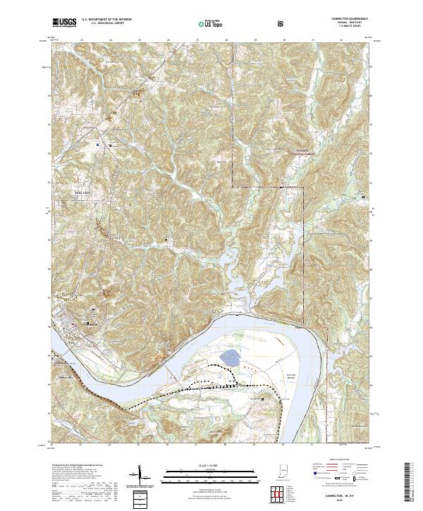 2022 Cannelton2022 Print · USGSThe riverfront towns of Cannelton and Tell City are captured here at the edge of the Hoosier National Forest. Family historians can trace numerous rural burial grounds like Log Church Cem and Powell Cem among the ridges of Coontail Ridge and Goosetown Ridge.
 - 2022 Map of Cloverport, 2022 Print
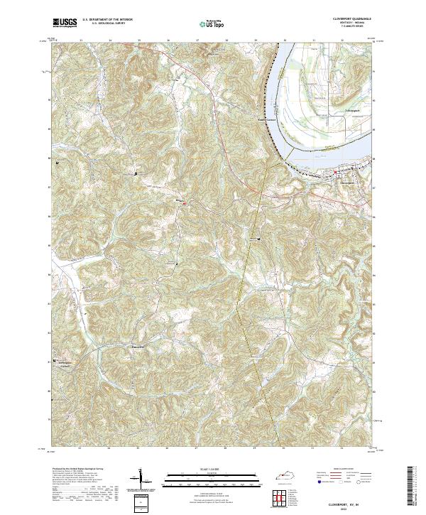 2022 Cloverport2022 Print · USGSThe Ohio River borderlands between Kentucky and Indiana are captured here as they appeared in the early 2020s. Genealogists can locate several rural burial sites, including Old Saint Rose Cem and Parson Easton Cem, near the settlement of Dukes.
 - 2022 Map of Mattingly, 2022 Print
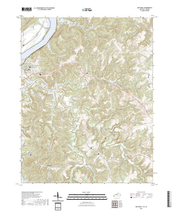 2022 Mattingly2022 Print · USGSBreckinridge County, Kentucky, at the bend of the Ohio River, shows a landscape defined by deep creek valleys and rural homesteads. Genealogists can trace family names through numerous burial sites like Murray Cemetery, Pate Cemetery, and Lamb Cemetery.
End of results
Showing maps 1-15 of 15
Top cities of Perry County
Frequently asked questions
- What are the different types of historical maps available for Perry County?
- What is the oldest map of Perry County?
- Where can I purchase historical maps of Perry County for my home or office?
- Where can I download high-res historical maps of Perry County?
- Are there historical topographic maps available for Perry County?
- Is there historical aerial imagery available for Perry County?
- Where are historical maps of Perry County sourced from?