Old Maps of Porter County, Indiana for Hiking & Exploration
Hike through history with 124 historic maps of Porter County. Explore old trails, ghost towns, and forgotten backroads — perfect for outdoor adventurers and local explorers.
- Rediscover forgotten places: Map out old mining camps, roads, and footpaths that no longer exist on modern maps.
- Layer with modern tools: Combine with LiDAR or satellite views to plan hikes through historical terrain.
- Made for exploration: Popular among hikers, overlanders, and local history lovers.
Use these maps to find adventure and explore the hidden past of Porter County.
Porter County, IN maps
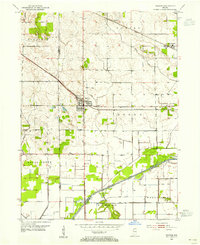
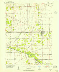
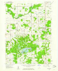
(124)- 1934 Map of Porter
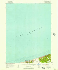
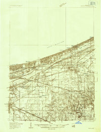 1934 Porter1934 Print · USGSThe Indiana shoreline of the mid-1930s is mapped here in detail, from the sands of Indiana Dunes State Park to the rail hubs of Chesterton. Trace local family history through sites like the Seven Dolors Shrine, Liberty Center Sch, and the Mc Cool Emergency Landing Field.
 - 1940 Map of Porter
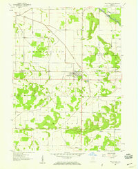
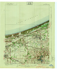 1940 Porter1940 Print · USGSPorter County's industrial and shoreline heritage is captured here in the years before World War II. Researchers can locate early lakefront settlements like Baillytown or trace the routes of the Wabash and Pere Marquette railroads past Tratebas Mill.3 unique versions available
 - 1953 Map of Palmer, 1955 Print
 1953 Palmer1955 Print · USGSPorter County's agricultural heartland is captured here in the early fifties, showing a rural landscape dominated by massive rail corridors and the Lincoln Highway. Genealogists can locate family landmarks like Betz Cem and Ludington Cem or trace the early development around Lake Eliza and Palmer.
 - 1953 Map of Wanatah, 1955 Print
 1953 Wanatah1955 Print · USGSIn the early 1950s, this area of Indiana was a bustling rail corridor where several major lines converged at Wanatah. Trace the path of the Lincoln Highway and find rural landmarks like Luther Cem and Haskells.
 - 1953 Map of Hebron, 1955 Print
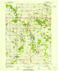
 1953 Hebron1955 Print · USGSPorter County in the early 1950s is defined by its rail-linked small towns and the managed waters of the Kankakee basin. Genealogists and local historians can trace the early layout of Hebron, explore rural Boone Grove, or locate family sites at Hebron Cem.
 - 1953 Map of Garyton, 1955 Print
 1953 Garyton1955 Print · USGSNorthwest Indiana's dunes and rail corridors are captured here during the mid-fifties industrial boom. Researchers can trace historic family burial sites at Calvary Cemetery and Jaynes Cem or locate early community hubs like the Seven Dolors Shrine and Portage Central Sch.
 - 1953 Map of Westville, 1955 Print
 1953 Westville1955 Print · USGSLaPorte and Porter counties in the early fifties show a landscape defined by industrial rail corridors and institutional development. Researchers can trace the sprawling grounds of Beatty Memorial Hospital and old pioneer sites like Quakerdom Cem or Eight Square Cem.
 - 1953 Map of Valparaiso, 1955 Print
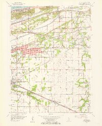
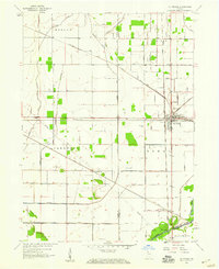
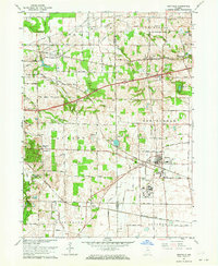
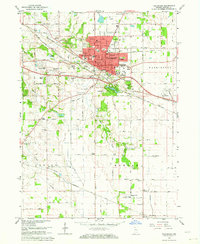
 1953 Valparaiso1955 Print · USGSValparaiso and the surrounding Porter County townships are captured here in the mid-fifties, during a period of steady institutional and rural growth. Genealogists and local historians can trace family plots at Adam Cem, locate the old Morgan Sch, or follow the historic Lincoln Highway through town.
 - 1953 Map of Ogden Dunes, 1955 Print
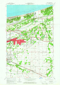
 1953 Ogden Dunes1955 Print · USGSThe southern shoreline of Indiana appears in the early fifties as the lakefront community of Ogden Dunes begins to take shape. Researchers can trace the original landscape including the Flowing Well, early residential streets, and the nearby Burns Ditch.2 unique versions available
 - 1953 Map of Chesterton, 1955 Print
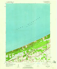
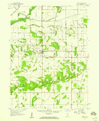
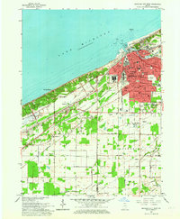
 1953 Chesterton1955 Print · USGSPorter County's industrial and recreational landscape is captured here in the mid-fifties, centered on the busy rail junctions of Chesterton and Porter. Researchers can trace historic family burial sites at Gossett Cemetery and follow the old milling operations at Tratabas Mill.
 - 1953 Map of Dune Acres, 1955 Print
 1953 Dune Acres1955 Print · USGSThe Indiana shoreline during the early fifties reveals a landscape where conservation at Indiana Dunes State Park meets a dense rail corridor. Genealogists and researchers can locate Burstrom Cem, Bailey Cem, and the early footprints of Dune Acres and Baileytown.2 unique versions available
 - 1953 Map of Michigan City West, 1955 Print
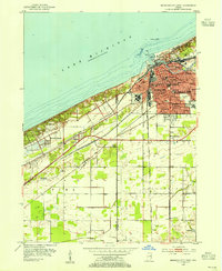 1953 Michigan City West1955 Print · USGSMichigan City and the Indiana shoreline appear in the early fifties as a bustling hub of rail and industry. Trace the footprints of civic life at State Prison, Greenwood Cemetery, and the Bayles Sch (Abandoned) while exploring the dunes.
 - 1953 Map of Kouts, 1955 Print
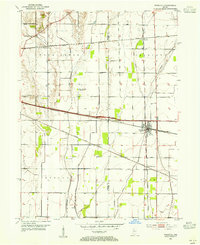
 1953 Kouts1955 Print · USGSSouthern Porter County is captured here in the mid-1950s as a bustling rail junction and engineered agricultural landscape. Genealogists and rail historians can trace the crossing of the Erie and Pennsylvania lines near Kouts and locate several rural burial grounds like Merriman Cem.
 - 1953 Map of Chicago, 1964 Print
 1953 Chicago1964 Print · USGSThe southern Lake Michigan shoreline was rapidly modernizing in the mid-fifties, balancing heavy industry with its famous academic centers. Researchers can trace the footprints of Notre Dame University or locate vanished sites like the Kingsbury Ordnance Plant and Meigs Field.5 unique versions available
 - 1957 Map of Chicago
 1957 Chicago1957 Print · USGSThe industrial heartland and southern Great Lakes shoreline are captured here during the peak of mid-century growth. Researchers can trace the massive Gary Steel Works, the grounds of the University of Notre Dame, and the early paths of the Tri-State Tollway.
 - 1957 Map of Wheatfield, 1959 Print
 1957 Wheatfield1959 Print · USGSJasper County farmland and the village of Wheatfield are captured here in the late fifties, showcasing a landscape transformed by drainage engineering. Trace the local rail-and-river economy through the New York Central line and features like Kniman Cem and Stoutsburg.2 unique versions available
 - 1957 Map of DeMotte, 1959 Print
 1957 DeMotte1959 Print · USGSJasper County agricultural life in the late fifties is centered around the New York Central rail line. Researchers can trace family-named roads like Bosma and Schatzley or locate early rural hubs such as Demotte, Kniman, and Kersey.3 unique versions available
 - 1958 Map of La Crosse, 1959 Print
 1958 La Crosse1959 Print · USGSLa Crosse was a bustling rail hub in the late fifties, where four major lines intersected amidst the reclaimed marshlands. Genealogists and rail historians can trace the paths of the Monon Railroad and Erie Railroad through early settlements like Clanricarde and Wilders.2 unique versions available
 - 1959 Map of San Pierre, 1961 Print
 1959 San Pierre1961 Print · USGSNorthwest Indiana in the late fifties is defined by managed wetlands and the intersection of major rail lines. Genealogists and historians can trace the rural communities of San Pierre and Tefft, locating the All Saints Cem & Cem and the Township Sch.2 unique versions available
 - 1960 Map of Portage, 1961 Print
 1960 Portage1961 Print · USGSPorter County's lakefront and industrial heartland are captured here during the post-war boom. Genealogists and historians can trace family-named sites like Robbins Cem and Blake Cem or the development of Garyton and Ogden Dunes along the rails.2 unique versions available
 - 1962 Map of Palmer, 1964 Print
 1962 Palmer1964 Print · USGSPorter and Lake Counties are captured here in the early 1960s, showing a landscape of rural crossroads and dense rail networks. Researchers can trace family history through numerous landmarks like Blachly Cem, Salem Ch, and the community at Lake Eliza.3 unique versions available
 - 1962 Map of Westville, 1964 Print
 1962 Westville1964 Print · USGSWestville and the surrounding townships are shown at a peak of rail and institutional development during the early sixties. Genealogists and local historians can trace family roots through the Quakerdom Cem, the Eight-Square Ch, and old stops at Burdick and Coburg.
 - 1962 Map of Michigan City West, 1964 Print
 1962 Michigan City West1964 Print · USGSCoastal life and heavy industry meet along the Indiana dunes in the early sixties. Genealogists and rail historians can trace the paths of the South Shore Line, local schools like Barker Jr High, and the grounds of the State Prison.
 - 1962 Map of Chesterton, 1964 Print
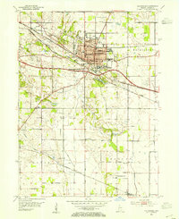
 1962 Chesterton1964 Print · USGSNorthwestern Indiana in the early sixties was a landscape of expanding suburbs and historic rail corridors. Genealogists and local historians can trace family sites at Chesterton Cemetery, Augsburg Ch, and rural outposts like Tratebas Mill or Crocker.4 unique versions available
 - 1962 Map of Valparaiso, 1964 Print
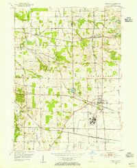
 1962 Valparaiso1964 Print · USGSValparaiso and its surrounding townships in the early sixties show a region transitioning from traditional farmland to modern suburban expansion. Genealogists and historians can trace family locations at Graceland Cemetery or locate old schoolhouses like Morgan Sch and the Shults-Lewis Childrens Home.4 unique versions available
Showing maps 1-25 of 124
Top cities of Porter County
- Portage historical maps
- Valparaiso historical maps
- Chesterton historical maps
- Porter historical maps
- Hebron historical maps
- Kouts historical maps
See more
Frequently asked questions
- What are the different types of historical maps available for Porter County?
- What is the oldest map of Porter County?
- Where can I purchase historical maps of Porter County for my home or office?
- Where can I download high-res historical maps of Porter County?
- Are there historical topographic maps available for Porter County?
- Is there historical aerial imagery available for Porter County?
- Where are historical maps of Porter County sourced from?