Old Maps of New Harmony, Indiana for Hiking & Exploration
Hike through history with 21 historic maps of New Harmony. Explore old trails, ghost towns, and forgotten backroads — perfect for outdoor adventurers and local explorers.
- Rediscover forgotten places: Map out old mining camps, roads, and footpaths that no longer exist on modern maps.
- Layer with modern tools: Combine with LiDAR or satellite views to plan hikes through historical terrain.
- Made for exploration: Popular among hikers, overlanders, and local history lovers.
Use these maps to find adventure and explore the hidden past of New Harmony.
New Harmony, IN maps
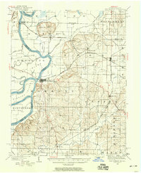
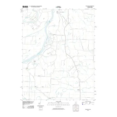
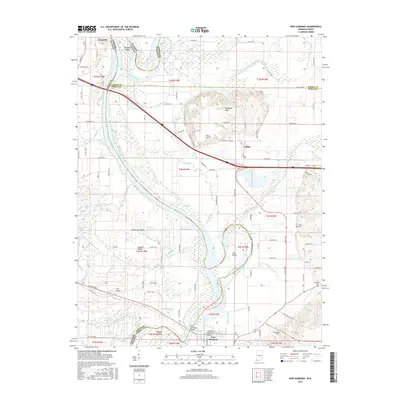
(21)- 1903 Map of New Harmony
 1903 New Harmony1903 Print · USGSPosey County at the opening of the twentieth century was a landscape of thriving river towns and bustling rail junctions. Genealogists and historians can trace the early footprints of New Harmony and Poseyville, or locate vanished locales like Rapture and Solitude.3 unique versions available
 - 1903 Map of Patoka
 1903 Patoka1903 Print · USGSThe lower Wabash Valley at the start of the twentieth century was a vital crossroads of river trade and rail expansion. Genealogists can trace family roots through settlements like New Harmony and Parker's Settlement or locate the County Farm and Grand Rapids.2 unique versions available
 - 1938 Map of New Harmony, 1958 Print
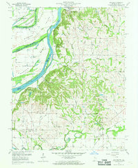
 1938 New Harmony1958 Print · USGSIndiana's southwestern tip along the Wabash River is captured here during the late thirties. Genealogists and local historians can trace family land near the Mumford Hills or locate historic rail stops in Poseyville, Stewartsville, and Griffin.
 - 1956 Map of Vincennes, 1967 Print
 1956 Vincennes1967 Print · USGSSouthern Indiana and the Illinois borderlands are captured here in the mid-fifties, showing the region's dense network of river towns and rail lines. Researchers can trace historic river crossings along the Wabash River or locate landmarks like Wyandotte Cave and Lincoln State Park.4 unique versions available
 - 1957 Map of Vincennes
 1957 Vincennes1957 Print · USGSSouthwest Indiana and the Illinois borderlands come alive in the late 1950s, a period of heavy rail traffic and expanding state forests. Genealogists and historians can trace the riverfronts and rail lines of Vincennes, New Harmony, and the vast Crane Naval Ammunition Depot.
 - 1958 Map of Vincennes
 1958 Vincennes1958 Print · USGSSouthern Indiana and the Illinois borderlands are captured during a mid-century period of heavy rail traffic and military activity. Researchers can trace the sprawling bounds of the Crane Naval Ammunition Depot or locate historic settlements like New Harmony and French Lick.2 unique versions available
 - 1959 Map of Solitude, 1961 Print
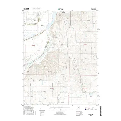
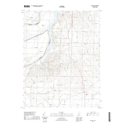
 1959 Solitude1961 Print · USGSLower Posey County in the late fifties is a landscape of complex river bends and quiet rural hamlets along the Wabash. Genealogists and local historians can locate ancestral sites like McFadden Cem, the Bethesda Ch, and the settlement of Solitude.2 unique versions available
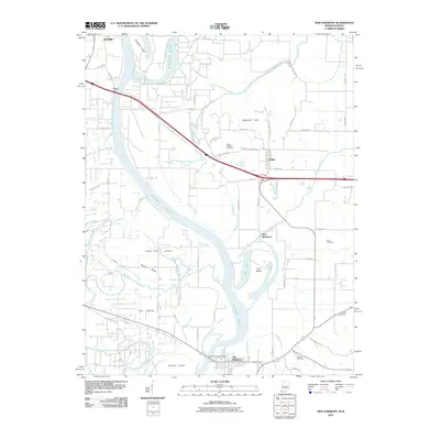
 - 1959 Map of New Harmony, 1961 Print
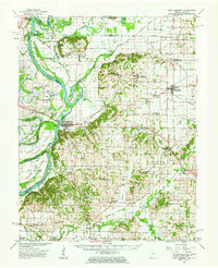
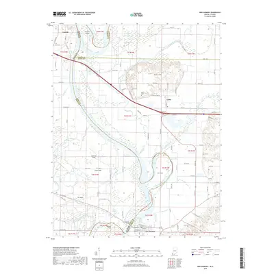
 1959 New Harmony1961 Print · USGSThe Indiana-Illinois borderlands of the late fifties are defined here by the winding channels of the Wabash River and its many islands. Researchers can trace family history through sites like Mt Pleasant Cem or explore the mid-century infrastructure of Griffin and New Harmony.4 unique versions available
 - 1959 Map of New Harmony, 1963 Print
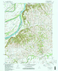
 1959 New Harmony1963 Print · USGSThe Indiana-Illinois borderlands of the late fifties are defined here by the winding Wabash River and a landscape dotted with oil wells. Trace ancestral connections at Old Union Ch, The Labyrinth State Mem, or schools like South Terrace Sch.2 unique versions available
 - 1981 Map of Solitude
 1981 Solitude1981 Print · USGSThe lower Wabash River valley comes to life in this early 1980s survey, showing the intricate bend of the river and the historic site of New Harmony. Trace rural family history through local landmarks like Bethesda Ch, Savah, and the Alexander Cem near the Illinois border.2 unique versions available
 - 1986 Map of Princeton
 1986 Princeton1986 Print · USGSSouthwestern Indiana is defined by the confluence of the Wabash and White Rivers during the mid-eighties, a period of established rail lines and expanding interstates. Genealogists and historians can trace property locations across numerous townships or locate family sites in Mount Carmel, Poseyville, and Boonville.2 unique versions available
 - 2010 Map of Solitude, 2010 Print
 2010 Solitude2010 Print · USGSCovers New Harmony, including Savah, Solitude, and other nearby areas
 - 2010 Map of New Harmony, 2010 Print
 2010 New Harmony2010 Print · USGSCovers New Harmony, including Grayville, Griffin, and other nearby areas
 - 2013 Map of Solitude, 2013 Print
 2013 Solitude2013 Print · USGSCovers New Harmony, including Savah, Solitude, and other nearby areas
 - 2013 Map of New Harmony, 2013 Print
 2013 New Harmony2013 Print · USGSCovers New Harmony, including Grayville, Griffin, and other nearby areas
 - 2016 Map of New Harmony, 2016 Print
 2016 New Harmony2016 Print · USGSCovers New Harmony, including Grayville, Griffin, and other nearby areas
 - 2016 Map of Solitude, 2016 Print
 2016 Solitude2016 Print · USGSCovers New Harmony, including Savah, Solitude, and other nearby areas
 - 2019 Map of New Harmony, 2019 Print
 2019 New Harmony2019 Print · USGSCovers New Harmony, including Grayville, Griffin, and other nearby areas
 - 2019 Map of Solitude, 2019 Print
 2019 Solitude2019 Print · USGSCovers New Harmony, including Savah, Solitude, and other nearby areas
 - 2022 Map of New Harmony, 2022 Print
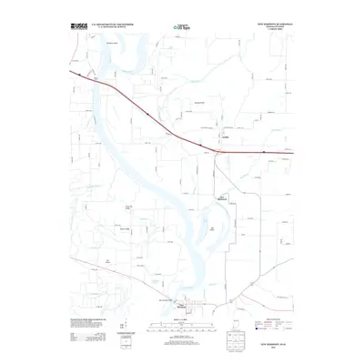
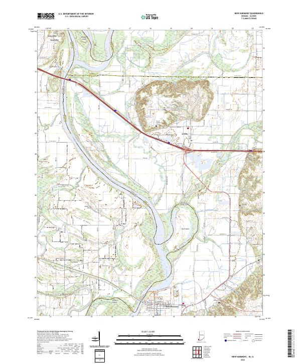 2022 New Harmony2022 Print · USGSThe Illinois-Indiana borderlands along the Wabash River are captured here in the early twenty-first century, showing a landscape shaped by shifting waters and historic town sites. Researchers can trace family roots at Mount Pleasant Cem or explore the river's path around Bull Island and Ribeyre Island.
 - 2022 Map of Solitude, 2022 Print
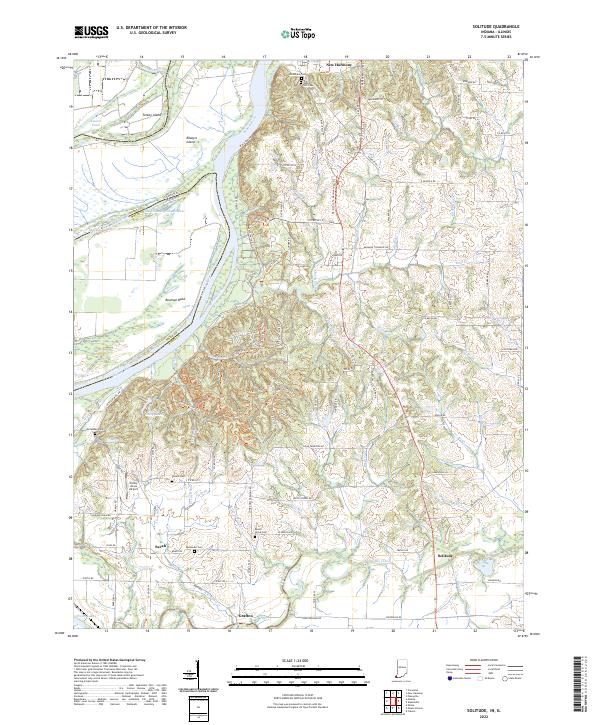 2022 Solitude2022 Print · USGSThe Indiana-Illinois border along the Wabash River comes into focus in this recent survey of Posey County. Researchers can trace the communal roots of New Harmony, locate the Harmonist Cem, or find smaller settlements like Savah and Solitude.
End of results
Showing maps 1-21 of 21
Top cities near New Harmony
- Mount Vernon historical maps
- Carmi historical maps
- Johnson historical maps
- Grayville historical maps
- Poseyville historical maps
- Crossville historical maps
See more
Frequently asked questions
- What are the different types of historical maps available for New Harmony?
- What is the oldest map of New Harmony?
- Where can I purchase historical maps of New Harmony for my home or office?
- Where can I download high-res historical maps of New Harmony?
- Are there historical topographic maps available for New Harmony?
- Is there historical aerial imagery available for New Harmony?
- Where are historical maps of New Harmony sourced from?