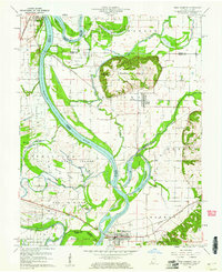
1959 Map of New Harmony
USGS Topo · Published 1961About this map
New Harmony anchors this 1959 landscape, where the shifting currents of the Wabash River define the winding border between Indiana and Illinois. The terrain is a complex network of backwaters and low-lying land, featuring Little Fox Island, Fox Island, and Ribeyre Island, punctuated by the distinctive elevation of Mumford Hills. In this era, the region’s economic life was tied to both the river and the extraction of resources, as evidenced by an Oil Field and a network of pipelines and storage facilities like the Storage Bin near Griffin.
Find a feature on this map
36 named features on this map. Tap any name to fly to it.
Don’t see what you’re looking for? This feature index may not catch every label — zoom into the map to look around manually.
Map Details
Editions of this 1959 New Harmony Map
4 editions found
Other maps of this area

1903 · New Harmony
USGS Topo · 1:62,500

1903 · Patoka
USGS Topo · 1:125,000

1904 · Mount Carmel
USGS Topo · 1:62,500

1938 · New Harmony
USGS Topo · 1:62,500

1940 · Carmi
USGS Topo · 1:62,500

1943 · Carmi
USGS Topo · 1:62,500

1943 · Albion
USGS Topo · 1:62,500

1946 · Albion
USGS Topo · 1:62,500

1956 · Vincennes
USGS Topo · 1:250,000

1957 · Vincennes
USGS Topo · 1:250,000