Old Maps of Parkers Settlement, Indiana for Academic Research
Study the evolution of Parkers Settlement with 14 high-resolution historic maps. Whether you're teaching, researching, or modeling changes in land use, these maps provide essential visual documentation of urban, environmental, and geographic change.
- Analyze long-term change: Track patterns in development, transportation, and natural features.
- Ideal for environmental or urban studies: Support academic projects with primary historical map data.
- Use in the classroom or lab: Educators and researchers rely on these maps to bring historical context to life.
These maps are a powerful tool for teaching, research, and visualizing how Parkers Settlement has changed over the decades.
Parkers Settlement, IN maps
(14)- 1901 Map of Haubstadt, 1955 Print
 1901 Haubstadt1955 Print · USGSSouthwestern Indiana thrived as a rail-centric farming region at the turn of the century. Genealogists and historians can trace old property lines and rural crossroads like Parker's Settlement, St. Wendells, and the thriving rail hub at Haubstadt.
 - 1903 Map of Haubstadt
 1903 Haubstadt1903 Print · USGSSouthern Indiana at the start of the century shows a landscape of busy rail junctions and tight-knit crossroads. Genealogists can trace family footprints across Parker's Settlement, St. Wendells, and McCutchanville as they appeared before modern road expansion.2 unique versions available
 - 1903 Map of Patoka
 1903 Patoka1903 Print · USGSThe lower Wabash Valley at the start of the twentieth century was a vital crossroads of river trade and rail expansion. Genealogists can trace family roots through settlements like New Harmony and Parker's Settlement or locate the County Farm and Grand Rapids.2 unique versions available
 - 1956 Map of Vincennes, 1967 Print
 1956 Vincennes1967 Print · USGSSouthern Indiana and the Illinois borderlands are captured here in the mid-fifties, showing the region's dense network of river towns and rail lines. Researchers can trace historic river crossings along the Wabash River or locate landmarks like Wyandotte Cave and Lincoln State Park.4 unique versions available
 - 1957 Map of Vincennes
 1957 Vincennes1957 Print · USGSSouthwest Indiana and the Illinois borderlands come alive in the late 1950s, a period of heavy rail traffic and expanding state forests. Genealogists and historians can trace the riverfronts and rail lines of Vincennes, New Harmony, and the vast Crane Naval Ammunition Depot.
 - 1958 Map of Vincennes
 1958 Vincennes1958 Print · USGSSouthern Indiana and the Illinois borderlands are captured during a mid-century period of heavy rail traffic and military activity. Researchers can trace the sprawling bounds of the Crane Naval Ammunition Depot or locate historic settlements like New Harmony and French Lick.2 unique versions available
 - 1961 Map of Kasson, 1963 Print
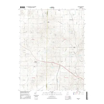
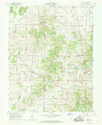 1961 Kasson1963 Print · USGSThe rural border of Vanderburgh and Posey counties is captured here in the early sixties, showing a landscape of oil production and scattered farming hamlets. Genealogists can locate family landmarks like Parkers Settlement, Engleheim Cem, and the Memorial Cem Ch.2 unique versions available
 - 1981 Map of Kasson
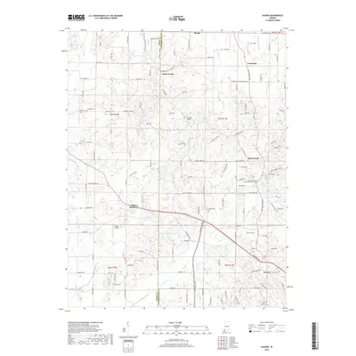
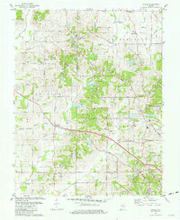 1981 Kasson1981 Print · USGSVanderburgh and Posey Counties appear here in the early eighties as a landscape of rural parish life and active oil production. Genealogists can trace family landmarks like Parkers Settlement, Engleheim Cem, and the old No 6 School.3 unique versions available
 - 1986 Map of Princeton
 1986 Princeton1986 Print · USGSSouthwestern Indiana is defined by the confluence of the Wabash and White Rivers during the mid-eighties, a period of established rail lines and expanding interstates. Genealogists and historians can trace property locations across numerous townships or locate family sites in Mount Carmel, Poseyville, and Boonville.2 unique versions available
 - 2010 Map of Kasson, 2010 Print
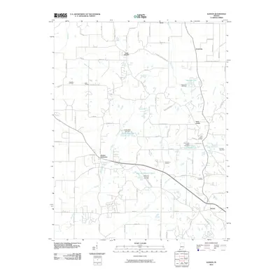 2010 Kasson2010 Print · USGSCovers Parkers Settlement, including Armstrong, Kasson, and other nearby areas
 - 2013 Map of Kasson, 2013 Print
 2013 Kasson2013 Print · USGSCovers Parkers Settlement, including Armstrong, Kasson, and other nearby areas
 - 2016 Map of Kasson, 2016 Print
 2016 Kasson2016 Print · USGSCovers Parkers Settlement, including Armstrong, Kasson, and other nearby areas
 - 2019 Map of Kasson, 2019 Print
 2019 Kasson2019 Print · USGSCovers Parkers Settlement, including Armstrong, Kasson, and other nearby areas
 - 2022 Map of Kasson, 2022 Print
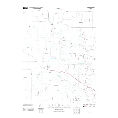
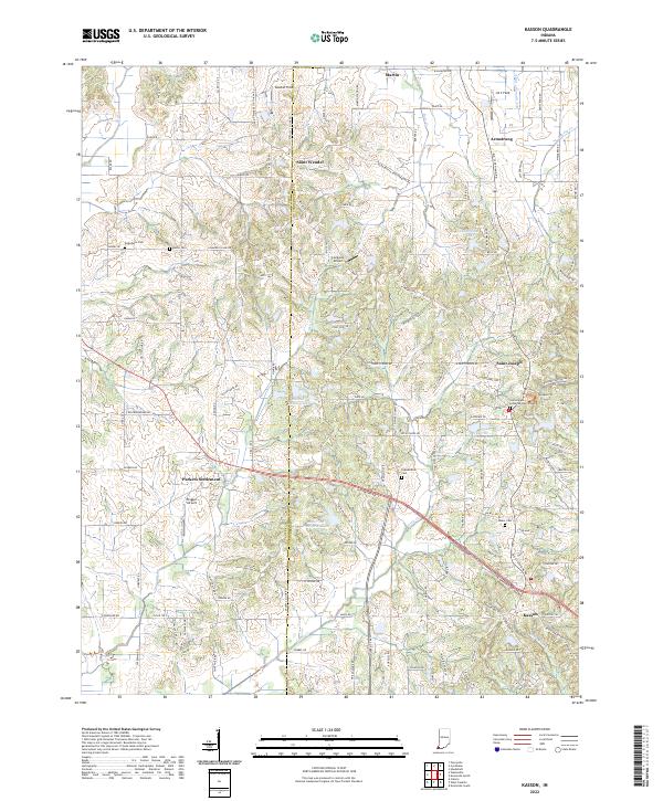 2022 Kasson2022 Print · USGSThe rural borders of Posey and Vanderburgh counties are captured here in the early 2020s, showing a landscape of traditional farmsteads and modern country estates. Researchers can locate several burial grounds like Kunze Cem and historic community centers such as Saint Wendel or Parkers Settlement.
End of results
Showing maps 1-14 of 14
Top cities near Parkers Settlement
- Evansville historical maps
- Henderson historical maps
- Mount Vernon historical maps
- Armstrong historical maps
- Fort Branch historical maps
- Haubstadt historical maps
See more
Frequently asked questions
- What are the different types of historical maps available for Parkers Settlement?
- What is the oldest map of Parkers Settlement?
- Where can I purchase historical maps of Parkers Settlement for my home or office?
- Where can I download high-res historical maps of Parkers Settlement?
- Are there historical topographic maps available for Parkers Settlement?
- Is there historical aerial imagery available for Parkers Settlement?
- Where are historical maps of Parkers Settlement sourced from?